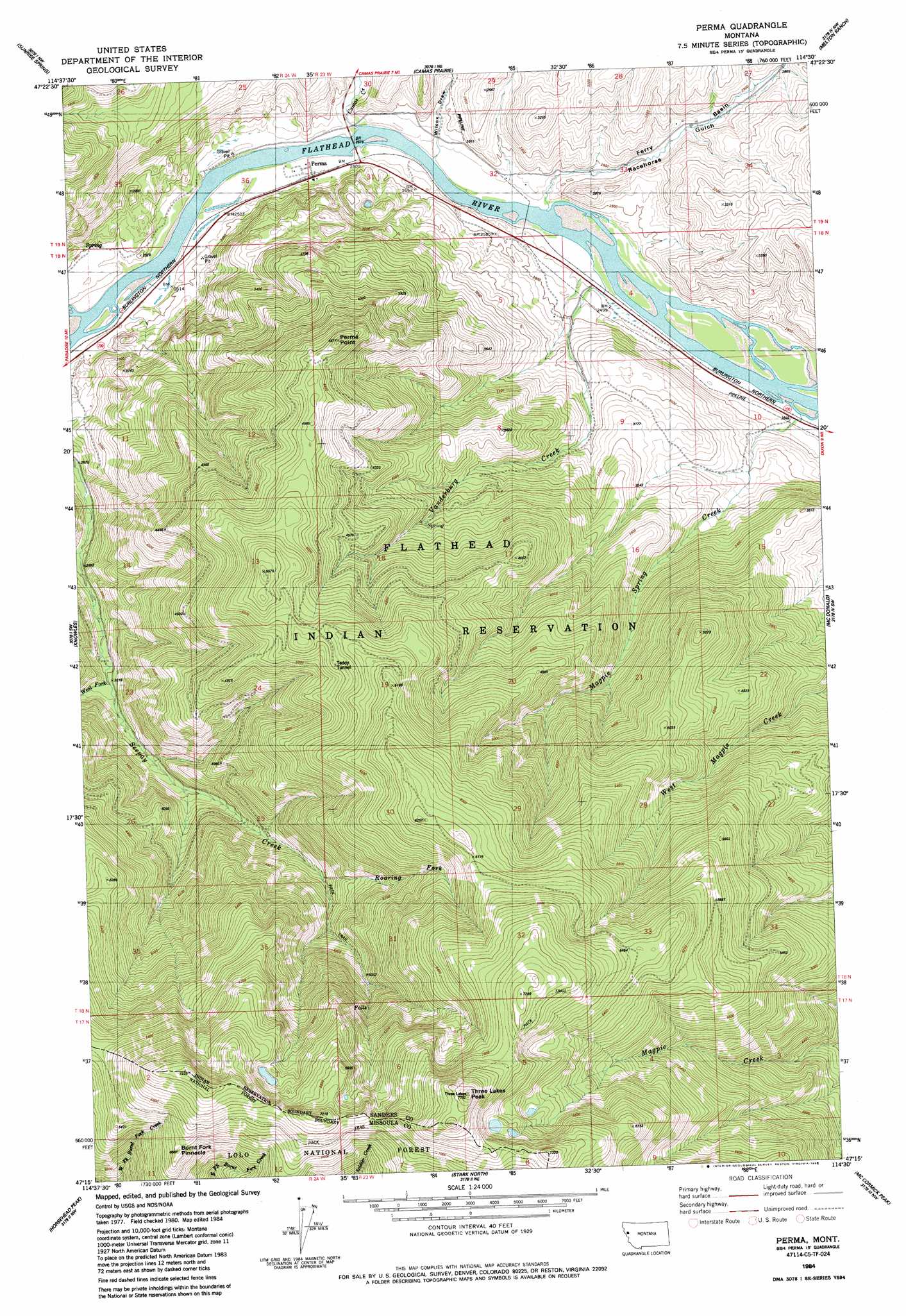
Perma Topo Map Montana
To zoom in, hover over the map of Perma
USGS Topo Quad 47114c5 - 1:24,000 scale
| Topo Map Name: | Perma |
| USGS Topo Quad ID: | 47114c5 |
| Print Size: | ca. 21 1/4" wide x 27" high |
| Southeast Coordinates: | 47.25° N latitude / 114.5° W longitude |
| Map Center Coordinates: | 47.3125° N latitude / 114.5625° W longitude |
| U.S. State: | MT |
| Filename: | o47114c5.jpg |
| Download Map JPG Image: | Perma topo map 1:24,000 scale |
| Map Type: | Topographic |
| Topo Series: | 7.5´ |
| Map Scale: | 1:24,000 |
| Source of Map Images: | United States Geological Survey (USGS) |
| Alternate Map Versions: |
Perma MT 1984, updated 1985 Download PDF Buy paper map Perma MT 1999, updated 2003 Download PDF Buy paper map Perma MT 2011 Download PDF Buy paper map Perma MT 2014 Download PDF Buy paper map |
| FStopo: | US Forest Service topo Perma is available: Download FStopo PDF Download FStopo TIF |
1:24,000 Topo Quads surrounding Perma
Baldy Lake |
Hot Springs |
Markle Pass |
Oliver Point |
Round Butte |
Paradise |
Sunrise Spring |
Camas Prairie |
Melton Ranch |
Sloan |
Quinns Hot Springs |
Knowles |
Perma |
Mcdonald |
Dixon |
Idaho Gulch |
Horsehead Peak |
Stark North |
Mccormick Peak |
Hewolf Mountain |
Lozeau |
Tarkio |
Stark South |
Alberton |
Huson |
> Back to 47114a1 at 1:100,000 scale
> Back to 47114a1 at 1:250,000 scale
> Back to U.S. Topo Maps home
Perma topo map: Gazetteer
Perma: Basins
Ferry Basin elevation 850m 2788′Perma: Mines
Teddy Tunnel elevation 1556m 5104′Perma: Populated Places
Perma elevation 765m 2509′Perma: Post Offices
Perma Post Office (historical) elevation 765m 2509′Perma: Streams
Camas Creek elevation 757m 2483′Magpie Spring Creek elevation 763m 2503′
Roaring Fork Seepay Creek elevation 1283m 4209′
Vanderburg Creek elevation 757m 2483′
West Fork Seepay Creek elevation 923m 3028′
Perma: Summits
Burnt Fork Pinnacle elevation 2019m 6624′Perma Point elevation 1450m 4757′
Three Lakes Peak elevation 2356m 7729′
Perma: Valleys
Racehorse Gulch elevation 769m 2522′Wilcox Draw elevation 757m 2483′
Perma: Wells
18N23W03CDD_01 Well elevation 762m 2500′19N23W32BCBA01 Well elevation 768m 2519′
Perma digital topo map on disk
Buy this Perma topo map showing relief, roads, GPS coordinates and other geographical features, as a high-resolution digital map file on DVD: