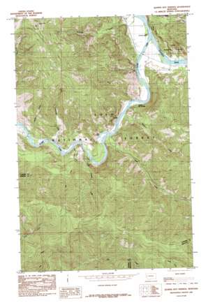
Quinns Hot Springs Topo Map Montana
To zoom in, hover over the map of Quinns Hot Springs
USGS Topo Quad 47114c7 - 1:24,000 scale
| Topo Map Name: | Quinns Hot Springs |
| USGS Topo Quad ID: | 47114c7 |
| Print Size: | ca. 21 1/4" wide x 27" high |
| Southeast Coordinates: | 47.25° N latitude / 114.75° W longitude |
| Map Center Coordinates: | 47.3125° N latitude / 114.8125° W longitude |
| U.S. State: | MT |
| Filename: | o47114c7.jpg |
| Download Map JPG Image: | Quinns Hot Springs topo map 1:24,000 scale |
| Map Type: | Topographic |
| Topo Series: | 7.5´ |
| Map Scale: | 1:24,000 |
| Source of Map Images: | United States Geological Survey (USGS) |
| Alternate Map Versions: |
Quinns Hot Springs MT 1985, updated 1985 Download PDF Buy paper map Quinns Hot Springs MT 1999, updated 2003 Download PDF Buy paper map Quinns Hot Springs MT 2011 Download PDF Buy paper map Quinns Hot Springs MT 2014 Download PDF Buy paper map |
| FStopo: | US Forest Service topo Quinns Hot Springs is available: Download FStopo PDF Download FStopo TIF |
1:24,000 Topo Quads surrounding Quinns Hot Springs
> Back to 47114a1 at 1:100,000 scale
> Back to 47114a1 at 1:250,000 scale
> Back to U.S. Topo Maps home
Quinns Hot Springs topo map: Gazetteer
Quinns Hot Springs: Falls
Cascade Falls elevation 897m 2942′Quinns Hot Springs: Lakes
Bass Pond elevation 763m 2503′Quinns Hot Springs: Mines
Belle of the Hills Mine elevation 1552m 5091′Dillon Millsite elevation 1411m 4629′
Hall Gulch Mine elevation 1402m 4599′
Hopkins Mine elevation 1428m 4685′
Victor Mine elevation 1566m 5137′
West Hall Gulch Mine elevation 1500m 4921′
Quinns Hot Springs: Populated Places
Hopkins elevation 1375m 4511′Island City (historical) elevation 768m 2519′
Quinns elevation 757m 2483′
Quinns Hot Springs: Springs
Quinns Hot Springs elevation 828m 2716′Quinns Hot Springs: Streams
Cascade Creek elevation 759m 2490′Dragonfly Creek elevation 804m 2637′
Falls Creek elevation 765m 2509′
Flathead River elevation 757m 2483′
Fourteenmile Creek elevation 777m 2549′
Kennedy Creek elevation 757m 2483′
Much Water Creek elevation 765m 2509′
Sheep Creek elevation 757m 2483′
Siegel Creek elevation 757m 2483′
Wallace Creek elevation 759m 2490′
Quinns Hot Springs: Summits
Patricks Knob elevation 2065m 6774′Quinns Hot Springs: Tunnels
John Tunnel elevation 817m 2680′Quinns Hot Springs digital topo map on disk
Buy this Quinns Hot Springs topo map showing relief, roads, GPS coordinates and other geographical features, as a high-resolution digital map file on DVD:


