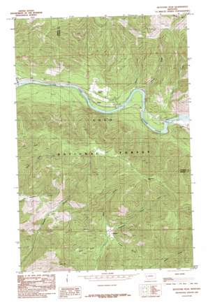
Keystone Peak Topo Map Montana
To zoom in, hover over the map of Keystone Peak
USGS Topo Quad 47114c8 - 1:24,000 scale
| Topo Map Name: | Keystone Peak |
| USGS Topo Quad ID: | 47114c8 |
| Print Size: | ca. 21 1/4" wide x 27" high |
| Southeast Coordinates: | 47.25° N latitude / 114.875° W longitude |
| Map Center Coordinates: | 47.3125° N latitude / 114.9375° W longitude |
| U.S. State: | MT |
| Filename: | o47114c8.jpg |
| Download Map JPG Image: | Keystone Peak topo map 1:24,000 scale |
| Map Type: | Topographic |
| Topo Series: | 7.5´ |
| Map Scale: | 1:24,000 |
| Source of Map Images: | United States Geological Survey (USGS) |
| Alternate Map Versions: |
Keystone Peak MT 1985, updated 1985 Download PDF Buy paper map Keystone Peak MT 1999, updated 2003 Download PDF Buy paper map Keystone Peak MT 2011 Download PDF Buy paper map Keystone Peak MT 2014 Download PDF Buy paper map |
| FStopo: | US Forest Service topo Keystone Peak is available: Download FStopo PDF Download FStopo TIF |
1:24,000 Topo Quads surrounding Keystone Peak
> Back to 47114a1 at 1:100,000 scale
> Back to 47114a1 at 1:250,000 scale
> Back to U.S. Topo Maps home
Keystone Peak topo map: Gazetteer
Keystone Peak: Flats
Donlan Flats elevation 830m 2723′Keystone Peak: Mines
Chevrolet Number 1 and 2 Mine elevation 1555m 5101′Keystone Mine elevation 1105m 3625′
Little Anaconda Mine elevation 1628m 5341′
Little Pittsburg Mine elevation 1073m 3520′
Little Pittsburg Mine elevation 1081m 3546′
Lower Prosperity Mine elevation 1325m 4347′
Nancy Lee Millsite elevation 1013m 3323′
Nancy Lee Mine elevation 1132m 3713′
Nancy Lee Mine elevation 1164m 3818′
Nancy Lee/Fawcett Mine elevation 1272m 4173′
Nite Owl Number 2 Mine elevation 1148m 3766′
Nite Owl Number 3 Mine elevation 1132m 3713′
Nite Owl Number 8 Mine elevation 1262m 4140′
O R and N Mine elevation 1295m 4248′
S and H Mine elevation 859m 2818′
Santa Rita Mine elevation 1049m 3441′
Seven Mile Creek Mine elevation 1168m 3832′
Triumph Mine elevation 1562m 5124′
Upper Keesey Mine elevation 1489m 4885′
Upper Nancy Lee Mine elevation 1253m 4110′
Upper Prosperity Mine elevation 1414m 4639′
Keystone Peak: Populated Places
Donlan elevation 792m 2598′Keystone elevation 1029m 3375′
Keystone Peak: Post Offices
Carter Post Office (historical) elevation 1029m 3375′Keystone Post Office (historical) elevation 1029m 3375′
Keystone Peak: Streams
Patrick Creek elevation 781m 2562′Sesame Creek elevation 780m 2559′
Sevenmile Creek elevation 792m 2598′
Keystone Peak: Summits
Bald Hill elevation 1570m 5150′Keystone Peak elevation 1781m 5843′
Keystone Peak: Valleys
Brian Gulch elevation 999m 3277′Dunns Draw elevation 831m 2726′
Firman Gulch elevation 1029m 3375′
Pack Gulch elevation 1038m 3405′
Keystone Peak digital topo map on disk
Buy this Keystone Peak topo map showing relief, roads, GPS coordinates and other geographical features, as a high-resolution digital map file on DVD:


