Melton Ranch Topo Map Montana
To zoom in, hover over the map of Melton Ranch
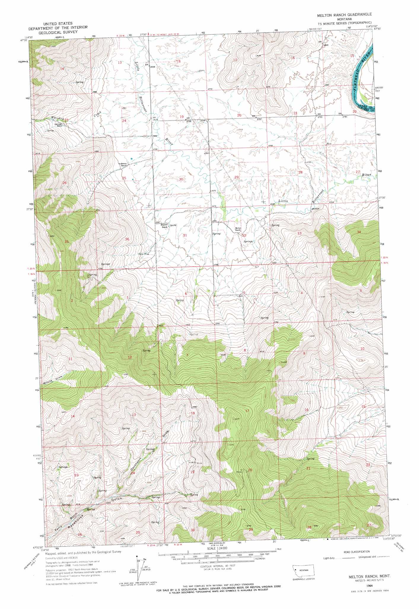
USGS Topo Quad 47114d4 - 1:24,000 scale
| Topo Map Name: | Melton Ranch |
| USGS Topo Quad ID: | 47114d4 |
| Print Size: | ca. 21 1/4" wide x 27" high |
| Southeast Coordinates: | 47.375° N latitude / 114.375° W longitude |
| Map Center Coordinates: | 47.4375° N latitude / 114.4375° W longitude |
| U.S. State: | MT |
| Filename: | o47114d4.jpg |
| Download Map JPG Image: | Melton Ranch topo map 1:24,000 scale |
| Map Type: | Topographic |
| Topo Series: | 7.5´ |
| Map Scale: | 1:24,000 |
| Source of Map Images: | United States Geological Survey (USGS) |
| Alternate Map Versions: |
Melton Ranch MT 1964, updated 1966 Download PDF Buy paper map Melton Ranch MT 1964, updated 1966 Download PDF Buy paper map Melton Ranch MT 2011 Download PDF Buy paper map Melton Ranch MT 2014 Download PDF Buy paper map |
1:24,000 Topo Quads surrounding Melton Ranch
Lonepine |
Hot Springs Ne |
Irvine Hill |
Buffalo Bridge |
Polson |
Hot Springs |
Markle Pass |
Oliver Point |
Round Butte |
Lower Crow Reservoir |
Sunrise Spring |
Camas Prairie |
Melton Ranch |
Sloan |
Charlo |
Knowles |
Perma |
Mcdonald |
Dixon |
Ravalli |
Horsehead Peak |
Stark North |
Mccormick Peak |
Hewolf Mountain |
Saddle Mountain |
> Back to 47114a1 at 1:100,000 scale
> Back to 47114a1 at 1:250,000 scale
> Back to U.S. Topo Maps home
Melton Ranch topo map: Gazetteer
Melton Ranch: Streams
Pine Creek elevation 812m 2664′Whiskey Creek elevation 816m 2677′
Melton Ranch: Valleys
Davenport Draw elevation 958m 3143′Melton Ranch: Wells
20N22W21CBDA01 Well elevation 841m 2759′20N22W28ABCB01 Well elevation 836m 2742′
20N22W28ABCB02 Well elevation 836m 2742′
20N22W30AAC_01 Well elevation 817m 2680′
20N22W30DADD01 Well elevation 815m 2673′
Melton Ranch digital topo map on disk
Buy this Melton Ranch topo map showing relief, roads, GPS coordinates and other geographical features, as a high-resolution digital map file on DVD: