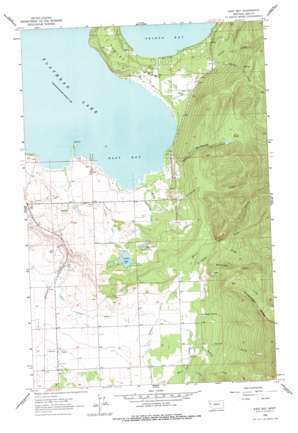
East Bay Topo Map Montana
To zoom in, hover over the map of East Bay
USGS Topo Quad 47114f1 - 1:24,000 scale
| Topo Map Name: | East Bay |
| USGS Topo Quad ID: | 47114f1 |
| Print Size: | ca. 21 1/4" wide x 27" high |
| Southeast Coordinates: | 47.625° N latitude / 114° W longitude |
| Map Center Coordinates: | 47.6875° N latitude / 114.0625° W longitude |
| U.S. State: | MT |
| Filename: | o47114f1.jpg |
| Download Map JPG Image: | East Bay topo map 1:24,000 scale |
| Map Type: | Topographic |
| Topo Series: | 7.5´ |
| Map Scale: | 1:24,000 |
| Source of Map Images: | United States Geological Survey (USGS) |
| Alternate Map Versions: |
East Bay MT 1964, updated 1966 Download PDF Buy paper map East Bay MT 1964, updated 1977 Download PDF Buy paper map East Bay MT 2011 Download PDF Buy paper map East Bay MT 2014 Download PDF Buy paper map |
1:24,000 Topo Quads surrounding East Bay
> Back to 47114e1 at 1:100,000 scale
> Back to 47114a1 at 1:250,000 scale
> Back to U.S. Topo Maps home
East Bay topo map: Gazetteer
East Bay: Bays
East Bay elevation 883m 2896′East Bay: Canals
Bousquet Ditch elevation 996m 3267′Polson A Canal elevation 914m 2998′
Polson D Canal elevation 931m 3054′
Polson Z Canal elevation 945m 3100′
East Bay: Capes
Bird Point elevation 882m 2893′East Bay: Dams
Hellroaring Dam elevation 1150m 3772′Twin Dam elevation 944m 3097′
East Bay: Lakes
Lost Lake elevation 937m 3074′East Bay: Populated Places
Allard (historical) elevation 902m 2959′Finley Point elevation 892m 2926′
Mountain View (historical) elevation 988m 3241′
Peaceful Haven Mobile Home Park elevation 901m 2956′
Turtle Lake elevation 944m 3097′
East Bay: Reservoirs
Hellroaring Reservoir elevation 1150m 3772′Turtle Lake elevation 944m 3097′
East Bay: Ridges
Minesinger Ridge elevation 1612m 5288′East Bay: Springs
Blumhagen Spring elevation 1017m 3336′East Bay: Streams
Ashley Creek elevation 996m 3267′Big Creek elevation 1012m 3320′
Bisson Creek elevation 1018m 3339′
Centipede Creek elevation 890m 2919′
Dubay Creek elevation 1018m 3339′
Ducharme Creek elevation 886m 2906′
Hell Roaring Creek elevation 883m 2896′
Holmes Creek elevation 933m 3061′
Minesinger Creek elevation 1035m 3395′
Moss Creek elevation 883m 2896′
Poirier Creek elevation 996m 3267′
Skidoo Creek elevation 883m 2896′
East Bay: Wells
22N19W04CCCC01 Well elevation 930m 3051′22N19W05CCA_01 Well elevation 889m 2916′
22N19W08AAB_01 Well elevation 896m 2939′
22N19W09BCB_01 Well elevation 943m 3093′
22N19W17CBA_01 Well elevation 959m 3146′
22N19W18DAA_01 Well elevation 951m 3120′
22N19W20ADAA01 Well elevation 1009m 3310′
22N19W20ADAA02 Well elevation 1009m 3310′
22N19W20BBDD01 Well elevation 1009m 3310′
22N19W29CBC_01 Well elevation 977m 3205′
22N19W32BCDD01 Well elevation 982m 3221′
22N19W33BBBD01 Well elevation 993m 3257′
22N20W11CADB01 Well elevation 1020m 3346′
22N20W12CCC_01 Well elevation 1007m 3303′
22N20W13ADDD01 Well elevation 945m 3100′
22N20W14DDC_01 Well elevation 982m 3221′
22N20W23DAD_01 Well elevation 982m 3221′
22N20W24CDD_01 Well elevation 983m 3225′
22N20W25ABA_01 Well elevation 984m 3228′
22N20W25BABD01 Well elevation 980m 3215′
23N19W15CCA_01 Well elevation 901m 2956′
23N19W15CCC_01 Well elevation 900m 2952′
23N19W19ADB_01 Well elevation 919m 3015′
23N19W28BCC_01 Well elevation 895m 2936′
23N19W29ADAD01 Well elevation 895m 2936′
East Bay digital topo map on disk
Buy this East Bay topo map showing relief, roads, GPS coordinates and other geographical features, as a high-resolution digital map file on DVD:


