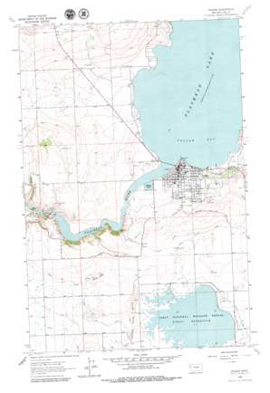
Polson Topo Map Montana
To zoom in, hover over the map of Polson
USGS Topo Quad 47114f2 - 1:24,000 scale
| Topo Map Name: | Polson |
| USGS Topo Quad ID: | 47114f2 |
| Print Size: | ca. 21 1/4" wide x 27" high |
| Southeast Coordinates: | 47.625° N latitude / 114.125° W longitude |
| Map Center Coordinates: | 47.6875° N latitude / 114.1875° W longitude |
| U.S. State: | MT |
| Filename: | o47114f2.jpg |
| Download Map JPG Image: | Polson topo map 1:24,000 scale |
| Map Type: | Topographic |
| Topo Series: | 7.5´ |
| Map Scale: | 1:24,000 |
| Source of Map Images: | United States Geological Survey (USGS) |
| Alternate Map Versions: |
Polson MT 1964, updated 1966 Download PDF Buy paper map Polson MT 2011 Download PDF Buy paper map Polson MT 2014 Download PDF Buy paper map |
1:24,000 Topo Quads surrounding Polson
> Back to 47114e1 at 1:100,000 scale
> Back to 47114a1 at 1:250,000 scale
> Back to U.S. Topo Maps home
Polson topo map: Gazetteer
Polson: Airports
Polson Airport elevation 896m 2939′Polson: Bays
Polson Bay elevation 883m 2896′Polson: Bridges
Polson Bridge elevation 883m 2896′Polson: Canals
Pablo 31 A 07 Canal elevation 968m 3175′Pablo 31 A Canal elevation 944m 3097′
Polson B Canal elevation 913m 2995′
Polson C Canal elevation 940m 3083′
Polson: Capes
Vista Point elevation 978m 3208′Polson: Dams
Kerr Dam elevation 834m 2736′Kerr Dam elevation 884m 2900′
Pablo Dam elevation 977m 3205′
Polson Sewage Lagoon Dam elevation 893m 2929′
Polson: Parks
Boettcher Park elevation 883m 2896′Ducharme Park elevation 892m 2926′
Lions Park elevation 892m 2926′
O'Malley Park elevation 896m 2939′
Pablo National Wildlife Refuge elevation 980m 3215′
Polson Sports Complex elevation 894m 2933′
Pomajevich Field elevation 903m 2962′
Riverside Park elevation 885m 2903′
Sacajawea Park elevation 888m 2913′
Polson: Populated Places
Belle-Vue Court elevation 894m 2933′Jette elevation 895m 2936′
Kerr elevation 904m 2965′
Polson elevation 892m 2926′
Rocky Point elevation 893m 2929′
Polson: Post Offices
Polson Post Office elevation 892m 2926′Polson: Reservoirs
Flathead Lake elevation 884m 2900′Pablo Reservoir elevation 977m 3205′
Pablo Reservoir elevation 986m 3234′
Polson: Summits
Rocky Butte elevation 1045m 3428′Polson: Valleys
Weythman Gulch elevation 823m 2700′Polson: Wells
22N20W02CBD_01 Well elevation 906m 2972′22N20W05AAB_01 Well elevation 884m 2900′
22N20W09ACD_01 Well elevation 911m 2988′
22N20W09CBB_01 Well elevation 910m 2985′
22N20W10CAA_01 Well elevation 945m 3100′
22N20W17ABAC01 Well elevation 957m 3139′
22N20W17DCAB01 Well elevation 985m 3231′
22N20W22BAA_01 Well elevation 977m 3205′
22N20W29DCDC01 Well elevation 946m 3103′
22N21W02ADAC01 Well elevation 972m 3188′
22N21W23DAA_01 Well elevation 944m 3097′
22N21W24BAB_01 Well elevation 992m 3254′
22N21W24DDC_01 Well elevation 942m 3090′
22N21W25CCC_01 Well elevation 903m 2962′
22N21W25DDCB01 Well elevation 909m 2982′
22N21W36ABB_01 Well elevation 904m 2965′
23N20W20DCC_01 Well elevation 898m 2946′
23N20W21CBC_01 Well elevation 892m 2926′
23N20W21CCB_01 Well elevation 892m 2926′
23N20W29BAB_01 Well elevation 906m 2972′
23N20W29BAB_02 Well elevation 903m 2962′
23N20W29CBCB01 Well elevation 904m 2965′
23N21W24ABC_01 Well elevation 1041m 3415′
23N21W25ADDD01 Well elevation 937m 3074′
23N21W25DAAA01 Well elevation 934m 3064′
Polson digital topo map on disk
Buy this Polson topo map showing relief, roads, GPS coordinates and other geographical features, as a high-resolution digital map file on DVD:


