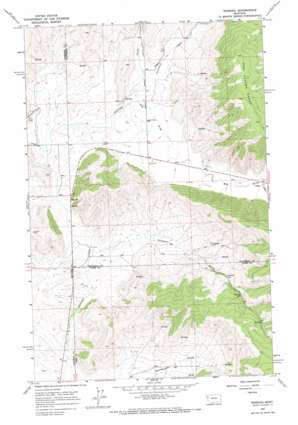
Niarada Topo Map Montana
To zoom in, hover over the map of Niarada
USGS Topo Quad 47114g5 - 1:24,000 scale
| Topo Map Name: | Niarada |
| USGS Topo Quad ID: | 47114g5 |
| Print Size: | ca. 21 1/4" wide x 27" high |
| Southeast Coordinates: | 47.75° N latitude / 114.5° W longitude |
| Map Center Coordinates: | 47.8125° N latitude / 114.5625° W longitude |
| U.S. State: | MT |
| Filename: | o47114g5.jpg |
| Download Map JPG Image: | Niarada topo map 1:24,000 scale |
| Map Type: | Topographic |
| Topo Series: | 7.5´ |
| Map Scale: | 1:24,000 |
| Source of Map Images: | United States Geological Survey (USGS) |
| Alternate Map Versions: |
Niarada MT 1964, updated 1967 Download PDF Buy paper map Niarada MT 2011 Download PDF Buy paper map Niarada MT 2014 Download PDF Buy paper map |
1:24,000 Topo Quads surrounding Niarada
> Back to 47114e1 at 1:100,000 scale
> Back to 47114a1 at 1:250,000 scale
> Back to U.S. Topo Maps home
Niarada topo map: Gazetteer
Niarada: Populated Places
Niarada elevation 878m 2880′Niarada: Post Offices
Niarada Post Office elevation 878m 2880′Niarada: Streams
Cromwell Creek elevation 887m 2910′Niarada: Valleys
Big Draw elevation 879m 2883′Deep Draw elevation 936m 3070′
Sullivan Gulch elevation 867m 2844′
Niarada: Wells
23N24W13DBBA01 Well elevation 867m 2844′24N23W09BAA_01 Well elevation 903m 2962′
24N23W16BCC_01 Well elevation 891m 2923′
24N23W17DAC_01 Well elevation 891m 2923′
24N23W20AAB_01 Well elevation 891m 2923′
24N23W21BCDA01 Well elevation 894m 2933′
24N24W24ABBB01 Well elevation 873m 2864′
24N24W24ABBB02 Well elevation 873m 2864′
24N24W25DDBB01 Well elevation 874m 2867′
Niarada digital topo map on disk
Buy this Niarada topo map showing relief, roads, GPS coordinates and other geographical features, as a high-resolution digital map file on DVD:


