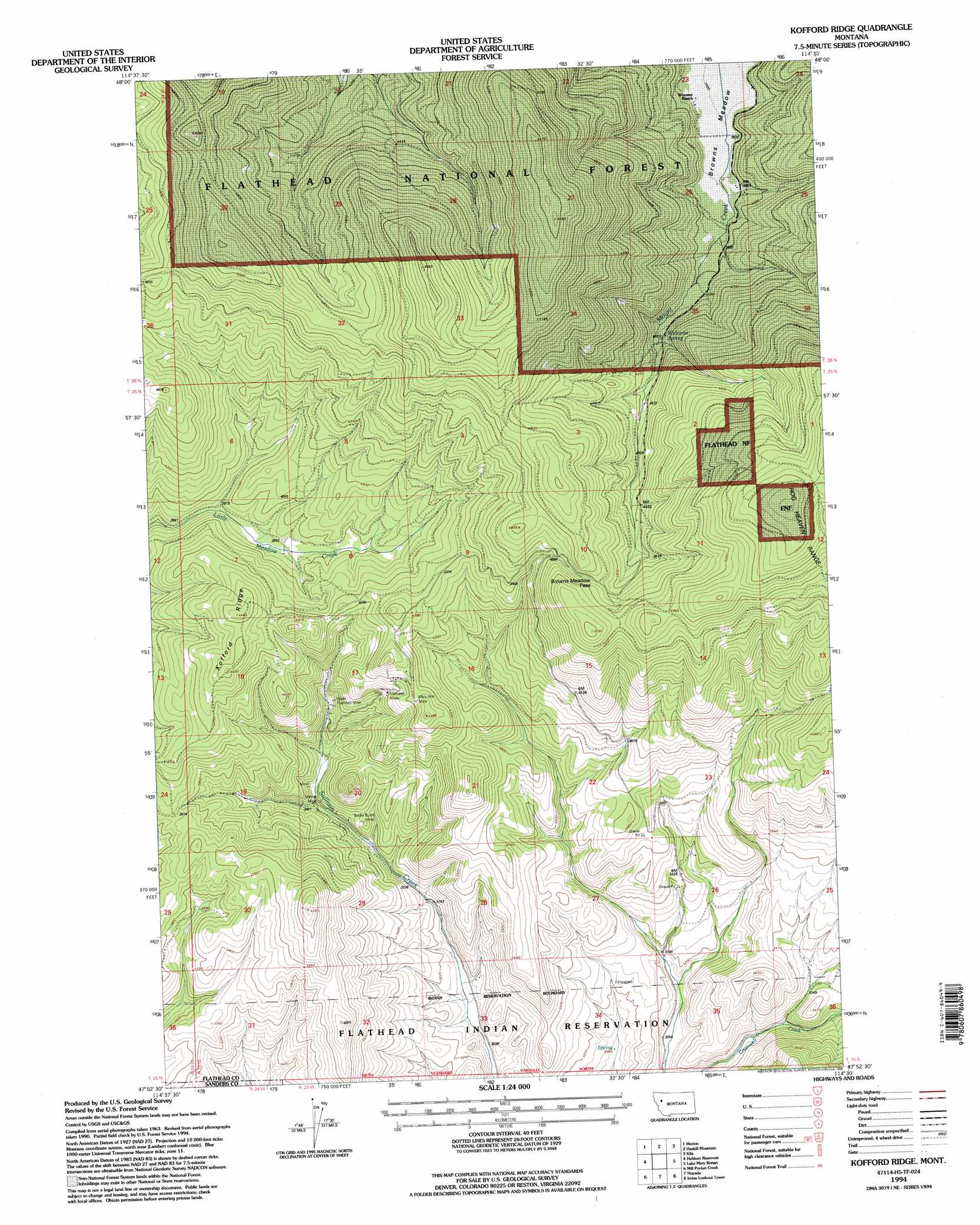
Kofford Ridge Topo Map Montana
To zoom in, hover over the map of Kofford Ridge
USGS Topo Quad 47114h5 - 1:24,000 scale
| Topo Map Name: | Kofford Ridge |
| USGS Topo Quad ID: | 47114h5 |
| Print Size: | ca. 21 1/4" wide x 27" high |
| Southeast Coordinates: | 47.875° N latitude / 114.5° W longitude |
| Map Center Coordinates: | 47.9375° N latitude / 114.5625° W longitude |
| U.S. State: | MT |
| Filename: | o47114h5.jpg |
| Download Map JPG Image: | Kofford Ridge topo map 1:24,000 scale |
| Map Type: | Topographic |
| Topo Series: | 7.5´ |
| Map Scale: | 1:24,000 |
| Source of Map Images: | United States Geological Survey (USGS) |
| Alternate Map Versions: |
Kofford Ridge MT 1964, updated 1967 Download PDF Buy paper map Kofford Ridge MT 1994, updated 1996 Download PDF Buy paper map Kofford Ridge MT 2011 Download PDF Buy paper map Kofford Ridge MT 2014 Download PDF Buy paper map |
| FStopo: | US Forest Service topo Kofford Ridge is available: Download FStopo PDF Download FStopo TIF |
1:24,000 Topo Quads surrounding Kofford Ridge
Dahl Lake |
Pleasant Valley Mountain |
Lone Lake |
Blue Grass Ridge |
Kalispell |
Mcgregor Peak |
Marion |
Haskill Mountain |
Kila |
Lion Mountain |
Murr Peak |
Hubbart Reservoir |
Kofford Ridge |
Lake Mary Ronan |
Proctor |
Bassoo Peak |
Mill Pocket Creek |
Niarada |
Irvine Lookout Tower |
Elmo |
Coney Peak |
Lonepine |
Hot Springs Ne |
Irvine Hill |
Buffalo Bridge |
> Back to 47114e1 at 1:100,000 scale
> Back to 47114a1 at 1:250,000 scale
> Back to U.S. Topo Maps home
Kofford Ridge topo map: Gazetteer
Kofford Ridge: Gaps
Browns Meadow Pass elevation 1437m 4714′Kofford Ridge: Mines
Battle Butte Mine elevation 1074m 3523′Flathead Mine elevation 1201m 3940′
Flathead Mine elevation 1207m 3959′
Martin Mine elevation 1046m 3431′
Mary Ann Mine elevation 1309m 4294′
Mary Ann Mine elevation 1287m 4222′
SE Section 8 Mine elevation 1297m 4255′
West Flathead Mine elevation 1115m 3658′
Kofford Ridge: Ridges
Kofford Ridge elevation 1335m 4379′Kofford Ridge: Springs
Welcome Spring elevation 1250m 4101′Kofford Ridge digital topo map on disk
Buy this Kofford Ridge topo map showing relief, roads, GPS coordinates and other geographical features, as a high-resolution digital map file on DVD: