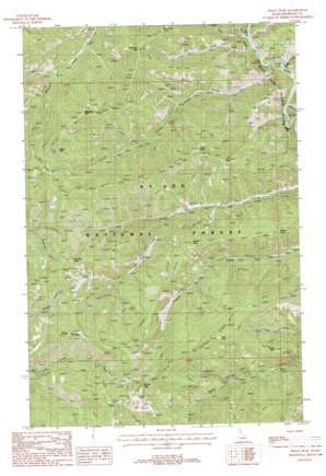
Peggy Peak Topo Map Idaho
To zoom in, hover over the map of Peggy Peak
USGS Topo Quad 47115a4 - 1:24,000 scale
| Topo Map Name: | Peggy Peak |
| USGS Topo Quad ID: | 47115a4 |
| Print Size: | ca. 21 1/4" wide x 27" high |
| Southeast Coordinates: | 47° N latitude / 115.375° W longitude |
| Map Center Coordinates: | 47.0625° N latitude / 115.4375° W longitude |
| U.S. State: | ID |
| Filename: | o47115a4.jpg |
| Download Map JPG Image: | Peggy Peak topo map 1:24,000 scale |
| Map Type: | Topographic |
| Topo Series: | 7.5´ |
| Map Scale: | 1:24,000 |
| Source of Map Images: | United States Geological Survey (USGS) |
| Alternate Map Versions: |
Peggy Peak ID 1988, updated 1988 Download PDF Buy paper map Peggy Peak ID 1995, updated 1997 Download PDF Buy paper map Peggy Peak ID 2011 Download PDF Buy paper map Peggy Peak ID 2013 Download PDF Buy paper map |
| FStopo: | US Forest Service topo Peggy Peak is available: Download FStopo PDF Download FStopo TIF |
1:24,000 Topo Quads surrounding Peggy Peak
> Back to 47115a1 at 1:100,000 scale
> Back to 47114a1 at 1:250,000 scale
> Back to U.S. Topo Maps home
Peggy Peak topo map: Gazetteer
Peggy Peak: Lakes
Twin Lakes elevation 1816m 5958′Peggy Peak: Ridges
Copper Ridge elevation 1860m 6102′Peggy Peak: Streams
Bad Bear Creek elevation 1216m 3989′Fly Creek elevation 1066m 3497′
Midget Creek elevation 1065m 3494′
Slide Creek elevation 1046m 3431′
Tento Creek elevation 1047m 3435′
Wahoo Creek elevation 1118m 3667′
Walo Creek elevation 1066m 3497′
Peggy Peak: Summits
Angle Point elevation 1749m 5738′Attention Peak elevation 1842m 6043′
Bad Bear Peak elevation 1713m 5620′
Badger Mountain elevation 1810m 5938′
Beaver Peak elevation 1697m 5567′
Bridge Point elevation 1604m 5262′
Club Point elevation 1891m 6204′
Fly Peak elevation 1725m 5659′
Granite Peak elevation 1922m 6305′
Mosquito Peak elevation 1906m 6253′
Peggy Peak elevation 1975m 6479′
Timber Peak elevation 1560m 5118′
Walo Point elevation 1777m 5830′
Peggy Peak digital topo map on disk
Buy this Peggy Peak topo map showing relief, roads, GPS coordinates and other geographical features, as a high-resolution digital map file on DVD:


