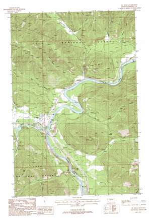
Saint Regis Topo Map Montana
To zoom in, hover over the map of Saint Regis
USGS Topo Quad 47115c1 - 1:24,000 scale
| Topo Map Name: | Saint Regis |
| USGS Topo Quad ID: | 47115c1 |
| Print Size: | ca. 21 1/4" wide x 27" high |
| Southeast Coordinates: | 47.25° N latitude / 115° W longitude |
| Map Center Coordinates: | 47.3125° N latitude / 115.0625° W longitude |
| U.S. State: | MT |
| Filename: | o47115c1.jpg |
| Download Map JPG Image: | Saint Regis topo map 1:24,000 scale |
| Map Type: | Topographic |
| Topo Series: | 7.5´ |
| Map Scale: | 1:24,000 |
| Source of Map Images: | United States Geological Survey (USGS) |
| Alternate Map Versions: |
St Regis MT 1988, updated 1988 Download PDF Buy paper map Saint Regis MT 1999, updated 2003 Download PDF Buy paper map Saint Regis MT 2011 Download PDF Buy paper map Saint Regis MT 2014 Download PDF Buy paper map |
| FStopo: | US Forest Service topo Saint Regis is available: Download FStopo PDF Download FStopo TIF |
1:24,000 Topo Quads surrounding Saint Regis
> Back to 47115a1 at 1:100,000 scale
> Back to 47114a1 at 1:250,000 scale
> Back to U.S. Topo Maps home
Saint Regis topo map: Gazetteer
Saint Regis: Crossings
Interchange 33 elevation 802m 2631′Interchange 37 elevation 829m 2719′
Saint Regis: Gaps
Burr Saddle elevation 1033m 3389′Burr Saddle elevation 1044m 3425′
Saint Regis: Mines
Spitfire Mine elevation 1023m 3356′Saint Regis: Parks
John Mullan Statue elevation 803m 2634′Saint Regis: Populated Places
Saint Regis elevation 803m 2634′Toole elevation 796m 2611′
Saint Regis: Post Offices
Halpin Post Office (historical) elevation 813m 2667′Riberdy Post Office (historical) elevation 809m 2654′
Saint Regis Post Office elevation 803m 2634′
Saint Regis: Streams
Cold Creek elevation 805m 2641′Fourmile Creek elevation 879m 2883′
Little Joe Creek elevation 814m 2670′
Mill Creek elevation 793m 2601′
Saint Regis River elevation 802m 2631′
Tamarack Creek elevation 792m 2598′
Saint Regis: Summits
Cold Peak elevation 1516m 4973′Red Hill elevation 914m 2998′
Tamarack Hill elevation 1264m 4146′
Saint Regis: Valleys
Brown Gulch elevation 981m 3218′Butler Gulch elevation 816m 2677′
Graham Gulch elevation 889m 2916′
Long Gulch elevation 907m 2975′
Mayo Gulch elevation 838m 2749′
Miller Draw elevation 1026m 3366′
Mullan Gulch elevation 832m 2729′
Saint Regis digital topo map on disk
Buy this Saint Regis topo map showing relief, roads, GPS coordinates and other geographical features, as a high-resolution digital map file on DVD:


