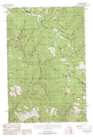
Adair Topo Map Idaho
To zoom in, hover over the map of Adair
USGS Topo Quad 47115c5 - 1:24,000 scale
| Topo Map Name: | Adair |
| USGS Topo Quad ID: | 47115c5 |
| Print Size: | ca. 21 1/4" wide x 27" high |
| Southeast Coordinates: | 47.25° N latitude / 115.5° W longitude |
| Map Center Coordinates: | 47.3125° N latitude / 115.5625° W longitude |
| U.S. States: | ID, MT |
| Filename: | o47115c5.jpg |
| Download Map JPG Image: | Adair topo map 1:24,000 scale |
| Map Type: | Topographic |
| Topo Series: | 7.5´ |
| Map Scale: | 1:24,000 |
| Source of Map Images: | United States Geological Survey (USGS) |
| Alternate Map Versions: |
Adair ID 1988, updated 1988 Download PDF Buy paper map Adair ID 1995, updated 1997 Download PDF Buy paper map Adair ID 2011 Download PDF Buy paper map Adair ID 2013 Download PDF Buy paper map |
| FStopo: | US Forest Service topo Adair is available: Download FStopo PDF Download FStopo TIF |
1:24,000 Topo Quads surrounding Adair
> Back to 47115a1 at 1:100,000 scale
> Back to 47114a1 at 1:250,000 scale
> Back to U.S. Topo Maps home
Adair topo map: Gazetteer
Adair: Cliffs
Bernier Point elevation 1724m 5656′Adair: Lakes
Silver Lake elevation 1621m 5318′Adair: Mines
Hansey Mines elevation 1325m 4347′Miller Mine (historical) elevation 1100m 3608′
Monitor Mine (historical) elevation 1728m 5669′
Monitor Mines (historical) elevation 1180m 3871′
Silver Lake Mine elevation 1686m 5531′
Silver Lake West Mine elevation 1728m 5669′
Adair: Populated Places
Adair elevation 1149m 3769′Adair: Streams
Adams Creek elevation 1158m 3799′Allen Creek elevation 1337m 4386′
Bernier Creek elevation 1070m 3510′
Bluebird Creek elevation 968m 3175′
Craddock Creek elevation 1316m 4317′
Kelly Creek elevation 1069m 3507′
Manhattan Creek elevation 1107m 3631′
Mineral Creek elevation 1181m 3874′
Mirror Creek elevation 1010m 3313′
Morgan Creek elevation 1070m 3510′
Olentange Creek elevation 1242m 4074′
Turkey Creek elevation 1072m 3517′
Ward Creek elevation 1237m 4058′
Wendle Creek elevation 1301m 4268′
Adair: Summits
Crittenden Peak elevation 1952m 6404′Dominion Peak elevation 1826m 5990′
Dominion Peak elevation 1823m 5980′
Grays Peak elevation 1491m 4891′
Malin Point elevation 1553m 5095′
Mirror Peak elevation 1342m 4402′
Point Eightyone elevation 1832m 6010′
Point Henry elevation 1577m 5173′
Quarles Peak elevation 1993m 6538′
Storm Peak elevation 1712m 5616′
Tin Can Hill elevation 1514m 4967′
Wishard Peak elevation 1941m 6368′
Wishard Peak elevation 1941m 6368′
Adair digital topo map on disk
Buy this Adair topo map showing relief, roads, GPS coordinates and other geographical features, as a high-resolution digital map file on DVD:


