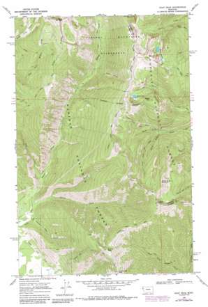
Goat Peak Topo Map Montana
To zoom in, hover over the map of Goat Peak
USGS Topo Quad 47115h5 - 1:24,000 scale
| Topo Map Name: | Goat Peak |
| USGS Topo Quad ID: | 47115h5 |
| Print Size: | ca. 21 1/4" wide x 27" high |
| Southeast Coordinates: | 47.875° N latitude / 115.5° W longitude |
| Map Center Coordinates: | 47.9375° N latitude / 115.5625° W longitude |
| U.S. State: | MT |
| Filename: | o47115h5.jpg |
| Download Map JPG Image: | Goat Peak topo map 1:24,000 scale |
| Map Type: | Topographic |
| Topo Series: | 7.5´ |
| Map Scale: | 1:24,000 |
| Source of Map Images: | United States Geological Survey (USGS) |
| Alternate Map Versions: |
Goat Peak MT 1966, updated 1970 Download PDF Buy paper map Goat Peak MT 1966, updated 1983 Download PDF Buy paper map Goat Peak MT 1966, updated 1984 Download PDF Buy paper map Goat Peak MT 1997, updated 2000 Download PDF Buy paper map Goat Peak MT 2011 Download PDF Buy paper map Goat Peak MT 2014 Download PDF Buy paper map |
| FStopo: | US Forest Service topo Goat Peak is available: Download FStopo PDF Download FStopo TIF |
1:24,000 Topo Quads surrounding Goat Peak
> Back to 47115e1 at 1:100,000 scale
> Back to 47114a1 at 1:250,000 scale
> Back to U.S. Topo Maps home
Goat Peak topo map: Gazetteer
Goat Peak: Lakes
Baree Lake elevation 1680m 5511′Bear Lakes elevation 1670m 5479′
Goat Peak: Mines
King Mine elevation 1542m 5059′Goat Peak: Ridges
Goat Ridge elevation 1777m 5830′Goat Peak: Streams
Falls Creek elevation 1036m 3398′Galena Creek elevation 778m 2552′
Goat Creek elevation 813m 2667′
North Fork Silver Butte Creek elevation 1231m 4038′
Goat Peak: Summits
Baree Mountain elevation 1845m 6053′Canyon Peak elevation 1914m 6279′
Goat Peak elevation 2097m 6879′
Silver Butte Mountain elevation 1977m 6486′
Twenty Odd Peak elevation 1837m 6026′
Twenty Peak elevation 1863m 6112′
Goat Peak: Trails
Cabinet Divide Trail elevation 1844m 6049′Canyon Peak Trail elevation 1731m 5679′
Divide Cutoff Trail elevation 1680m 5511′
Goat Peak Trail elevation 1673m 5488′
Goat Ridge Trail elevation 1591m 5219′
Lake Creek Trail elevation 1416m 4645′
Silver Butte Trail elevation 1476m 4842′
Twenty Odd Peak Trail elevation 1553m 5095′
Goat Peak: Valleys
Twenty Peak Gulch elevation 797m 2614′Goat Peak digital topo map on disk
Buy this Goat Peak topo map showing relief, roads, GPS coordinates and other geographical features, as a high-resolution digital map file on DVD:


