Alder Creek Flats Topo Map Idaho
To zoom in, hover over the map of Alder Creek Flats
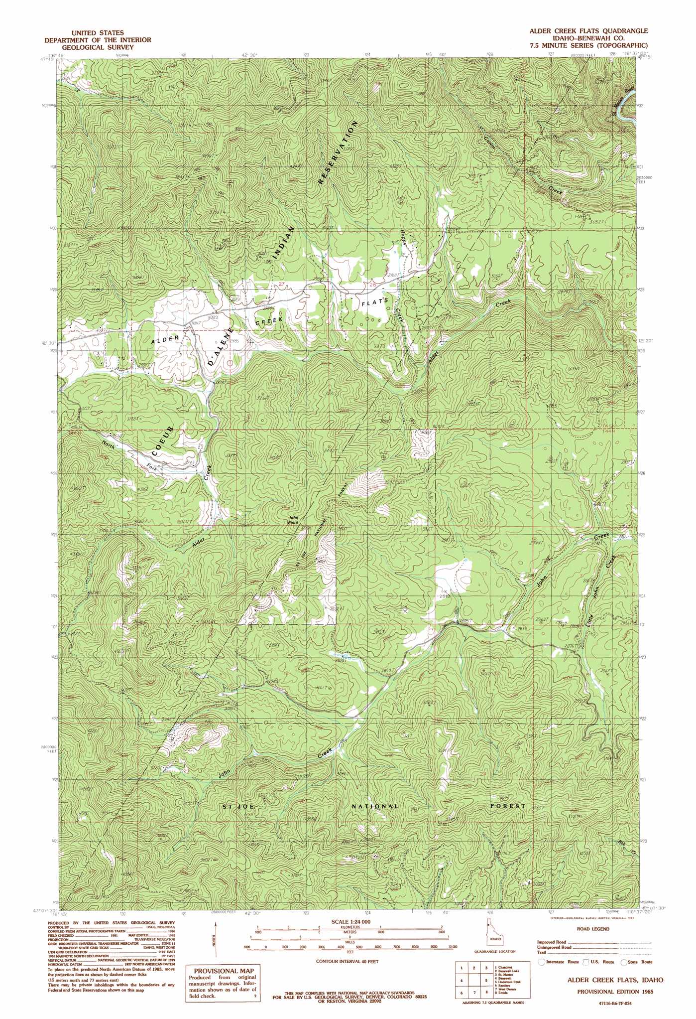
USGS Topo Quad 47116b6 - 1:24,000 scale
| Topo Map Name: | Alder Creek Flats |
| USGS Topo Quad ID: | 47116b6 |
| Print Size: | ca. 21 1/4" wide x 27" high |
| Southeast Coordinates: | 47.125° N latitude / 116.625° W longitude |
| Map Center Coordinates: | 47.1875° N latitude / 116.6875° W longitude |
| U.S. State: | ID |
| Filename: | o47116b6.jpg |
| Download Map JPG Image: | Alder Creek Flats topo map 1:24,000 scale |
| Map Type: | Topographic |
| Topo Series: | 7.5´ |
| Map Scale: | 1:24,000 |
| Source of Map Images: | United States Geological Survey (USGS) |
| Alternate Map Versions: |
Alder Creek Flats ID 1985, updated 1985 Download PDF Buy paper map Alder Creek Flats ID 1994, updated 1997 Download PDF Buy paper map Alder Creek Flats ID 1994, updated 1997 Download PDF Buy paper map Alder Creek Flats ID 2011 Download PDF Buy paper map Alder Creek Flats ID 2013 Download PDF Buy paper map |
| FStopo: | US Forest Service topo Alder Creek Flats is available: Download FStopo PDF Download FStopo TIF |
1:24,000 Topo Quads surrounding Alder Creek Flats
Worley |
Harrison |
Black Lake |
Medimont |
Rochat Peak |
Plummer |
Chatcolet |
Benewah Lake |
Saint Maries |
Saint Joe Baldy |
Tensed |
Benewah |
Alder Creek Flats |
Lindstrom Peak |
Santa |
Mission Mountain |
Sanders |
West Dennis |
Emida |
Fernwood |
Potlatch |
Princeton |
Harvard |
Sand Mountain |
Abes Knob |
> Back to 47116a1 at 1:100,000 scale
> Back to 47116a1 at 1:250,000 scale
> Back to U.S. Topo Maps home
Alder Creek Flats topo map: Gazetteer
Alder Creek Flats: Flats
Alder Creek Flats elevation 920m 3018′Alder Creek Flats: Lakes
Beaver Ponds elevation 886m 2906′Alder Creek Flats: Streams
Happy Creek elevation 827m 2713′Little John Creek elevation 829m 2719′
North Fork Alder Creek elevation 890m 2919′
Alder Creek Flats: Summits
John Point elevation 1126m 3694′Alder Creek Flats digital topo map on disk
Buy this Alder Creek Flats topo map showing relief, roads, GPS coordinates and other geographical features, as a high-resolution digital map file on DVD: