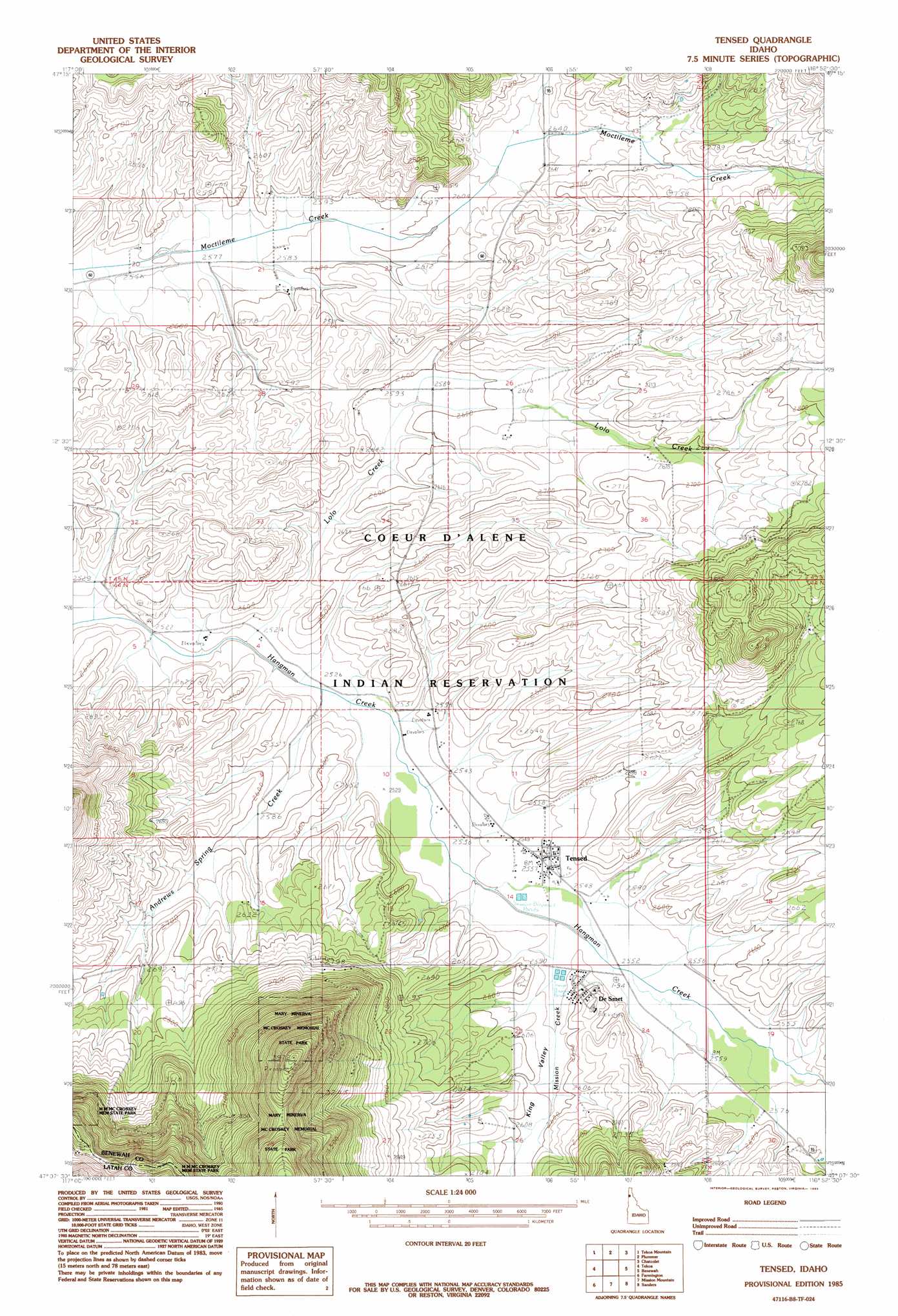
Tensed Topo Map Idaho
To zoom in, hover over the map of Tensed
USGS Topo Quad 47116b8 - 1:24,000 scale
| Topo Map Name: | Tensed |
| USGS Topo Quad ID: | 47116b8 |
| Print Size: | ca. 21 1/4" wide x 27" high |
| Southeast Coordinates: | 47.125° N latitude / 116.875° W longitude |
| Map Center Coordinates: | 47.1875° N latitude / 116.9375° W longitude |
| U.S. State: | ID |
| Filename: | o47116b8.jpg |
| Download Map JPG Image: | Tensed topo map 1:24,000 scale |
| Map Type: | Topographic |
| Topo Series: | 7.5´ |
| Map Scale: | 1:24,000 |
| Source of Map Images: | United States Geological Survey (USGS) |
| Alternate Map Versions: |
Tensed ID 1985, updated 1985 Download PDF Buy paper map Tensed ID 2010 Download PDF Buy paper map Tensed ID 2013 Download PDF Buy paper map |
1:24,000 Topo Quads surrounding Tensed
Fairfield |
Setters |
Worley |
Harrison |
Black Lake |
Latah |
Tekoa Mountain |
Plummer |
Chatcolet |
Benewah Lake |
Oakesdale |
Tekoa |
Tensed |
Benewah |
Alder Creek Flats |
Garfield |
Farmington |
Mission Mountain |
Sanders |
West Dennis |
Elberton |
Palouse |
Potlatch |
Princeton |
Harvard |
> Back to 47116a1 at 1:100,000 scale
> Back to 47116a1 at 1:250,000 scale
> Back to U.S. Topo Maps home
Tensed topo map: Gazetteer
Tensed: Populated Places
De Smet elevation 792m 2598′Tensed elevation 781m 2562′
Tensed: Springs
Ts'ts'p'qhwi'lus Spring elevation 773m 2536′Tensed: Streams
Andrews Spring Creek elevation 772m 2532′Lolo Creek elevation 769m 2522′
Mission Creek elevation 775m 2542′
Tensed: Summits
Łukwle' Mountain elevation 941m 3087′Tensed: Valleys
King Valley elevation 779m 2555′Tensed digital topo map on disk
Buy this Tensed topo map showing relief, roads, GPS coordinates and other geographical features, as a high-resolution digital map file on DVD: