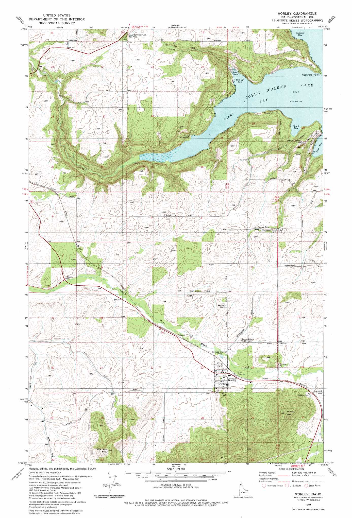
Worley Topo Map Idaho
To zoom in, hover over the map of Worley
USGS Topo Quad 47116d8 - 1:24,000 scale
| Topo Map Name: | Worley |
| USGS Topo Quad ID: | 47116d8 |
| Print Size: | ca. 21 1/4" wide x 27" high |
| Southeast Coordinates: | 47.375° N latitude / 116.875° W longitude |
| Map Center Coordinates: | 47.4375° N latitude / 116.9375° W longitude |
| U.S. State: | ID |
| Filename: | o47116d8.jpg |
| Download Map JPG Image: | Worley topo map 1:24,000 scale |
| Map Type: | Topographic |
| Topo Series: | 7.5´ |
| Map Scale: | 1:24,000 |
| Source of Map Images: | United States Geological Survey (USGS) |
| Alternate Map Versions: |
Plummer NW ID 1975, updated 1977 Download PDF Buy paper map Worley ID 1981, updated 1982 Download PDF Buy paper map Worley ID 2010 Download PDF Buy paper map Worley ID 2014 Download PDF Buy paper map |
1:24,000 Topo Quads surrounding Worley
Greenacres |
Liberty Lake |
Post Falls |
Coeur D'Alene |
Fernan Lake |
Freeman |
Mica Peak |
Rockford Bay |
Mica Bay |
Mount Coeur D'Alene |
Fairfield |
Setters |
Worley |
Harrison |
Black Lake |
Latah |
Tekoa Mountain |
Plummer |
Chatcolet |
Benewah Lake |
Oakesdale |
Tekoa |
Tensed |
Benewah |
Alder Creek Flats |
> Back to 47116a1 at 1:100,000 scale
> Back to 47116a1 at 1:250,000 scale
> Back to U.S. Topo Maps home
Worley topo map: Gazetteer
Worley: Bays
16 to 1 Bay elevation 649m 2129′Cave Bay elevation 649m 2129′
Sixteen-to-One Bay elevation 649m 2129′
Sun Up Bay elevation 649m 2129′
Windy Bay elevation 649m 2129′
Worley: Capes
Rockford Point elevation 682m 2237′Worley: Populated Places
Mozart elevation 796m 2611′Worley elevation 811m 2660′
Worley: Streams
Lake Creek elevation 649m 2129′Lake Creek elevation 649m 2129′
Worley: Summits
Warners Mountain elevation 1000m 3280′Worley Mountain elevation 1077m 3533′
Worley digital topo map on disk
Buy this Worley topo map showing relief, roads, GPS coordinates and other geographical features, as a high-resolution digital map file on DVD: