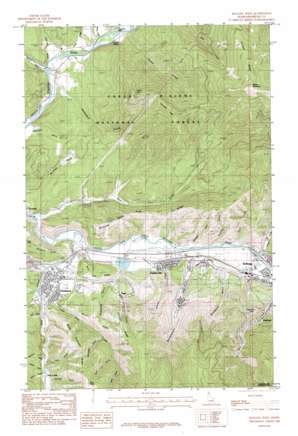
Kellogg West Topo Map Idaho
To zoom in, hover over the map of Kellogg West
USGS Topo Quad 47116e2 - 1:24,000 scale
| Topo Map Name: | Kellogg West |
| USGS Topo Quad ID: | 47116e2 |
| Print Size: | ca. 21 1/4" wide x 27" high |
| Southeast Coordinates: | 47.5° N latitude / 116.125° W longitude |
| Map Center Coordinates: | 47.5625° N latitude / 116.1875° W longitude |
| U.S. State: | ID |
| Filename: | o47116e2.jpg |
| Download Map JPG Image: | Kellogg West topo map 1:24,000 scale |
| Map Type: | Topographic |
| Topo Series: | 7.5´ |
| Map Scale: | 1:24,000 |
| Source of Map Images: | United States Geological Survey (USGS) |
| Alternate Map Versions: |
Kellogg West ID 1985, updated 1985 Download PDF Buy paper map Kellogg West ID 1985, updated 1985 Download PDF Buy paper map Kellogg West ID 1996, updated 1999 Download PDF Buy paper map Kellogg West ID 2011 Download PDF Buy paper map Kellogg West ID 2014 Download PDF Buy paper map |
| FStopo: | US Forest Service topo Kellogg West is available: Download FStopo PDF Download FStopo TIF |
1:24,000 Topo Quads surrounding Kellogg West
> Back to 47116e1 at 1:100,000 scale
> Back to 47116a1 at 1:250,000 scale
> Back to U.S. Topo Maps home
Kellogg West topo map: Gazetteer
Kellogg West: Airports
Shoshone County Airport elevation 676m 2217′Kellogg West: Bays
Deadmans Eddy elevation 672m 2204′Kellogg West: Bends
Devils Elbow elevation 671m 2201′Kellogg West: Dams
Bunker Hill Tailings Number One Dam elevation 742m 2434′Bunker Hill Tailings Number Three Dam elevation 791m 2595′
Bunker Hill Tailings Number Two Dam elevation 787m 2582′
Kellogg West: Mines
Amy-Matchless Mine elevation 719m 2358′Antimony Mine elevation 725m 2378′
Bobby Anderson Mine elevation 714m 2342′
Bunker Hill Mine elevation 1028m 3372′
General Mine elevation 719m 2358′
Last Chance Mine elevation 923m 3028′
Page Mine elevation 819m 2687′
Kellogg West: Parks
West Shoshone Park elevation 676m 2217′Kellogg West: Populated Places
Bradley elevation 697m 2286′Linfor elevation 674m 2211′
Page elevation 739m 2424′
Pine Creek elevation 669m 2194′
Pinehurst elevation 678m 2224′
Smelter Heights elevation 762m 2500′
Smelterville elevation 681m 2234′
Sweeney elevation 717m 2352′
Wardner elevation 810m 2657′
Kellogg West: Ridges
Blue Star Ridge elevation 776m 2545′Bobby Anderson Ridge elevation 1090m 3576′
Corrigan Ridge elevation 1065m 3494′
Graham Ridge elevation 1654m 5426′
Kingston Ridge elevation 855m 2805′
Maude Ridge elevation 904m 2965′
South Fork Ridge elevation 889m 2916′
Kellogg West: Streams
Bear Creek elevation 666m 2185′Cook Creek elevation 695m 2280′
Grouse Creek elevation 681m 2234′
Jackass Creek elevation 697m 2286′
Little North Fork Coeur d'Alene River elevation 666m 2185′
Little Pine Creek elevation 668m 2191′
Marsh Creek elevation 671m 2201′
Milo Creek elevation 762m 2500′
Pine Creek elevation 666m 2185′
Silver Creek elevation 850m 2788′
Studer Creek elevation 669m 2194′
Thomas Creek elevation 672m 2204′
Kellogg West: Summits
Fubar Peak elevation 871m 2857′Graham Mountain elevation 1745m 5725′
Haystack Peak elevation 1038m 3405′
Linfor Hill elevation 1320m 4330′
McLeod Hill elevation 1003m 3290′
Pine Point elevation 1330m 4363′
Thomas Hill elevation 1349m 4425′
Kellogg West: Valleys
Amy Gulch elevation 708m 2322′Caldwell Gulch elevation 719m 2358′
Deadwood Gulch elevation 729m 2391′
Deer Lick Gulch elevation 896m 2939′
Government Gulch elevation 724m 2375′
Grader Gulch elevation 719m 2358′
Hauck Gulch elevation 729m 2391′
Hazendorf Gulch elevation 694m 2276′
Heim Gulch elevation 741m 2431′
Hultman Gulch elevation 668m 2191′
Humboldt Gulch elevation 682m 2237′
Idaho Gulch elevation 946m 3103′
Klondike Gulch elevation 717m 2352′
Lightner Draw elevation 674m 2211′
Matchless Gulch elevation 735m 2411′
McKinley Gulch elevation 841m 2759′
McPhee Gulch elevation 682m 2237′
Slaughterhouse Gulch elevation 787m 2582′
Sweeney Gulch elevation 713m 2339′
Tucker Gulch elevation 684m 2244′
Weir Gulch elevation 693m 2273′
Kellogg West digital topo map on disk
Buy this Kellogg West topo map showing relief, roads, GPS coordinates and other geographical features, as a high-resolution digital map file on DVD:


