Rockford Bay Topo Map Idaho
To zoom in, hover over the map of Rockford Bay
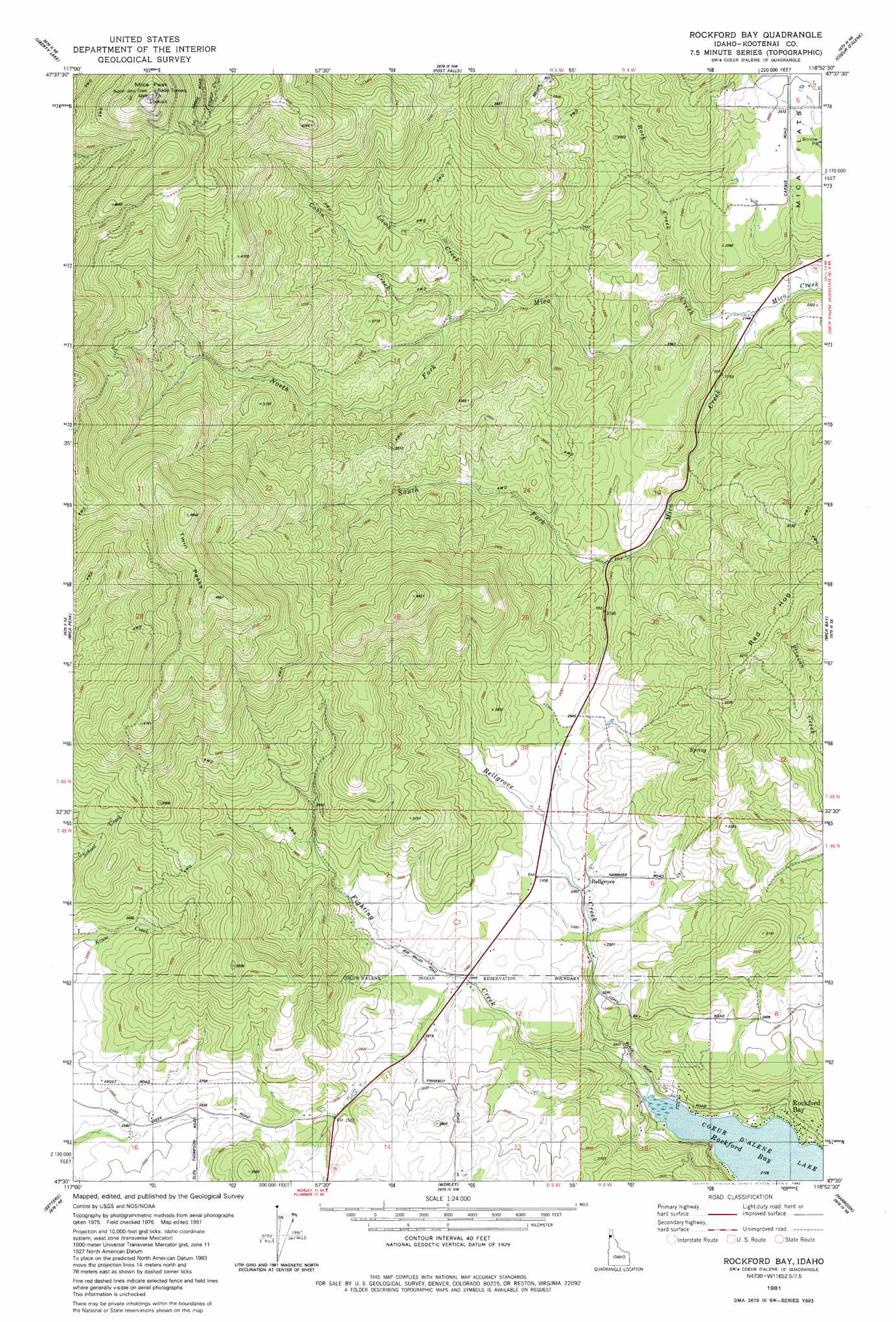
USGS Topo Quad 47116e8 - 1:24,000 scale
| Topo Map Name: | Rockford Bay |
| USGS Topo Quad ID: | 47116e8 |
| Print Size: | ca. 21 1/4" wide x 27" high |
| Southeast Coordinates: | 47.5° N latitude / 116.875° W longitude |
| Map Center Coordinates: | 47.5625° N latitude / 116.9375° W longitude |
| U.S. State: | ID |
| Filename: | o47116e8.jpg |
| Download Map JPG Image: | Rockford Bay topo map 1:24,000 scale |
| Map Type: | Topographic |
| Topo Series: | 7.5´ |
| Map Scale: | 1:24,000 |
| Source of Map Images: | United States Geological Survey (USGS) |
| Alternate Map Versions: |
Rockford Bay ID 1981, updated 1982 Download PDF Buy paper map Rockford Bay ID 1981, updated 1982 Download PDF Buy paper map Rockford Bay ID 2010 Download PDF Buy paper map Rockford Bay ID 2013 Download PDF Buy paper map |
1:24,000 Topo Quads surrounding Rockford Bay
Foothills |
Newman Lake |
Rathdrum |
Hayden |
Hayden Lake |
Greenacres |
Liberty Lake |
Post Falls |
Coeur D'Alene |
Fernan Lake |
Freeman |
Mica Peak |
Rockford Bay |
Mica Bay |
Mount Coeur D'Alene |
Fairfield |
Setters |
Worley |
Harrison |
Black Lake |
Latah |
Tekoa Mountain |
Plummer |
Chatcolet |
Benewah Lake |
> Back to 47116e1 at 1:100,000 scale
> Back to 47116a1 at 1:250,000 scale
> Back to U.S. Topo Maps home
Rockford Bay topo map: Gazetteer
Rockford Bay: Bays
Rockford Bay elevation 649m 2129′Rockford Bay: Populated Places
Bellgrove elevation 754m 2473′Rockford Bay elevation 668m 2191′
Rockford Bay: Streams
Bellgrove Creek elevation 658m 2158′Cabin Creek elevation 728m 2388′
Fighting Creek elevation 649m 2129′
Lamb Creek elevation 715m 2345′
North Fork Mica Creek elevation 653m 2142′
Rock Creek elevation 654m 2145′
South Fork Mica Creek elevation 654m 2145′
Rockford Bay: Summits
Mica Peak elevation 1598m 5242′Twin Peaks elevation 1429m 4688′
Rockford Bay digital topo map on disk
Buy this Rockford Bay topo map showing relief, roads, GPS coordinates and other geographical features, as a high-resolution digital map file on DVD: