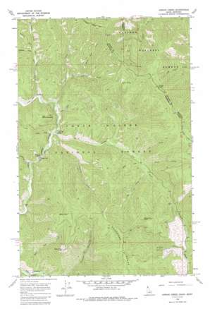
Jordan Creek Topo Map Idaho
To zoom in, hover over the map of Jordan Creek
USGS Topo Quad 47116h1 - 1:24,000 scale
| Topo Map Name: | Jordan Creek |
| USGS Topo Quad ID: | 47116h1 |
| Print Size: | ca. 21 1/4" wide x 27" high |
| Southeast Coordinates: | 47.875° N latitude / 116° W longitude |
| Map Center Coordinates: | 47.9375° N latitude / 116.0625° W longitude |
| U.S. States: | ID, MT |
| Filename: | o47116h1.jpg |
| Download Map JPG Image: | Jordan Creek topo map 1:24,000 scale |
| Map Type: | Topographic |
| Topo Series: | 7.5´ |
| Map Scale: | 1:24,000 |
| Source of Map Images: | United States Geological Survey (USGS) |
| Alternate Map Versions: |
Jordan Creek ID 1966, updated 1971 Download PDF Buy paper map Jordan Creek ID 1966, updated 1986 Download PDF Buy paper map Jordan Creek ID 1996, updated 1999 Download PDF Buy paper map Jordan Creek ID 2011 Download PDF Buy paper map Jordan Creek ID 2013 Download PDF Buy paper map |
| FStopo: | US Forest Service topo Jordan Creek is available: Download FStopo PDF Download FStopo TIF |
1:24,000 Topo Quads surrounding Jordan Creek
> Back to 47116e1 at 1:100,000 scale
> Back to 47116a1 at 1:250,000 scale
> Back to U.S. Topo Maps home
Jordan Creek topo map: Gazetteer
Jordan Creek: Cliffs
Cathedral Rocks elevation 958m 3143′Jordan Creek: Gaps
Jordan Saddle elevation 1234m 4048′Jordan Creek: Pillars
Spion Kop Rock elevation 1583m 5193′Jordan Creek: Springs
Jordan Springs elevation 1265m 4150′Jordan Creek: Streams
Alden Creek elevation 934m 3064′Blacktail Creek elevation 997m 3270′
Bluff Creek elevation 1034m 3392′
Calamity Creek elevation 933m 3061′
Cathedral Creek elevation 908m 2979′
Cub Creek elevation 1023m 3356′
Deer Creek elevation 948m 3110′
East Alden Creek elevation 984m 3228′
Falls Creek elevation 933m 3061′
Hemlock Creek elevation 1077m 3533′
Lost Fork elevation 983m 3225′
Plant Creek elevation 1035m 3395′
Sheep Run Creek elevation 1025m 3362′
Sho Creek elevation 1045m 3428′
Spion Kop Creek elevation 853m 2798′
Tsuga Creek elevation 950m 3116′
Whitetail Creek elevation 1014m 3326′
Jordan Creek: Summits
Divide Peak elevation 1589m 5213′Divide Peak elevation 1589m 5213′
East Cathedral Peak elevation 1241m 4071′
Shoshone Peak elevation 1651m 5416′
Spion Kop elevation 1685m 5528′
Jordan Creek: Trails
Coeur d'Alene River National Recreation Trail elevation 974m 3195′Jordan Creek digital topo map on disk
Buy this Jordan Creek topo map showing relief, roads, GPS coordinates and other geographical features, as a high-resolution digital map file on DVD:


