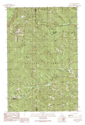
Faset Peak Topo Map Idaho
To zoom in, hover over the map of Faset Peak
USGS Topo Quad 47116h3 - 1:24,000 scale
| Topo Map Name: | Faset Peak |
| USGS Topo Quad ID: | 47116h3 |
| Print Size: | ca. 21 1/4" wide x 27" high |
| Southeast Coordinates: | 47.875° N latitude / 116.25° W longitude |
| Map Center Coordinates: | 47.9375° N latitude / 116.3125° W longitude |
| U.S. State: | ID |
| Filename: | o47116h3.jpg |
| Download Map JPG Image: | Faset Peak topo map 1:24,000 scale |
| Map Type: | Topographic |
| Topo Series: | 7.5´ |
| Map Scale: | 1:24,000 |
| Source of Map Images: | United States Geological Survey (USGS) |
| Alternate Map Versions: |
Faset Peak ID 1990, updated 1991 Download PDF Buy paper map Faset Peak ID 1996, updated 1999 Download PDF Buy paper map Faset Peak ID 2011 Download PDF Buy paper map Faset Peak ID 2013 Download PDF Buy paper map |
| FStopo: | US Forest Service topo Faset Peak is available: Download FStopo PDF Download FStopo TIF |
1:24,000 Topo Quads surrounding Faset Peak
> Back to 47116e1 at 1:100,000 scale
> Back to 47116a1 at 1:250,000 scale
> Back to U.S. Topo Maps home
Faset Peak topo map: Gazetteer
Faset Peak: Flats
Snowbird Meadows elevation 957m 3139′Faset Peak: Gaps
Bishop Saddle elevation 1260m 4133′Faset Peak: Mines
Dixie Queen Mine elevation 1082m 3549′Faset Peak: Springs
Bishop Spring elevation 1289m 4229′Faset Peak: Streams
Camp Creek elevation 993m 3257′Declaration Creek elevation 970m 3182′
Ellis Creek elevation 990m 3248′
Ermine Creek elevation 947m 3106′
Gorsuch Creek elevation 957m 3139′
Green Creek elevation 923m 3028′
Griffin Creek elevation 933m 3061′
Larch Creek elevation 1081m 3546′
North Creek elevation 934m 3064′
Powder Creek elevation 1097m 3599′
Snow Creek elevation 934m 3064′
Snowbird Creek elevation 972m 3188′
Surprise Creek elevation 969m 3179′
Faset Peak: Summits
Faset Peak elevation 1601m 5252′Griffith Peak elevation 1397m 4583′
Hamilton Mountain elevation 1527m 5009′
Magee Peak elevation 1465m 4806′
North Snow Peak elevation 1397m 4583′
Pierson Peak elevation 1404m 4606′
Spruce Mountain elevation 1548m 5078′
Faset Peak: Trails
Ermine Ridge Trail elevation 1277m 4189′Independence Creek National Recreation Trail elevation 962m 3156′
Upper Declaration Trail elevation 1311m 4301′
Faset Peak digital topo map on disk
Buy this Faset Peak topo map showing relief, roads, GPS coordinates and other geographical features, as a high-resolution digital map file on DVD:


