Spirit Lake East Topo Map Idaho
To zoom in, hover over the map of Spirit Lake East
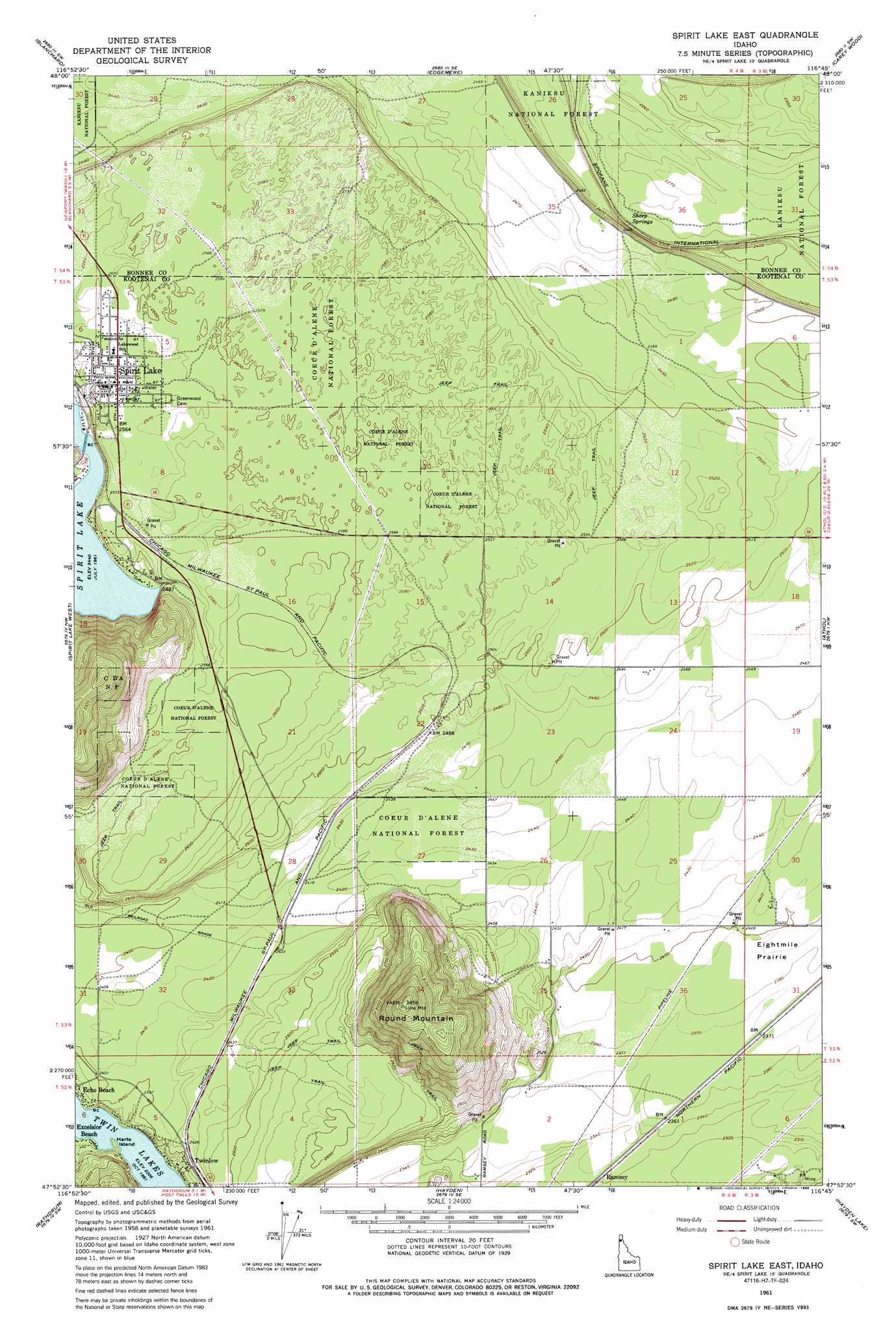
USGS Topo Quad 47116h7 - 1:24,000 scale
| Topo Map Name: | Spirit Lake East |
| USGS Topo Quad ID: | 47116h7 |
| Print Size: | ca. 21 1/4" wide x 27" high |
| Southeast Coordinates: | 47.875° N latitude / 116.75° W longitude |
| Map Center Coordinates: | 47.9375° N latitude / 116.8125° W longitude |
| U.S. State: | ID |
| Filename: | o47116h7.jpg |
| Download Map JPG Image: | Spirit Lake East topo map 1:24,000 scale |
| Map Type: | Topographic |
| Topo Series: | 7.5´ |
| Map Scale: | 1:24,000 |
| Source of Map Images: | United States Geological Survey (USGS) |
| Alternate Map Versions: |
Spirit Lake East ID 1961, updated 1962 Download PDF Buy paper map Spirit Lake East ID 1961, updated 1975 Download PDF Buy paper map Spirit Lake East ID 1961, updated 1986 Download PDF Buy paper map Spirit Lake East ID 1996, updated 1999 Download PDF Buy paper map Spirit Lake East ID 2011 Download PDF Buy paper map Spirit Lake East ID 2013 Download PDF Buy paper map |
| FStopo: | US Forest Service topo Spirit Lake East is available: Download FStopo PDF Download FStopo TIF |
1:24,000 Topo Quads surrounding Spirit Lake East
Newport |
Priest River |
Laclede |
Morton |
Sagle |
Tweedie |
Blanchard |
Edgemere |
Careywood |
Cocolalla |
Mount Spokane |
Spirit Lake West |
Spirit Lake East |
Athol |
Bayview |
Newman Lake |
Rathdrum |
Hayden |
Hayden Lake |
Spades Mountain |
Liberty Lake |
Post Falls |
Coeur D'Alene |
Fernan Lake |
Wolf Lodge |
> Back to 47116e1 at 1:100,000 scale
> Back to 47116a1 at 1:250,000 scale
> Back to U.S. Topo Maps home
Spirit Lake East topo map: Gazetteer
Spirit Lake East: Airports
Round Mountain Aerodrome elevation 745m 2444′Treeport Airport elevation 759m 2490′
Spirit Lake East: Capes
Harts Island elevation 710m 2329′Spirit Lake East: Populated Places
Spirit Lake elevation 783m 2568′Twinlow elevation 733m 2404′
Spirit Lake East: Springs
Sheep Springs elevation 698m 2290′Spirit Lake East: Summits
Round Mountain elevation 1052m 3451′Spirit Lake East digital topo map on disk
Buy this Spirit Lake East topo map showing relief, roads, GPS coordinates and other geographical features, as a high-resolution digital map file on DVD: