Farmington Topo Map Washington
To zoom in, hover over the map of Farmington
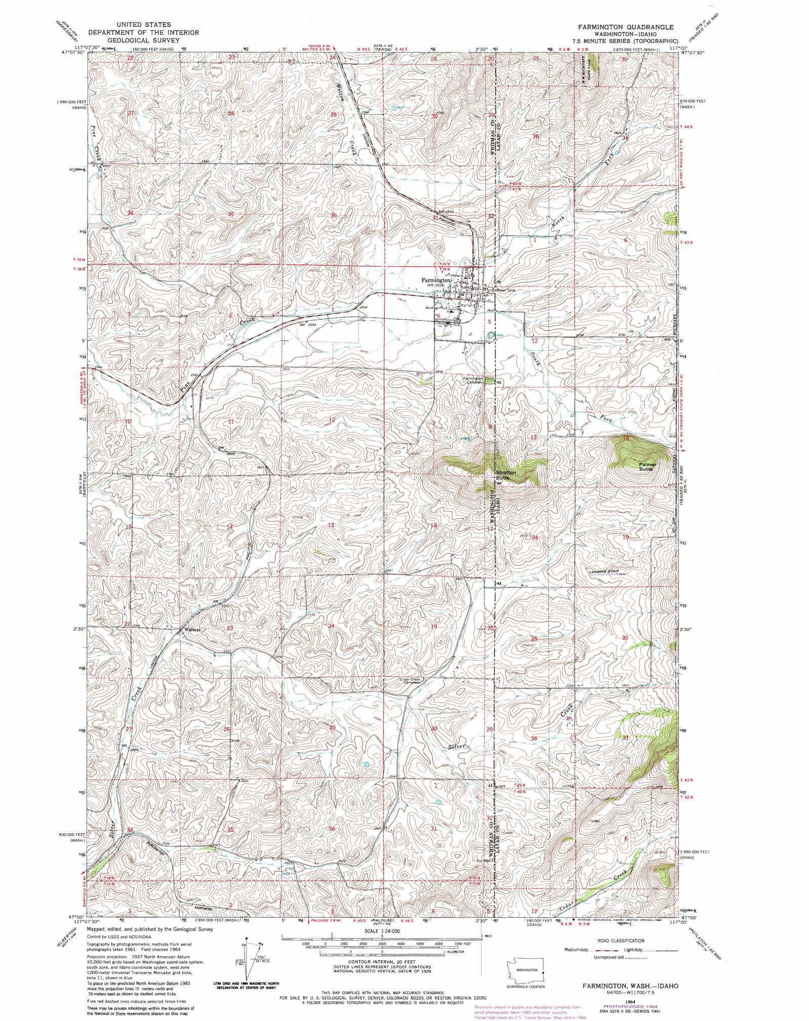
USGS Topo Quad 47117a1 - 1:24,000 scale
| Topo Map Name: | Farmington |
| USGS Topo Quad ID: | 47117a1 |
| Print Size: | ca. 21 1/4" wide x 27" high |
| Southeast Coordinates: | 47° N latitude / 117° W longitude |
| Map Center Coordinates: | 47.0625° N latitude / 117.0625° W longitude |
| U.S. States: | WA, ID |
| Filename: | o47117a1.jpg |
| Download Map JPG Image: | Farmington topo map 1:24,000 scale |
| Map Type: | Topographic |
| Topo Series: | 7.5´ |
| Map Scale: | 1:24,000 |
| Source of Map Images: | United States Geological Survey (USGS) |
| Alternate Map Versions: |
Farmington WA 1964, updated 1965 Download PDF Buy paper map Farmington WA 1964, updated 1984 Download PDF Buy paper map Farmington WA 1994, updated 1997 Download PDF Buy paper map Farmington WA 1994, updated 1997 Download PDF Buy paper map Farmington WA 2011 Download PDF Buy paper map Farmington WA 2014 Download PDF Buy paper map |
| FStopo: | US Forest Service topo Farmington is available: Download FStopo PDF Download FStopo TIF |
1:24,000 Topo Quads surrounding Farmington
Spring Valley |
Latah |
Tekoa Mountain |
Plummer |
Chatcolet |
Rosalia |
Oakesdale |
Tekoa |
Tensed |
Benewah |
Steptoe |
Garfield |
Farmington |
Mission Mountain |
Sanders |
Colfax North |
Elberton |
Palouse |
Potlatch |
Princeton |
Colfax South |
Albion |
Viola |
Robinson Lake |
Moscow Mountain |
> Back to 47117a1 at 1:100,000 scale
> Back to 47116a1 at 1:250,000 scale
> Back to U.S. Topo Maps home
Farmington topo map: Gazetteer
Farmington: Populated Places
Farmington elevation 805m 2641′Walters elevation 772m 2532′
Farmington: Streams
North Fork Pine Creek elevation 797m 2614′North Fork Pine Creek elevation 797m 2614′
South Fork Pine Creek elevation 797m 2614′
South Fork Pine Creek elevation 797m 2614′
Farmington: Summits
Palmer Butte elevation 965m 3166′Stratton Butte elevation 1002m 3287′
Stratton Butte elevation 1002m 3287′
Farmington digital topo map on disk
Buy this Farmington topo map showing relief, roads, GPS coordinates and other geographical features, as a high-resolution digital map file on DVD: