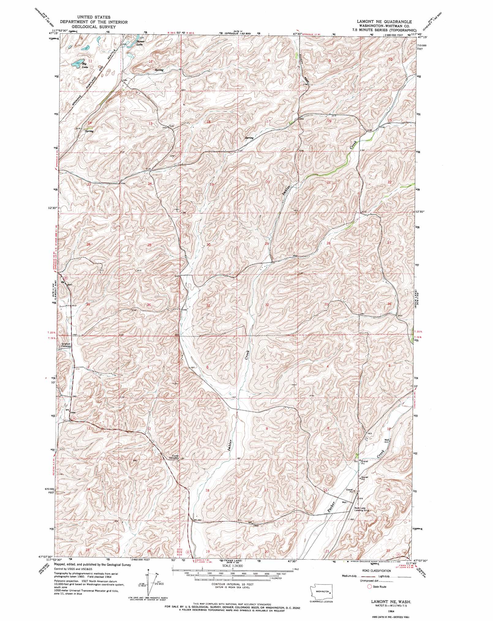
Lamont Ne Topo Map Washington
To zoom in, hover over the map of Lamont Ne
USGS Topo Quad 47117b7 - 1:24,000 scale
| Topo Map Name: | Lamont Ne |
| USGS Topo Quad ID: | 47117b7 |
| Print Size: | ca. 21 1/4" wide x 27" high |
| Southeast Coordinates: | 47.125° N latitude / 117.75° W longitude |
| Map Center Coordinates: | 47.1875° N latitude / 117.8125° W longitude |
| U.S. State: | WA |
| Filename: | o47117b7.jpg |
| Download Map JPG Image: | Lamont Ne topo map 1:24,000 scale |
| Map Type: | Topographic |
| Topo Series: | 7.5´ |
| Map Scale: | 1:24,000 |
| Source of Map Images: | United States Geological Survey (USGS) |
| Alternate Map Versions: |
Lamont NE WA 1964, updated 1965 Download PDF Buy paper map Lamont NE WA 2011 Download PDF Buy paper map Lamont NE WA 2014 Download PDF Buy paper map |
1:24,000 Topo Quads surrounding Lamont Ne
Sprague Lake Ne |
Sassin |
Tyler |
Lance Hills |
Cheney |
Sprague Lake |
Sprague |
Fishtrap Lake |
Amber |
Chapman Lake |
Palm Lake |
Lamont |
Lamont Ne |
Rock Lake |
Pine City |
Macall |
Revere |
Texas Lake |
Ewan |
Saint John |
Benge |
Honn Lakes |
Winona |
Endicott |
Thera |
> Back to 47117a1 at 1:100,000 scale
> Back to 47116a1 at 1:250,000 scale
> Back to U.S. Topo Maps home
Lamont Ne topo map: Gazetteer
Lamont Ne: Lakes
Big Lake elevation 610m 2001′Stoner Lake elevation 623m 2043′
Lamont Ne digital topo map on disk
Buy this Lamont Ne topo map showing relief, roads, GPS coordinates and other geographical features, as a high-resolution digital map file on DVD: