Spring Valley Topo Map Washington
To zoom in, hover over the map of Spring Valley
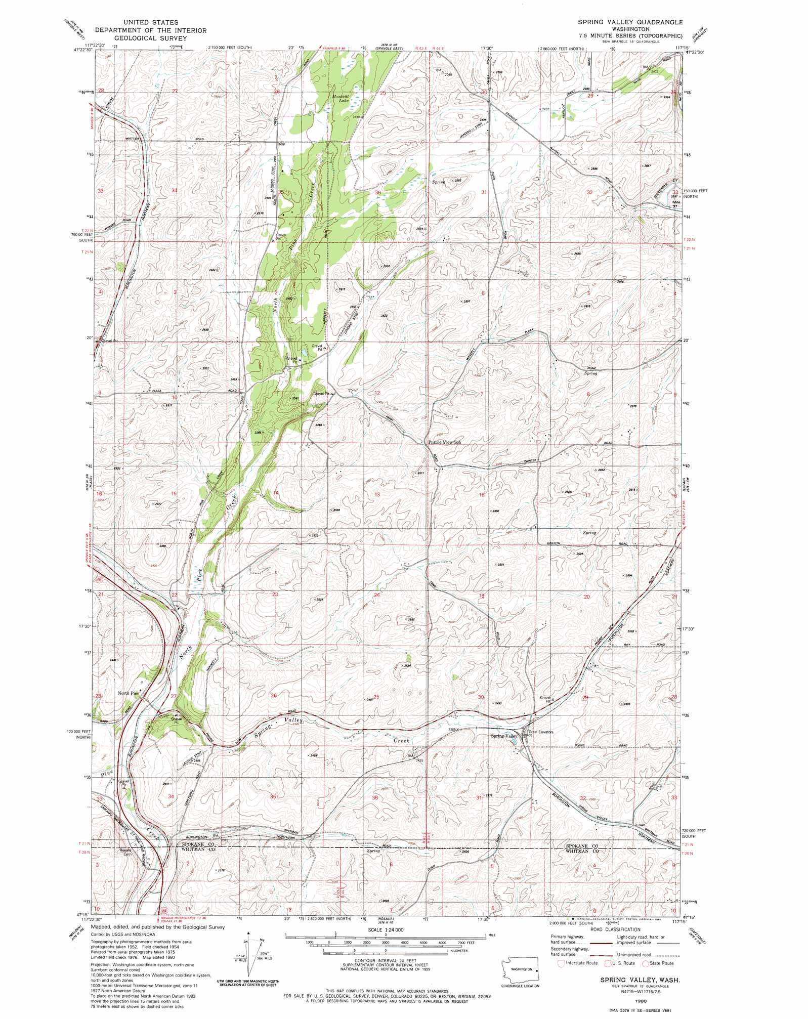
USGS Topo Quad 47117c3 - 1:24,000 scale
| Topo Map Name: | Spring Valley |
| USGS Topo Quad ID: | 47117c3 |
| Print Size: | ca. 21 1/4" wide x 27" high |
| Southeast Coordinates: | 47.25° N latitude / 117.25° W longitude |
| Map Center Coordinates: | 47.3125° N latitude / 117.3125° W longitude |
| U.S. State: | WA |
| Filename: | o47117c3.jpg |
| Download Map JPG Image: | Spring Valley topo map 1:24,000 scale |
| Map Type: | Topographic |
| Topo Series: | 7.5´ |
| Map Scale: | 1:24,000 |
| Source of Map Images: | United States Geological Survey (USGS) |
| Alternate Map Versions: |
Spring Valley WA 1980, updated 1981 Download PDF Buy paper map Spring Valley WA 2011 Download PDF Buy paper map Spring Valley WA 2014 Download PDF Buy paper map |
1:24,000 Topo Quads surrounding Spring Valley
Four Lakes |
Spokane Sw |
Spokane Se |
Freeman |
Mica Peak |
Cheney |
Spangle West |
Spangle East |
Fairfield |
Setters |
Chapman Lake |
Plaza |
Spring Valley |
Latah |
Tekoa Mountain |
Pine City |
Malden |
Rosalia |
Oakesdale |
Tekoa |
Saint John |
Thornton |
Steptoe |
Garfield |
Farmington |
> Back to 47117a1 at 1:100,000 scale
> Back to 47116a1 at 1:250,000 scale
> Back to U.S. Topo Maps home
Spring Valley topo map: Gazetteer
Spring Valley: Lakes
Muskrat Lake elevation 738m 2421′Spring Valley: Populated Places
North Pine elevation 676m 2217′Spring Valley elevation 733m 2404′
Spring Valley: Streams
North Pine Creek elevation 665m 2181′Spring Valley Creek elevation 666m 2185′
Spring Valley digital topo map on disk
Buy this Spring Valley topo map showing relief, roads, GPS coordinates and other geographical features, as a high-resolution digital map file on DVD: