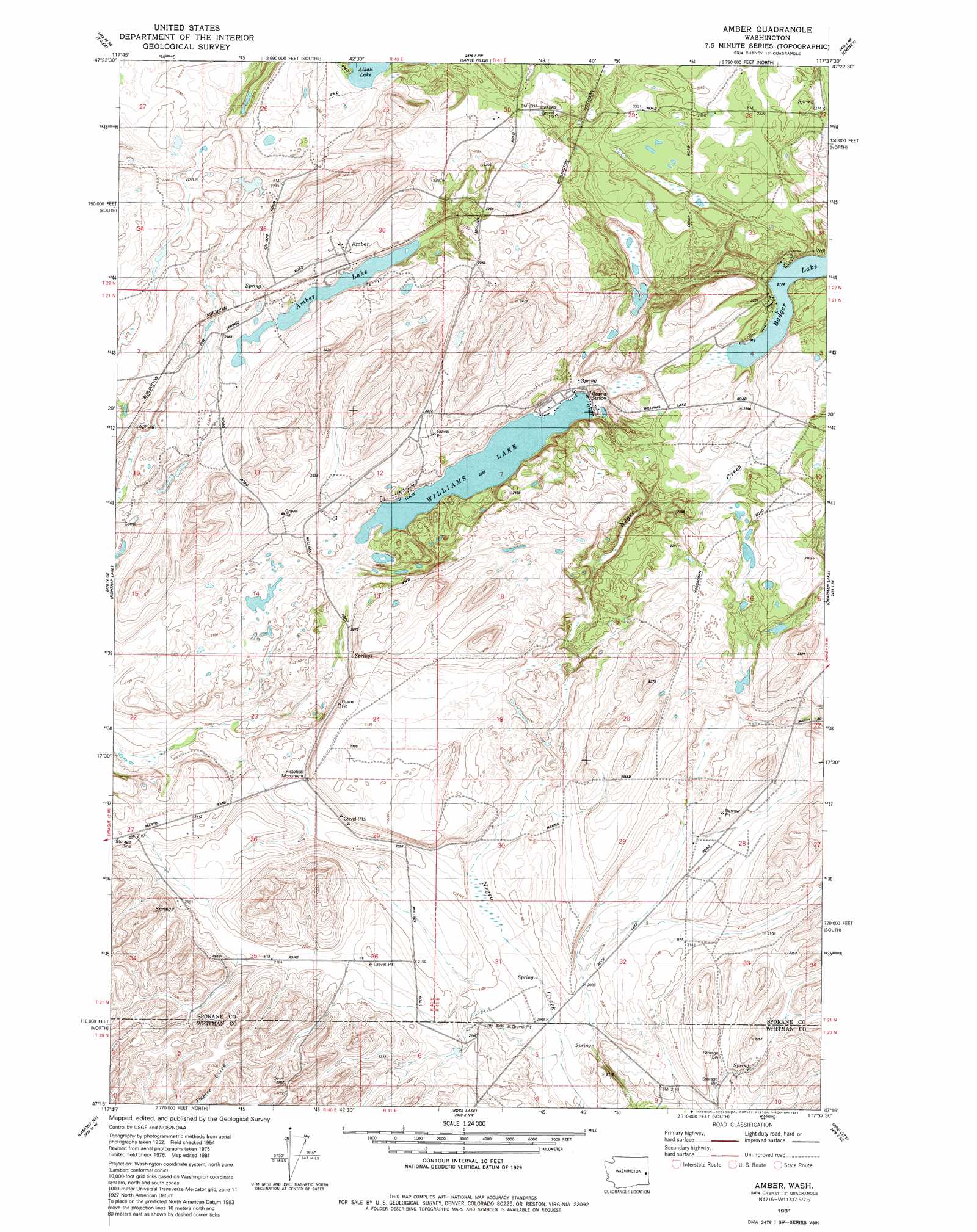
Amber Topo Map Washington
To zoom in, hover over the map of Amber
USGS Topo Quad 47117c6 - 1:24,000 scale
| Topo Map Name: | Amber |
| USGS Topo Quad ID: | 47117c6 |
| Print Size: | ca. 21 1/4" wide x 27" high |
| Southeast Coordinates: | 47.25° N latitude / 117.625° W longitude |
| Map Center Coordinates: | 47.3125° N latitude / 117.6875° W longitude |
| U.S. State: | WA |
| Filename: | o47117c6.jpg |
| Download Map JPG Image: | Amber topo map 1:24,000 scale |
| Map Type: | Topographic |
| Topo Series: | 7.5´ |
| Map Scale: | 1:24,000 |
| Source of Map Images: | United States Geological Survey (USGS) |
| Alternate Map Versions: |
Amber WA 1981, updated 1981 Download PDF Buy paper map Amber WA 2011 Download PDF Buy paper map Amber WA 2014 Download PDF Buy paper map |
1:24,000 Topo Quads surrounding Amber
Edwall |
Waukon |
Medical Lake |
Four Lakes |
Spokane Sw |
Sassin |
Tyler |
Lance Hills |
Cheney |
Spangle West |
Sprague |
Fishtrap Lake |
Amber |
Chapman Lake |
Plaza |
Lamont |
Lamont Ne |
Rock Lake |
Pine City |
Malden |
Revere |
Texas Lake |
Ewan |
Saint John |
Thornton |
> Back to 47117a1 at 1:100,000 scale
> Back to 47116a1 at 1:250,000 scale
> Back to U.S. Topo Maps home
Amber topo map: Gazetteer
Amber: Lakes
Amber Lake elevation 661m 2168′Badger Lake elevation 664m 2178′
Williams Lake elevation 627m 2057′
Amber: Parks
Captain J Mullan Historic Monument elevation 653m 2142′Amber: Populated Places
Amber elevation 686m 2250′Amber: Springs
Cherry Springs elevation 660m 2165′Amber digital topo map on disk
Buy this Amber topo map showing relief, roads, GPS coordinates and other geographical features, as a high-resolution digital map file on DVD: