Spangle East Topo Map Washington
To zoom in, hover over the map of Spangle East
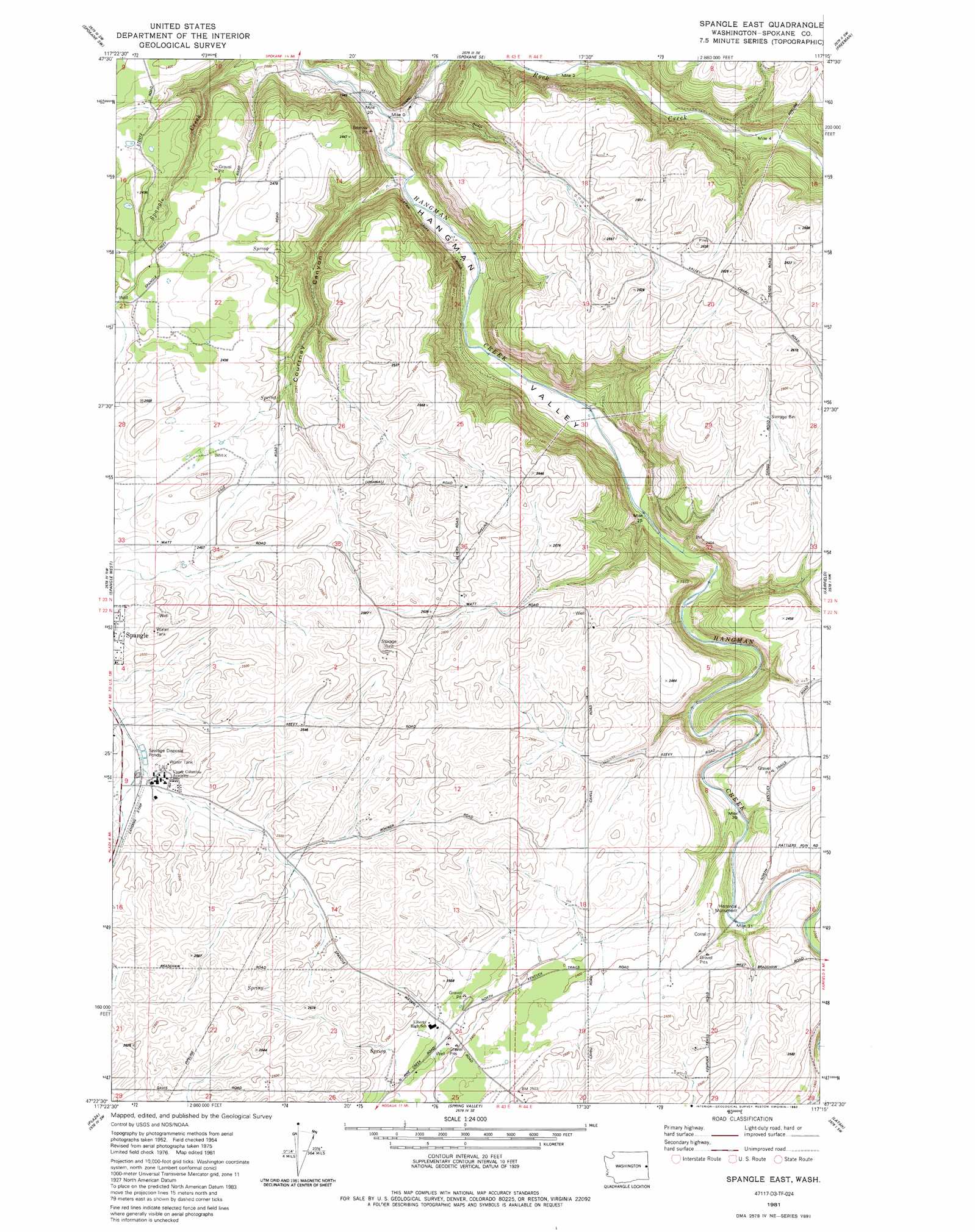
USGS Topo Quad 47117d3 - 1:24,000 scale
| Topo Map Name: | Spangle East |
| USGS Topo Quad ID: | 47117d3 |
| Print Size: | ca. 21 1/4" wide x 27" high |
| Southeast Coordinates: | 47.375° N latitude / 117.25° W longitude |
| Map Center Coordinates: | 47.4375° N latitude / 117.3125° W longitude |
| U.S. State: | WA |
| Filename: | o47117d3.jpg |
| Download Map JPG Image: | Spangle East topo map 1:24,000 scale |
| Map Type: | Topographic |
| Topo Series: | 7.5´ |
| Map Scale: | 1:24,000 |
| Source of Map Images: | United States Geological Survey (USGS) |
| Alternate Map Versions: |
Spangle East WA 1981, updated 1981 Download PDF Buy paper map Spangle East WA 1981, updated 1992 Download PDF Buy paper map Spangle East WA 2011 Download PDF Buy paper map Spangle East WA 2014 Download PDF Buy paper map |
1:24,000 Topo Quads surrounding Spangle East
Airway Heights |
Spokane Nw |
Spokane Ne |
Greenacres |
Liberty Lake |
Four Lakes |
Spokane Sw |
Spokane Se |
Freeman |
Mica Peak |
Cheney |
Spangle West |
Spangle East |
Fairfield |
Setters |
Chapman Lake |
Plaza |
Spring Valley |
Latah |
Tekoa Mountain |
Pine City |
Malden |
Rosalia |
Oakesdale |
Tekoa |
> Back to 47117a1 at 1:100,000 scale
> Back to 47116a1 at 1:250,000 scale
> Back to U.S. Topo Maps home
Spangle East topo map: Gazetteer
Spangle East: Airports
Spangle Field elevation 752m 2467′Spangle East: Parks
George Wright Camp/Treaty Site elevation 756m 2480′Hanging Tree Historical Monument elevation 696m 2283′
Spangle East: Streams
Rock Creek elevation 588m 1929′Spangle East: Valleys
Courtney Canyon elevation 598m 1961′Spangle East digital topo map on disk
Buy this Spangle East topo map showing relief, roads, GPS coordinates and other geographical features, as a high-resolution digital map file on DVD: