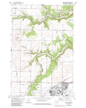
Deep Creek Topo Map Washington
To zoom in, hover over the map of Deep Creek
USGS Topo Quad 47117f6 - 1:24,000 scale
| Topo Map Name: | Deep Creek |
| USGS Topo Quad ID: | 47117f6 |
| Print Size: | ca. 21 1/4" wide x 27" high |
| Southeast Coordinates: | 47.625° N latitude / 117.625° W longitude |
| Map Center Coordinates: | 47.6875° N latitude / 117.6875° W longitude |
| U.S. State: | WA |
| Filename: | o47117f6.jpg |
| Download Map JPG Image: | Deep Creek topo map 1:24,000 scale |
| Map Type: | Topographic |
| Topo Series: | 7.5´ |
| Map Scale: | 1:24,000 |
| Source of Map Images: | United States Geological Survey (USGS) |
| Alternate Map Versions: |
Deep Creek WA 1954, updated 1956 Download PDF Buy paper map Deep Creek WA 1963, updated 1964 Download PDF Buy paper map Deep Creek WA 1973, updated 1975 Download PDF Buy paper map Deep Creek WA 1973, updated 1986 Download PDF Buy paper map Deep Creek WA 1973, updated 1986 Download PDF Buy paper map Deep Creek WA 2011 Download PDF Buy paper map Deep Creek WA 2014 Download PDF Buy paper map |
1:24,000 Topo Quads surrounding Deep Creek
> Back to 47117e1 at 1:100,000 scale
> Back to 47116a1 at 1:250,000 scale
> Back to U.S. Topo Maps home
Deep Creek topo map: Gazetteer
Deep Creek: Flats
Indian Prairie elevation 741m 2431′Deep Creek: Parks
Historical Monument elevation 746m 2447′Miller Park elevation 745m 2444′
Spokane Battlefield State Park elevation 737m 2417′
Deep Creek: Populated Places
Deep Creek elevation 705m 2312′Fairchild elevation 747m 2450′
Deep Creek: Streams
Spring Creek elevation 666m 2185′Deep Creek: Summits
McDowell Hill elevation 830m 2723′Deep Creek digital topo map on disk
Buy this Deep Creek topo map showing relief, roads, GPS coordinates and other geographical features, as a high-resolution digital map file on DVD:


