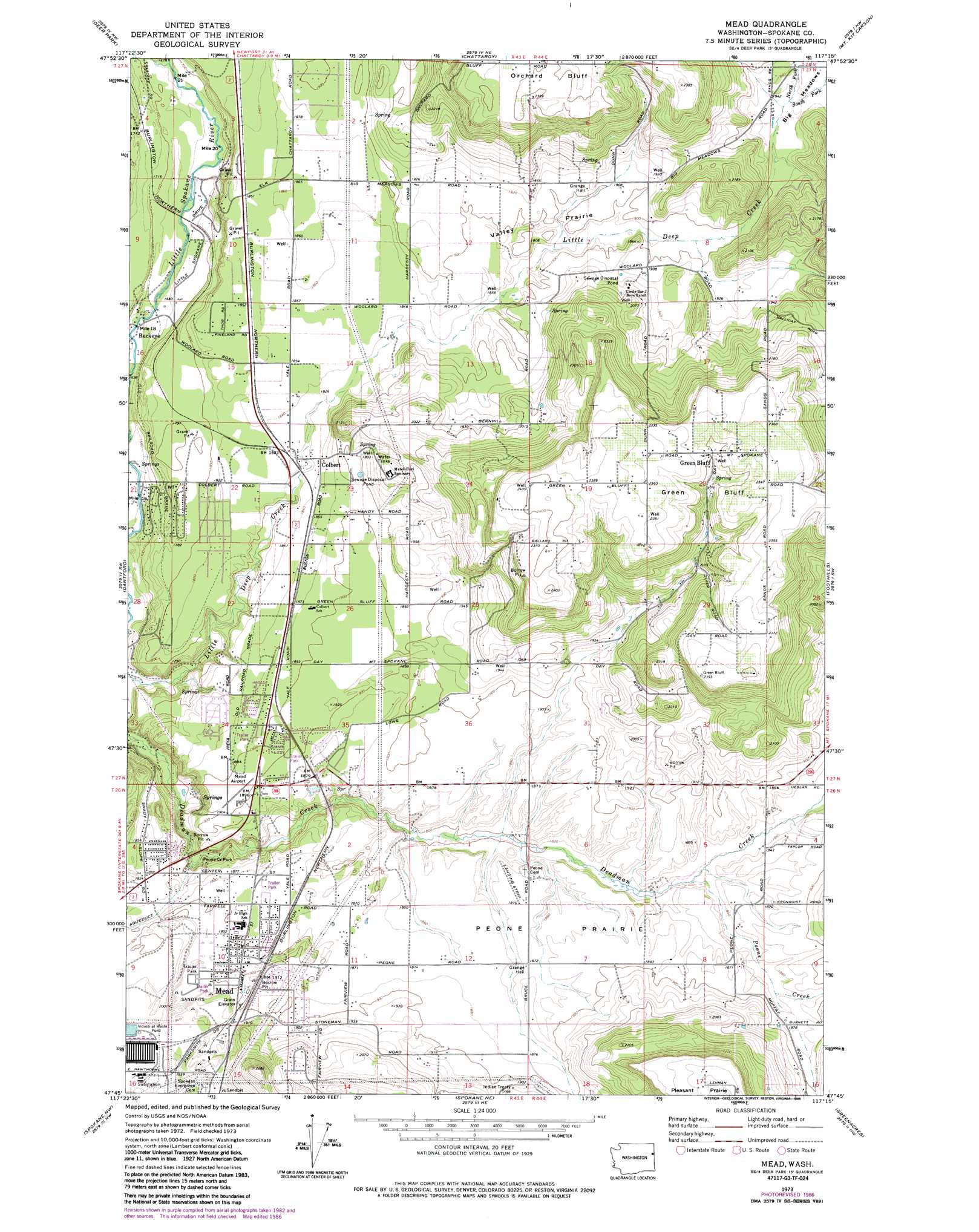
Mead Topo Map Washington
To zoom in, hover over the map of Mead
USGS Topo Quad 47117g3 - 1:24,000 scale
| Topo Map Name: | Mead |
| USGS Topo Quad ID: | 47117g3 |
| Print Size: | ca. 21 1/4" wide x 27" high |
| Southeast Coordinates: | 47.75° N latitude / 117.25° W longitude |
| Map Center Coordinates: | 47.8125° N latitude / 117.3125° W longitude |
| U.S. State: | WA |
| Filename: | o47117g3.jpg |
| Download Map JPG Image: | Mead topo map 1:24,000 scale |
| Map Type: | Topographic |
| Topo Series: | 7.5´ |
| Map Scale: | 1:24,000 |
| Source of Map Images: | United States Geological Survey (USGS) |
| Alternate Map Versions: |
Mead WA 1973, updated 1977 Download PDF Buy paper map Mead WA 1973, updated 1986 Download PDF Buy paper map Mead WA 1973, updated 1986 Download PDF Buy paper map Mead WA 2011 Download PDF Buy paper map Mead WA 2014 Download PDF Buy paper map |
1:24,000 Topo Quads surrounding Mead
Deer Lake |
Fan Lake |
Elk |
Camden |
Tweedie |
Clayton |
Deer Park |
Chattaroy |
Mount Kit Carson |
Mount Spokane |
Nine Mile Falls |
Dartford |
Mead |
Foothills |
Newman Lake |
Airway Heights |
Spokane Nw |
Spokane Ne |
Greenacres |
Liberty Lake |
Four Lakes |
Spokane Sw |
Spokane Se |
Freeman |
Mica Peak |
> Back to 47117e1 at 1:100,000 scale
> Back to 47116a1 at 1:250,000 scale
> Back to U.S. Topo Maps home
Mead topo map: Gazetteer
Mead: Airports
Mead Flying Service Airport elevation 581m 1906′Mead: Cliffs
Green Bluff elevation 710m 2329′Mead: Flats
Big Meadows elevation 595m 1952′Peone Prairie elevation 573m 1879′
Valley Prairie elevation 575m 1886′
Mead: Parks
Peone Creek Park elevation 538m 1765′Mead: Populated Places
Buckeye elevation 506m 1660′Colbert elevation 559m 1833′
Green Bluff elevation 704m 2309′
Mead elevation 581m 1906′
Mead: Streams
North Fork Little Deep Creek elevation 592m 1942′Pell Creek elevation 595m 1952′
Peone Creek elevation 556m 1824′
South Fork Little Deep Creek elevation 592m 1942′
Mead digital topo map on disk
Buy this Mead topo map showing relief, roads, GPS coordinates and other geographical features, as a high-resolution digital map file on DVD: