Four Mound Prairie Topo Map Washington
To zoom in, hover over the map of Four Mound Prairie
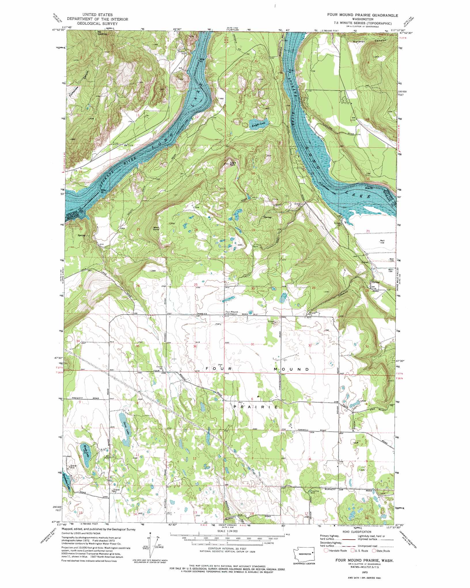
USGS Topo Quad 47117g6 - 1:24,000 scale
| Topo Map Name: | Four Mound Prairie |
| USGS Topo Quad ID: | 47117g6 |
| Print Size: | ca. 21 1/4" wide x 27" high |
| Southeast Coordinates: | 47.75° N latitude / 117.625° W longitude |
| Map Center Coordinates: | 47.8125° N latitude / 117.6875° W longitude |
| U.S. State: | WA |
| Filename: | o47117g6.jpg |
| Download Map JPG Image: | Four Mound Prairie topo map 1:24,000 scale |
| Map Type: | Topographic |
| Topo Series: | 7.5´ |
| Map Scale: | 1:24,000 |
| Source of Map Images: | United States Geological Survey (USGS) |
| Alternate Map Versions: |
Four Mound Prairie WA 1973, updated 1977 Download PDF Buy paper map Four Mound Prairie WA 2011 Download PDF Buy paper map Four Mound Prairie WA 2014 Download PDF Buy paper map |
1:24,000 Topo Quads surrounding Four Mound Prairie
Empey Mountain |
Forest Center |
Springdale |
Deer Lake |
Fan Lake |
Wellpinit |
Ford |
Tumtum |
Clayton |
Deer Park |
Little Falls |
Long Lake |
Four Mound Prairie |
Nine Mile Falls |
Dartford |
Reardan West |
Reardan East |
Deep Creek |
Airway Heights |
Spokane Nw |
Edwall |
Waukon |
Medical Lake |
Four Lakes |
Spokane Sw |
> Back to 47117e1 at 1:100,000 scale
> Back to 47116a1 at 1:250,000 scale
> Back to U.S. Topo Maps home
Four Mound Prairie topo map: Gazetteer
Four Mound Prairie: Cliffs
West Point elevation 690m 2263′Four Mound Prairie: Flats
Four Mound Prairie elevation 758m 2486′Four Mound Prairie: Lakes
Davis Lake elevation 745m 2444′Knight Lake elevation 535m 1755′
Woods Lake elevation 740m 2427′
Four Mound Prairie: Summits
Eagle Rock elevation 717m 2352′Mount Godfrey elevation 1038m 3405′
Four Mound Prairie digital topo map on disk
Buy this Four Mound Prairie topo map showing relief, roads, GPS coordinates and other geographical features, as a high-resolution digital map file on DVD: