Deer Park Topo Map Washington
To zoom in, hover over the map of Deer Park
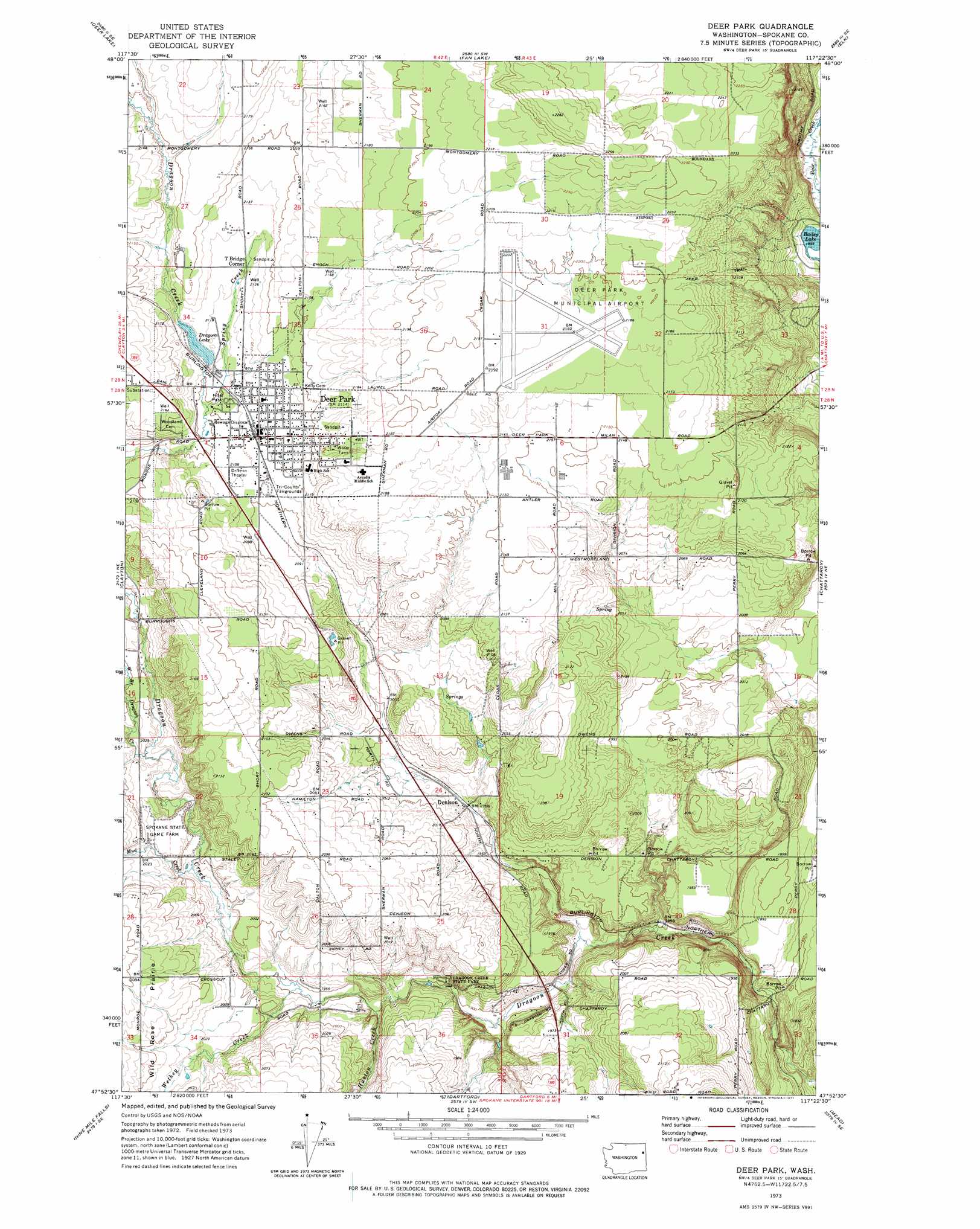
USGS Topo Quad 47117h4 - 1:24,000 scale
| Topo Map Name: | Deer Park |
| USGS Topo Quad ID: | 47117h4 |
| Print Size: | ca. 21 1/4" wide x 27" high |
| Southeast Coordinates: | 47.875° N latitude / 117.375° W longitude |
| Map Center Coordinates: | 47.9375° N latitude / 117.4375° W longitude |
| U.S. State: | WA |
| Filename: | o47117h4.jpg |
| Download Map JPG Image: | Deer Park topo map 1:24,000 scale |
| Map Type: | Topographic |
| Topo Series: | 7.5´ |
| Map Scale: | 1:24,000 |
| Source of Map Images: | United States Geological Survey (USGS) |
| Alternate Map Versions: |
Deer Park WA 1973, updated 1977 Download PDF Buy paper map Deer Park WA 2011 Download PDF Buy paper map Deer Park WA 2014 Download PDF Buy paper map |
1:24,000 Topo Quads surrounding Deer Park
Valley |
Nelson Peak |
Boyer Mountain |
Sacheen Lake |
Diamond Lake |
Springdale |
Deer Lake |
Fan Lake |
Elk |
Camden |
Tumtum |
Clayton |
Deer Park |
Chattaroy |
Mount Kit Carson |
Four Mound Prairie |
Nine Mile Falls |
Dartford |
Mead |
Foothills |
Deep Creek |
Airway Heights |
Spokane Nw |
Spokane Ne |
Greenacres |
> Back to 47117e1 at 1:100,000 scale
> Back to 47116a1 at 1:250,000 scale
> Back to U.S. Topo Maps home
Deer Park topo map: Gazetteer
Deer Park: Airports
Deer Park Airport elevation 668m 2191′Deer Park: Dams
Dragoon Lake Dam elevation 647m 2122′Deer Park: Lakes
Bailey Lake elevation 580m 1902′Little Trout Lake elevation 571m 1873′
Deer Park: Parks
Arcadia Park elevation 662m 2171′Dragoon Creek State Park elevation 586m 1922′
Hite Park elevation 642m 2106′
Perrins Field elevation 649m 2129′
Deer Park: Populated Places
Deer Park elevation 647m 2122′Denison elevation 598m 1961′
T Bridge Corner elevation 649m 2129′
Deer Park: Reservoirs
Dragoon Lake elevation 647m 2122′Deer Park: Streams
Ecks Creek elevation 653m 2142′Huston Creek elevation 588m 1929′
Mud Creek elevation 607m 1991′
West Branch Dragoon Creek elevation 617m 2024′
Wethey Creek elevation 595m 1952′
Deer Park: Valleys
Turpentine Hollow elevation 619m 2030′Deer Park digital topo map on disk
Buy this Deer Park topo map showing relief, roads, GPS coordinates and other geographical features, as a high-resolution digital map file on DVD: