Ford Topo Map Washington
To zoom in, hover over the map of Ford
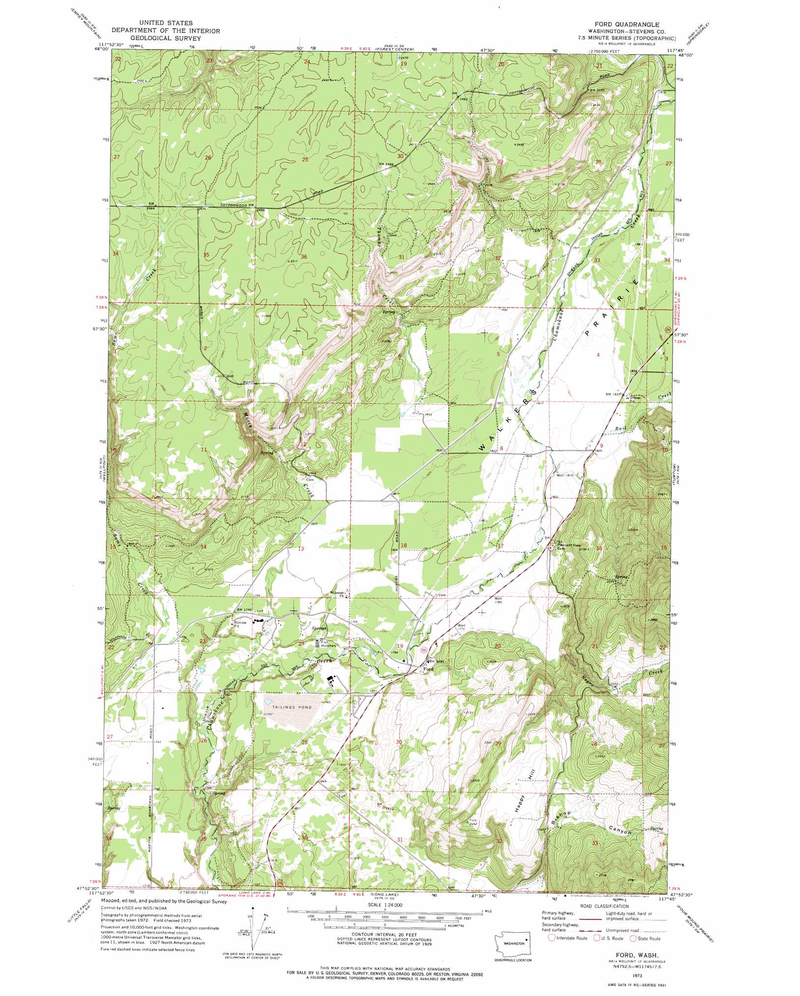
USGS Topo Quad 47117h7 - 1:24,000 scale
| Topo Map Name: | Ford |
| USGS Topo Quad ID: | 47117h7 |
| Print Size: | ca. 21 1/4" wide x 27" high |
| Southeast Coordinates: | 47.875° N latitude / 117.75° W longitude |
| Map Center Coordinates: | 47.9375° N latitude / 117.8125° W longitude |
| U.S. State: | WA |
| Filename: | o47117h7.jpg |
| Download Map JPG Image: | Ford topo map 1:24,000 scale |
| Map Type: | Topographic |
| Topo Series: | 7.5´ |
| Map Scale: | 1:24,000 |
| Source of Map Images: | United States Geological Survey (USGS) |
| Alternate Map Versions: |
Ford WA 1973, updated 1977 Download PDF Buy paper map Ford WA 2011 Download PDF Buy paper map Ford WA 2014 Download PDF Buy paper map |
1:24,000 Topo Quads surrounding Ford
Blackhorse Canyon |
Stensgar Mountain |
Waitts Lake |
Valley |
Nelson Peak |
Adams Mountain |
Empey Mountain |
Forest Center |
Springdale |
Deer Lake |
Turtle Lake |
Wellpinit |
Ford |
Tumtum |
Clayton |
Benjamin Lake |
Little Falls |
Long Lake |
Four Mound Prairie |
Nine Mile Falls |
Mondovi |
Reardan West |
Reardan East |
Deep Creek |
Airway Heights |
> Back to 47117e1 at 1:100,000 scale
> Back to 47116a1 at 1:250,000 scale
> Back to U.S. Topo Maps home
Ford topo map: Gazetteer
Ford: Dams
Dawn Mine Tailing Pond Area Three Dam elevation 534m 1751′Ford: Flats
Walkers Prairie elevation 558m 1830′Ford: Populated Places
Ford elevation 544m 1784′Ford: Reservoirs
Dawn Mine Tailings Pond elevation 534m 1751′Ford: Streams
Mission Creek elevation 563m 1847′Moss Creek elevation 497m 1630′
Rail Creek elevation 550m 1804′
Thomas Creek elevation 567m 1860′
Tshimakain Creek elevation 538m 1765′
Ford: Summits
Happy Hill elevation 727m 2385′Ford: Valleys
Bishop Canyon elevation 581m 1906′Ford digital topo map on disk
Buy this Ford topo map showing relief, roads, GPS coordinates and other geographical features, as a high-resolution digital map file on DVD: