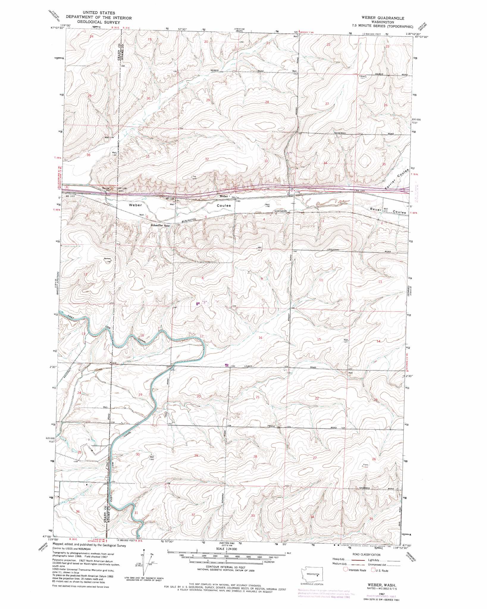
Weber Topo Map Washington
To zoom in, hover over the map of Weber
USGS Topo Quad 47118a8 - 1:24,000 scale
| Topo Map Name: | Weber |
| USGS Topo Quad ID: | 47118a8 |
| Print Size: | ca. 21 1/4" wide x 27" high |
| Southeast Coordinates: | 47° N latitude / 118.875° W longitude |
| Map Center Coordinates: | 47.0625° N latitude / 118.9375° W longitude |
| U.S. State: | WA |
| Filename: | o47118a8.jpg |
| Download Map JPG Image: | Weber topo map 1:24,000 scale |
| Map Type: | Topographic |
| Topo Series: | 7.5´ |
| Map Scale: | 1:24,000 |
| Source of Map Images: | United States Geological Survey (USGS) |
| Alternate Map Versions: |
Weber WA 1967, updated 1970 Download PDF Buy paper map Weber WA 1967, updated 1982 Download PDF Buy paper map Weber WA 2011 Download PDF Buy paper map Weber WA 2013 Download PDF Buy paper map |
1:24,000 Topo Quads surrounding Weber
Wilson Creek Sw |
Wilson Creek Se |
Marlin Sw |
Irby |
Odessa |
Wheeler |
Wheeler Ne |
Ruff |
Batum |
Reiman |
Sieler |
Bassett Junction |
Weber |
Schrag |
Reiman Sw |
Soda Lake |
Warden |
Hatton Nw |
Roxboro |
Providence |
Othello |
Bruce |
Shano |
Hatton |
Lind Sw |
> Back to 47118a1 at 1:100,000 scale
> Back to 47118a1 at 1:250,000 scale
> Back to U.S. Topo Maps home
Weber topo map: Gazetteer
Weber: Populated Places
Warden Hutterian Brethren elevation 418m 1371′Weber elevation 361m 1184′
Weber: Valleys
Bauer Coulee elevation 363m 1190′Farrier Coulee elevation 363m 1190′
Weber digital topo map on disk
Buy this Weber topo map showing relief, roads, GPS coordinates and other geographical features, as a high-resolution digital map file on DVD: