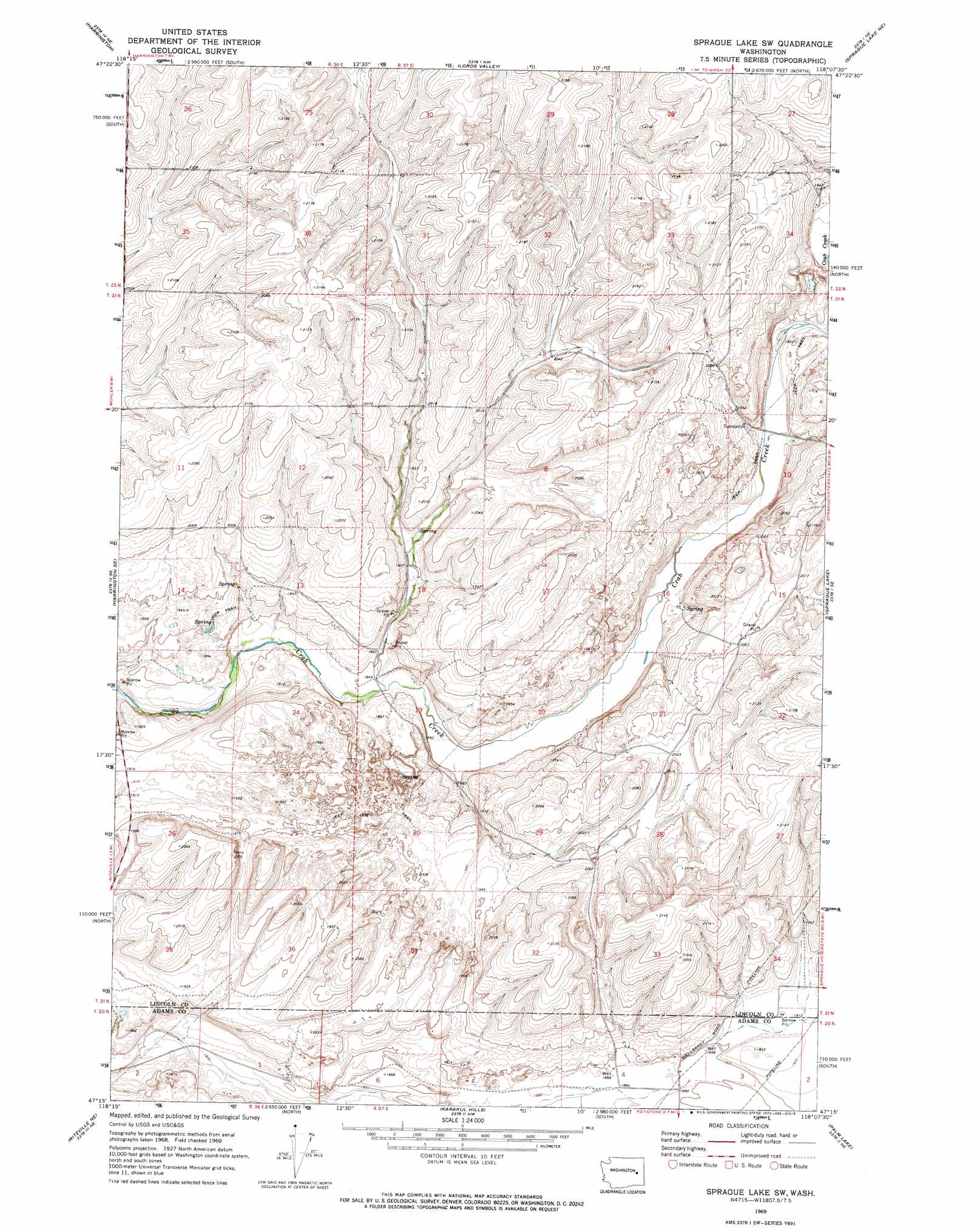
Sprague Lake Sw Topo Map Washington
To zoom in, hover over the map of Sprague Lake Sw
USGS Topo Quad 47118c2 - 1:24,000 scale
| Topo Map Name: | Sprague Lake Sw |
| USGS Topo Quad ID: | 47118c2 |
| Print Size: | ca. 21 1/4" wide x 27" high |
| Southeast Coordinates: | 47.25° N latitude / 118.125° W longitude |
| Map Center Coordinates: | 47.3125° N latitude / 118.1875° W longitude |
| U.S. State: | WA |
| Filename: | o47118c2.jpg |
| Download Map JPG Image: | Sprague Lake Sw topo map 1:24,000 scale |
| Map Type: | Topographic |
| Topo Series: | 7.5´ |
| Map Scale: | 1:24,000 |
| Source of Map Images: | United States Geological Survey (USGS) |
| Alternate Map Versions: |
Sprague Lake SW WA 1969, updated 1972 Download PDF Buy paper map Sprague Lake SW WA 2011 Download PDF Buy paper map Sprague Lake SW WA 2013 Download PDF Buy paper map |
1:24,000 Topo Quads surrounding Sprague Lake Sw
Rocklyn Sw |
Rocklyn Se |
Bluestem |
Omans |
Edwall |
Cormana Lake |
Harrington |
Lords Valley |
Sprague Lake Ne |
Sassin |
Lamona |
Harrington Se |
Sprague Lake Sw |
Sprague Lake |
Sprague |
Ritzville Nw |
Ritzville Ne |
Karakul Hills |
Palm Lake |
Lamont |
Ritzville Sw |
Ritzville Se |
Marengo |
Macall |
Revere |
> Back to 47118a1 at 1:100,000 scale
> Back to 47118a1 at 1:250,000 scale
> Back to U.S. Topo Maps home
No gazetteer data is available for the Sprague Lake Sw topo map sheet.
Sprague Lake Sw digital topo map on disk
Buy this Sprague Lake Sw topo map showing relief, roads, GPS coordinates and other geographical features, as a high-resolution digital map file on DVD: