Cormana Lake Topo Map Washington
To zoom in, hover over the map of Cormana Lake
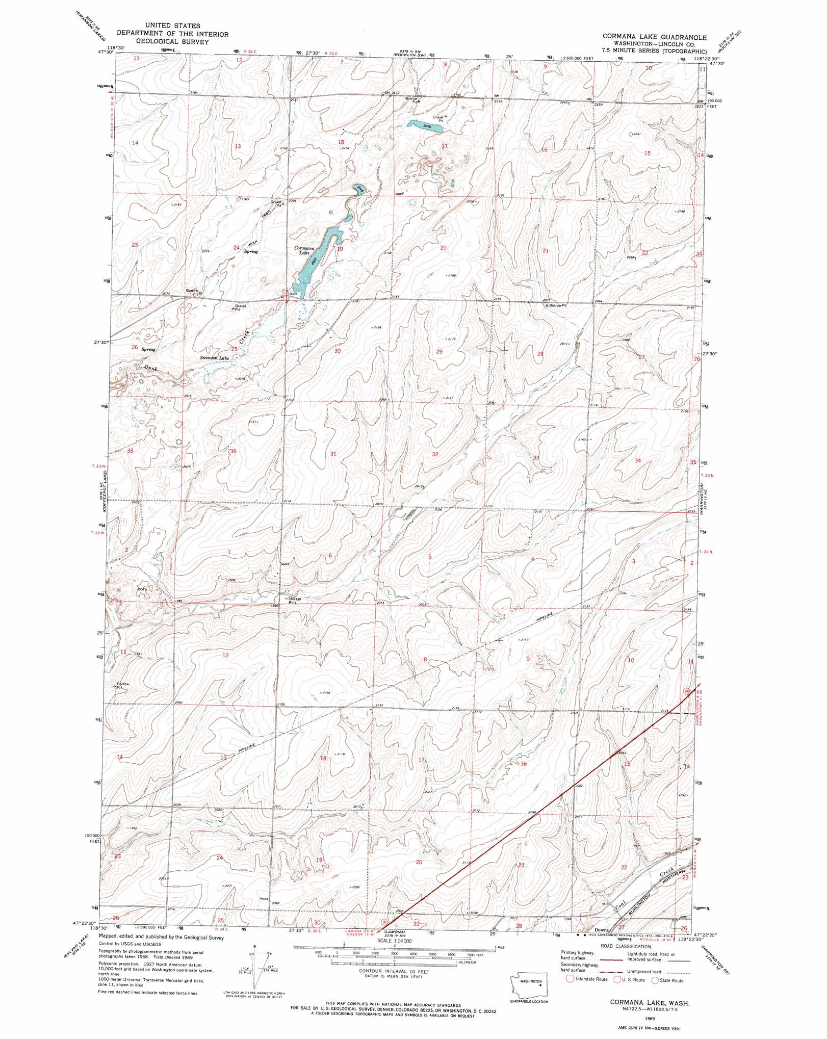
USGS Topo Quad 47118d4 - 1:24,000 scale
| Topo Map Name: | Cormana Lake |
| USGS Topo Quad ID: | 47118d4 |
| Print Size: | ca. 21 1/4" wide x 27" high |
| Southeast Coordinates: | 47.375° N latitude / 118.375° W longitude |
| Map Center Coordinates: | 47.4375° N latitude / 118.4375° W longitude |
| U.S. State: | WA |
| Filename: | o47118d4.jpg |
| Download Map JPG Image: | Cormana Lake topo map 1:24,000 scale |
| Map Type: | Topographic |
| Topo Series: | 7.5´ |
| Map Scale: | 1:24,000 |
| Source of Map Images: | United States Geological Survey (USGS) |
| Alternate Map Versions: |
Cormana Lake WA 1969, updated 1972 Download PDF Buy paper map Cormana Lake WA 2011 Download PDF Buy paper map Cormana Lake WA 2013 Download PDF Buy paper map |
1:24,000 Topo Quads surrounding Cormana Lake
Wagner Lake |
Creston Butte |
Telford |
Rocklyn |
Davenport |
Draper Lake |
Swanson Lakes |
Rocklyn Sw |
Rocklyn Se |
Bluestem |
Pacific Lake |
Coffeepot Lake |
Cormana Lake |
Harrington |
Lords Valley |
Odessa |
Sylvan Lake |
Lamona |
Harrington Se |
Sprague Lake Sw |
Reiman |
Schoonover |
Ritzville Nw |
Ritzville Ne |
Karakul Hills |
> Back to 47118a1 at 1:100,000 scale
> Back to 47118a1 at 1:250,000 scale
> Back to U.S. Topo Maps home
Cormana Lake topo map: Gazetteer
Cormana Lake: Lakes
Cormana Lake elevation 621m 2037′Swenson Lake elevation 612m 2007′
Cormana Lake digital topo map on disk
Buy this Cormana Lake topo map showing relief, roads, GPS coordinates and other geographical features, as a high-resolution digital map file on DVD: