Marlin Topo Map Washington
To zoom in, hover over the map of Marlin
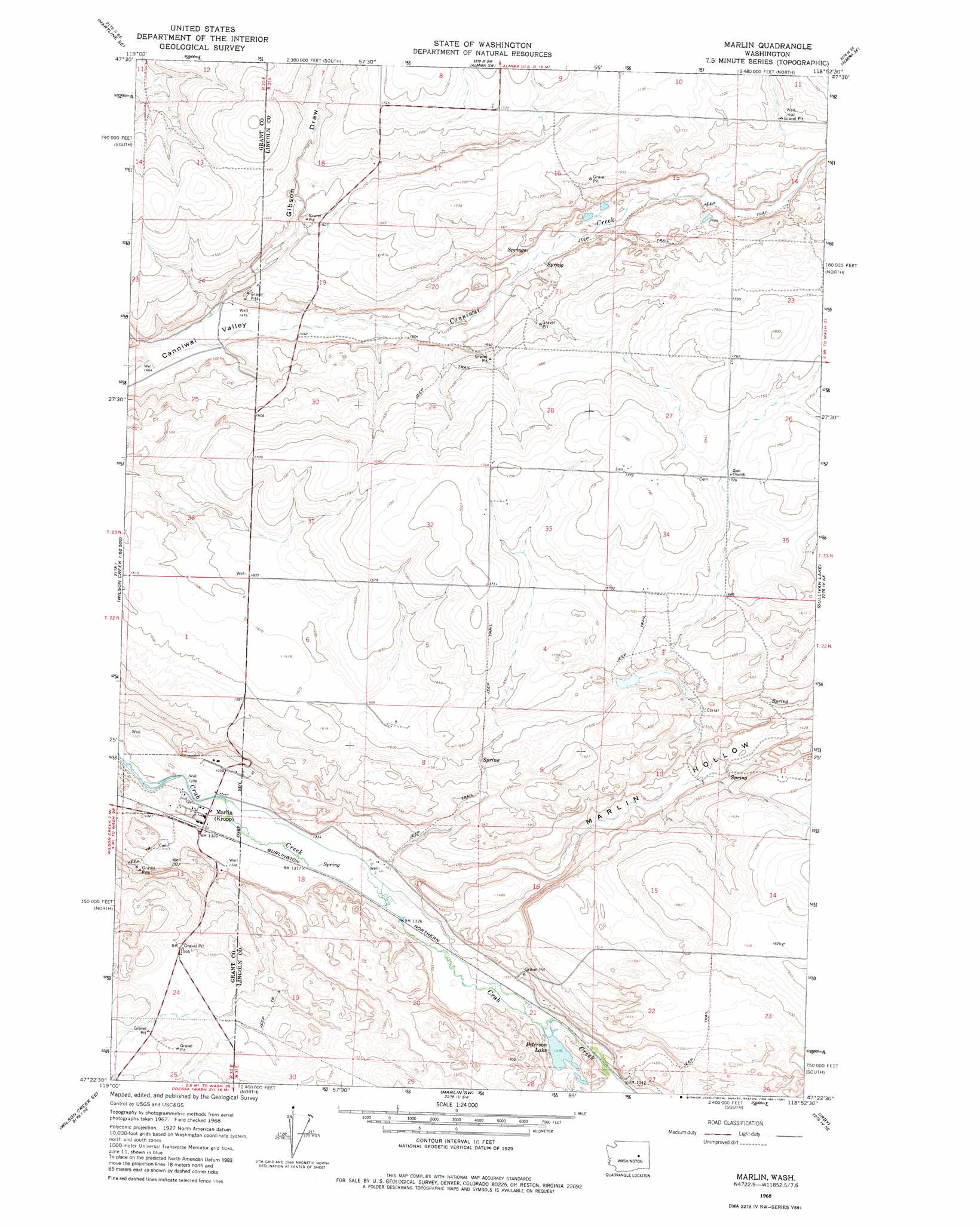
USGS Topo Quad 47118d8 - 1:24,000 scale
| Topo Map Name: | Marlin |
| USGS Topo Quad ID: | 47118d8 |
| Print Size: | ca. 21 1/4" wide x 27" high |
| Southeast Coordinates: | 47.375° N latitude / 118.875° W longitude |
| Map Center Coordinates: | 47.4375° N latitude / 118.9375° W longitude |
| U.S. State: | WA |
| Filename: | o47118d8.jpg |
| Download Map JPG Image: | Marlin topo map 1:24,000 scale |
| Map Type: | Topographic |
| Topo Series: | 7.5´ |
| Map Scale: | 1:24,000 |
| Source of Map Images: | United States Geological Survey (USGS) |
| Alternate Map Versions: |
Marlin WA 1968, updated 1971 Download PDF Buy paper map Marlin WA 1968, updated 1981 Download PDF Buy paper map Marlin WA 2011 Download PDF Buy paper map Marlin WA 2013 Download PDF Buy paper map |
1:24,000 Topo Quads surrounding Marlin
Hartline Nw |
Hartline |
Almira |
Govan |
Wagner Lake |
Hartline Sw |
Hartline Se |
Almira Sw |
Almira Se |
Draper Lake |
Wilson Creek Nw |
Wilson Creek |
Marlin |
Sullivan Lake |
Pacific Lake |
Wilson Creek Sw |
Wilson Creek Se |
Marlin Sw |
Irby |
Odessa |
Wheeler |
Wheeler Ne |
Ruff |
Batum |
Reiman |
> Back to 47118a1 at 1:100,000 scale
> Back to 47118a1 at 1:250,000 scale
> Back to U.S. Topo Maps home
Marlin topo map: Gazetteer
Marlin: Lakes
Peterson Lake elevation 406m 1332′Marlin: Populated Places
Marlin elevation 404m 1325′Marlin: Valleys
Gibson Draw elevation 455m 1492′Marlin Hollow elevation 408m 1338′
Marlin digital topo map on disk
Buy this Marlin topo map showing relief, roads, GPS coordinates and other geographical features, as a high-resolution digital map file on DVD: