Benjamin Lake Topo Map Washington
To zoom in, hover over the map of Benjamin Lake
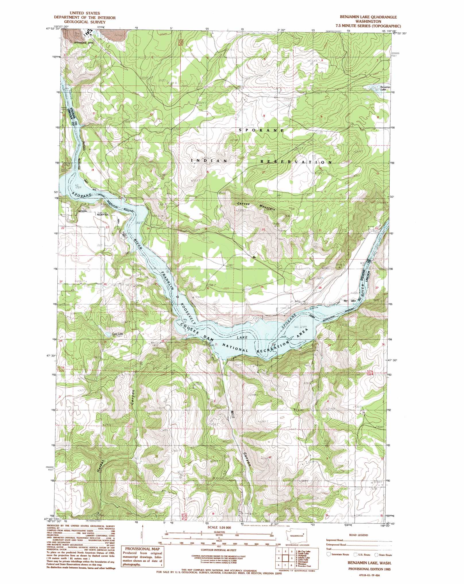
USGS Topo Quad 47118g1 - 1:24,000 scale
| Topo Map Name: | Benjamin Lake |
| USGS Topo Quad ID: | 47118g1 |
| Print Size: | ca. 21 1/4" wide x 27" high |
| Southeast Coordinates: | 47.75° N latitude / 118° W longitude |
| Map Center Coordinates: | 47.8125° N latitude / 118.0625° W longitude |
| U.S. State: | WA |
| Filename: | o47118g1.jpg |
| Download Map JPG Image: | Benjamin Lake topo map 1:24,000 scale |
| Map Type: | Topographic |
| Topo Series: | 7.5´ |
| Map Scale: | 1:24,000 |
| Source of Map Images: | United States Geological Survey (USGS) |
| Alternate Map Versions: |
Benjamin Lake WA 1985, updated 1985 Download PDF Buy paper map Benjamin Lake WA 2011 Download PDF Buy paper map Benjamin Lake WA 2013 Download PDF Buy paper map |
1:24,000 Topo Quads surrounding Benjamin Lake
Miller Mountain |
Hunters |
Adams Mountain |
Empey Mountain |
Forest Center |
Fort Spokane |
Mccoy Lake |
Turtle Lake |
Wellpinit |
Ford |
Olsen Canyon |
Inkster Lake |
Benjamin Lake |
Little Falls |
Long Lake |
Rocklyn |
Davenport |
Mondovi |
Reardan West |
Reardan East |
Rocklyn Se |
Bluestem |
Omans |
Edwall |
Waukon |
> Back to 47118e1 at 1:100,000 scale
> Back to 47118a1 at 1:250,000 scale
> Back to U.S. Topo Maps home
Benjamin Lake topo map: Gazetteer
Benjamin Lake: Lakes
Benjamin Lake elevation 690m 2263′Carp Lake elevation 583m 1912′
Benjamin Lake: Mines
Sherwood Mine elevation 630m 2066′Benjamin Lake: Summits
Cayuse Mountain elevation 832m 2729′Benjamin Lake: Valleys
Harker Canyon elevation 397m 1302′Mill Canyon elevation 398m 1305′
Benjamin Lake digital topo map on disk
Buy this Benjamin Lake topo map showing relief, roads, GPS coordinates and other geographical features, as a high-resolution digital map file on DVD: