Olsen Canyon Topo Map Washington
To zoom in, hover over the map of Olsen Canyon
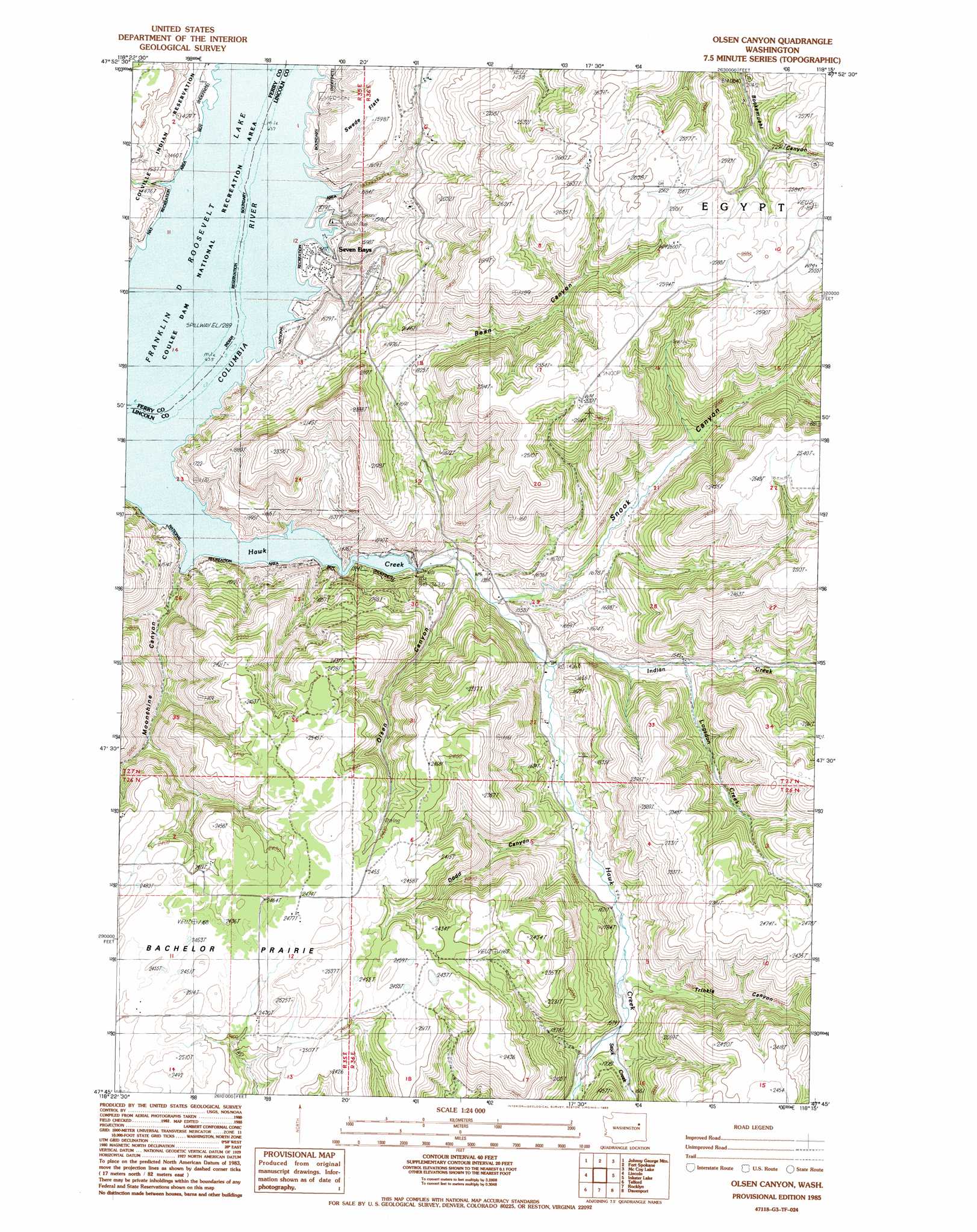
USGS Topo Quad 47118g3 - 1:24,000 scale
| Topo Map Name: | Olsen Canyon |
| USGS Topo Quad ID: | 47118g3 |
| Print Size: | ca. 21 1/4" wide x 27" high |
| Southeast Coordinates: | 47.75° N latitude / 118.25° W longitude |
| Map Center Coordinates: | 47.8125° N latitude / 118.3125° W longitude |
| U.S. State: | WA |
| Filename: | o47118g3.jpg |
| Download Map JPG Image: | Olsen Canyon topo map 1:24,000 scale |
| Map Type: | Topographic |
| Topo Series: | 7.5´ |
| Map Scale: | 1:24,000 |
| Source of Map Images: | United States Geological Survey (USGS) |
| Alternate Map Versions: |
Olsen Canyon WA 1985, updated 1985 Download PDF Buy paper map Olsen Canyon WA 2011 Download PDF Buy paper map Olsen Canyon WA 2013 Download PDF Buy paper map |
1:24,000 Topo Quads surrounding Olsen Canyon
Friedlander Meadows |
Ninemile Flat |
Miller Mountain |
Hunters |
Adams Mountain |
Whitestone Rock |
Johnny George Mountain |
Fort Spokane |
Mccoy Lake |
Turtle Lake |
Creston |
Lincoln |
Olsen Canyon |
Inkster Lake |
Benjamin Lake |
Creston Butte |
Telford |
Rocklyn |
Davenport |
Mondovi |
Swanson Lakes |
Rocklyn Sw |
Rocklyn Se |
Bluestem |
Omans |
> Back to 47118e1 at 1:100,000 scale
> Back to 47118a1 at 1:250,000 scale
> Back to U.S. Topo Maps home
Olsen Canyon topo map: Gazetteer
Olsen Canyon: Airports
7 Bays Airport elevation 473m 1551′Olsen Canyon: Areas
Egypt elevation 781m 2562′Olsen Canyon: Bays
Hawk Creek Harbor elevation 394m 1292′Olsen Canyon: Falls
Hawk Creek Falls elevation 593m 1945′Olsen Canyon: Populated Places
Seven Bays elevation 413m 1354′Olsen Canyon: Streams
George Creek elevation 397m 1302′Hawk Creek elevation 394m 1292′
Indian Creek elevation 438m 1437′
Logsdon Creek elevation 468m 1535′
Stock Creek elevation 488m 1601′
Olsen Canyon: Valleys
Bean Canyon elevation 421m 1381′Dodd Canyon elevation 467m 1532′
Moonshine Canyon elevation 404m 1325′
Moore Draw elevation 399m 1309′
Olsen Canyon elevation 436m 1430′
Snook Canyon elevation 490m 1607′
Trinkle Canyon elevation 489m 1604′
Olsen Canyon digital topo map on disk
Buy this Olsen Canyon topo map showing relief, roads, GPS coordinates and other geographical features, as a high-resolution digital map file on DVD: