Lincoln Topo Map Washington
To zoom in, hover over the map of Lincoln
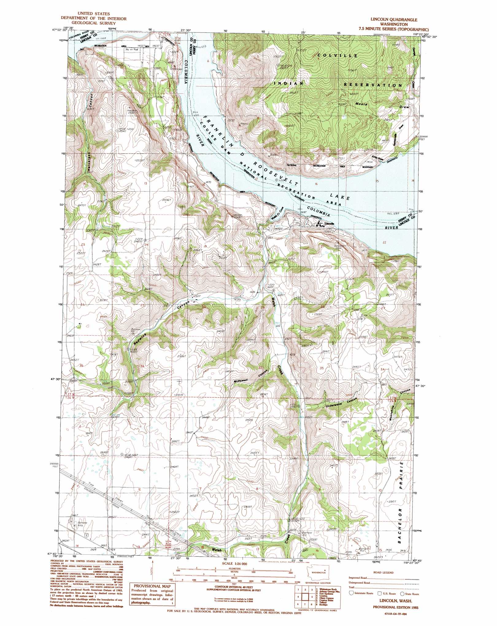
USGS Topo Quad 47118g4 - 1:24,000 scale
| Topo Map Name: | Lincoln |
| USGS Topo Quad ID: | 47118g4 |
| Print Size: | ca. 21 1/4" wide x 27" high |
| Southeast Coordinates: | 47.75° N latitude / 118.375° W longitude |
| Map Center Coordinates: | 47.8125° N latitude / 118.4375° W longitude |
| U.S. State: | WA |
| Filename: | o47118g4.jpg |
| Download Map JPG Image: | Lincoln topo map 1:24,000 scale |
| Map Type: | Topographic |
| Topo Series: | 7.5´ |
| Map Scale: | 1:24,000 |
| Source of Map Images: | United States Geological Survey (USGS) |
| Alternate Map Versions: |
Lincoln WA 1985, updated 1985 Download PDF Buy paper map Lincoln WA 2011 Download PDF Buy paper map Lincoln WA 2014 Download PDF Buy paper map |
1:24,000 Topo Quads surrounding Lincoln
Keller |
Friedlander Meadows |
Ninemile Flat |
Miller Mountain |
Hunters |
Keller Ferry |
Whitestone Rock |
Johnny George Mountain |
Fort Spokane |
Mccoy Lake |
Wilbur |
Creston |
Lincoln |
Olsen Canyon |
Inkster Lake |
Wagner Lake |
Creston Butte |
Telford |
Rocklyn |
Davenport |
Draper Lake |
Swanson Lakes |
Rocklyn Sw |
Rocklyn Se |
Bluestem |
> Back to 47118e1 at 1:100,000 scale
> Back to 47118a1 at 1:250,000 scale
> Back to U.S. Topo Maps home
Lincoln topo map: Gazetteer
Lincoln: Areas
Elbow Bend elevation 394m 1292′Lincoln: Bays
Welsh Creek Cove elevation 394m 1292′Lincoln: Populated Places
Lincoln elevation 425m 1394′Lincoln: Streams
Welsh Creek elevation 409m 1341′Lincoln: Valleys
Halverson Canyon elevation 406m 1332′Kirby Draw elevation 408m 1338′
McDowell Canyon elevation 522m 1712′
Rattlesnake Draw elevation 397m 1302′
Redwine Canyon elevation 489m 1604′
Underwood Canyon elevation 534m 1751′
Lincoln digital topo map on disk
Buy this Lincoln topo map showing relief, roads, GPS coordinates and other geographical features, as a high-resolution digital map file on DVD: