Wheeler Topo Map Washington
To zoom in, hover over the map of Wheeler
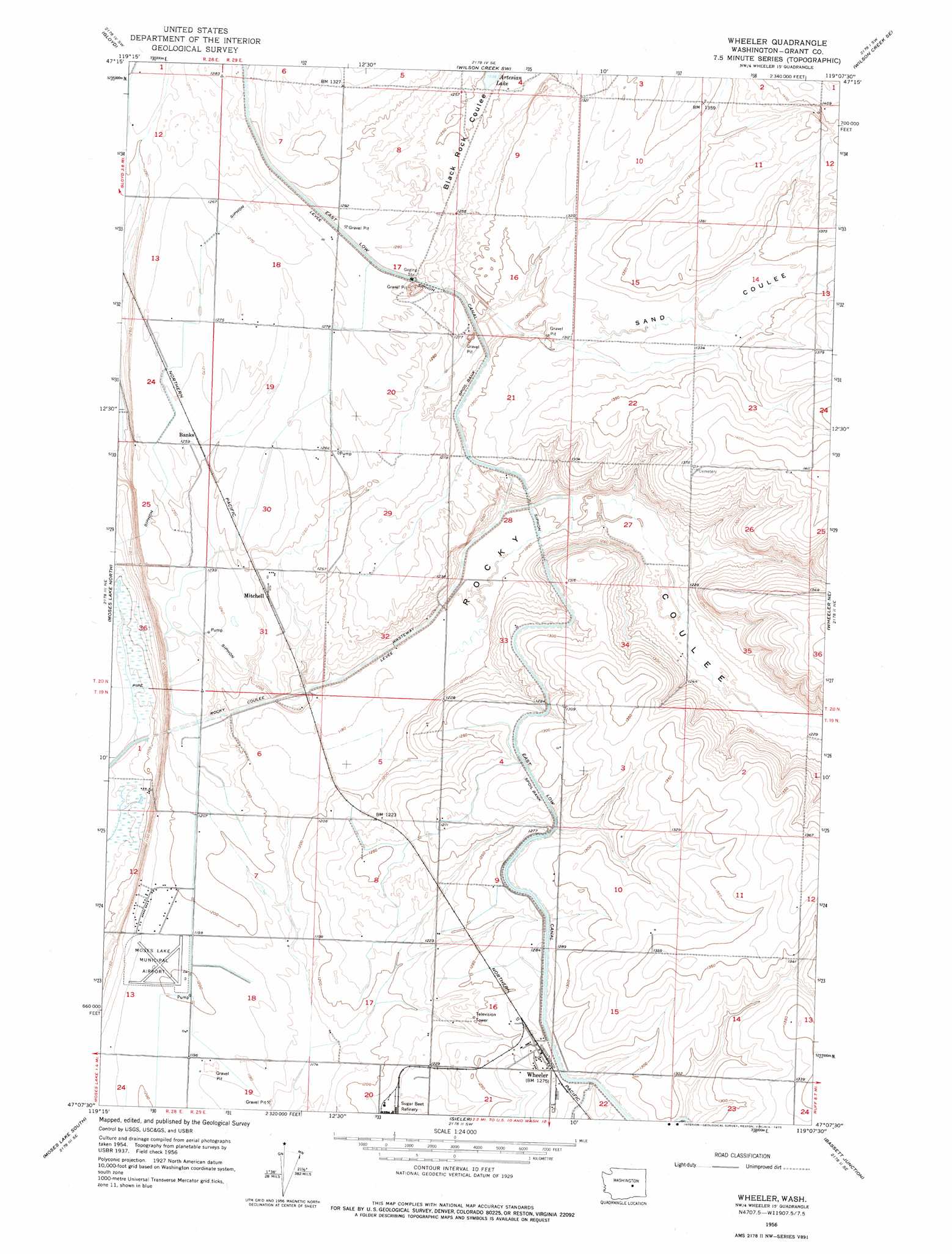
USGS Topo Quad 47119b2 - 1:24,000 scale
| Topo Map Name: | Wheeler |
| USGS Topo Quad ID: | 47119b2 |
| Print Size: | ca. 21 1/4" wide x 27" high |
| Southeast Coordinates: | 47.125° N latitude / 119.125° W longitude |
| Map Center Coordinates: | 47.1875° N latitude / 119.1875° W longitude |
| U.S. State: | WA |
| Filename: | o47119b2.jpg |
| Download Map JPG Image: | Wheeler topo map 1:24,000 scale |
| Map Type: | Topographic |
| Topo Series: | 7.5´ |
| Map Scale: | 1:24,000 |
| Source of Map Images: | United States Geological Survey (USGS) |
| Alternate Map Versions: |
Wheeler WA 1956, updated 1956 Download PDF Buy paper map Wheeler WA 1956, updated 1975 Download PDF Buy paper map Wheeler WA 1956, updated 1975 Download PDF Buy paper map Wheeler WA 2011 Download PDF Buy paper map Wheeler WA 2014 Download PDF Buy paper map |
1:24,000 Topo Quads surrounding Wheeler
Soap Lake |
Stratford |
Wilson Creek Nw |
Wilson Creek |
Marlin |
Grant Orchards |
Gloyd |
Wilson Creek Sw |
Wilson Creek Se |
Marlin Sw |
Moses Lake Nw |
Moses Lake North |
Wheeler |
Wheeler Ne |
Ruff |
Mae |
Moses Lake South |
Sieler |
Bassett Junction |
Weber |
Royal Camp |
O'Sullivan Dam |
Soda Lake |
Warden |
Hatton Nw |
> Back to 47119a1 at 1:100,000 scale
> Back to 47118a1 at 1:250,000 scale
> Back to U.S. Topo Maps home
Wheeler topo map: Gazetteer
Wheeler: Airports
Moses Lake Municipal Airport elevation 365m 1197′Wheeler: Canals
East Low Canal elevation 391m 1282′Rocky Coulee Syphon elevation 368m 1207′
Rocky Coulee Wasteway elevation 366m 1200′
Sand Coulee Syphon elevation 386m 1266′
Wheeler: Populated Places
Mitchell elevation 380m 1246′Wheeler elevation 392m 1286′
Wheeler: Valleys
Black Rock Coulee elevation 386m 1266′Rocky Coulee elevation 363m 1190′
Sand Coulee elevation 391m 1282′
Wheeler digital topo map on disk
Buy this Wheeler topo map showing relief, roads, GPS coordinates and other geographical features, as a high-resolution digital map file on DVD: