Wilson Creek Sw Topo Map Washington
To zoom in, hover over the map of Wilson Creek Sw
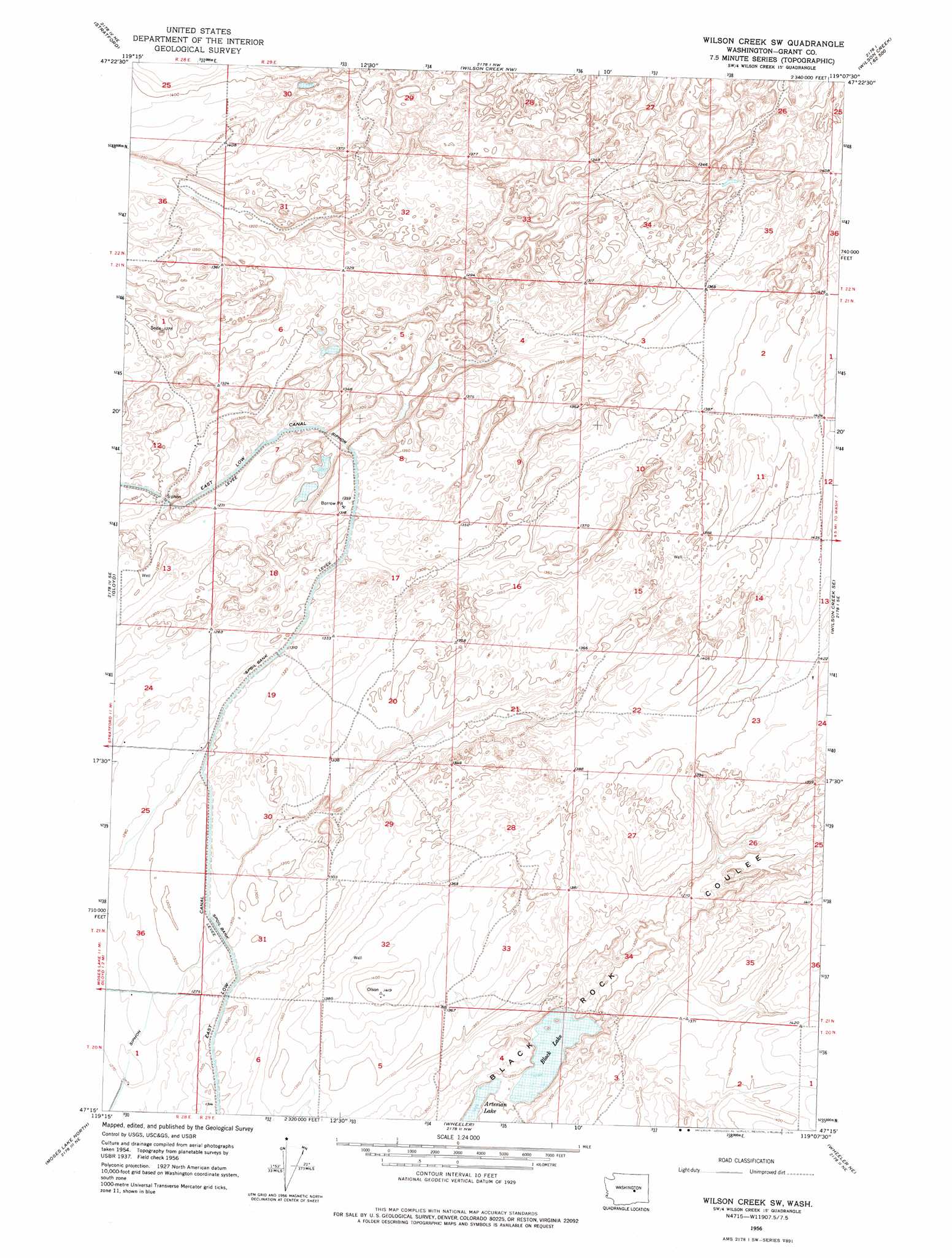
USGS Topo Quad 47119c2 - 1:24,000 scale
| Topo Map Name: | Wilson Creek Sw |
| USGS Topo Quad ID: | 47119c2 |
| Print Size: | ca. 21 1/4" wide x 27" high |
| Southeast Coordinates: | 47.25° N latitude / 119.125° W longitude |
| Map Center Coordinates: | 47.3125° N latitude / 119.1875° W longitude |
| U.S. State: | WA |
| Filename: | o47119c2.jpg |
| Download Map JPG Image: | Wilson Creek Sw topo map 1:24,000 scale |
| Map Type: | Topographic |
| Topo Series: | 7.5´ |
| Map Scale: | 1:24,000 |
| Source of Map Images: | United States Geological Survey (USGS) |
| Alternate Map Versions: |
Wilson Creek SW WA 1956, updated 1957 Download PDF Buy paper map Wilson Creek SW WA 1956, updated 1976 Download PDF Buy paper map Wilson Creek SW WA 2011 Download PDF Buy paper map Wilson Creek SW WA 2014 Download PDF Buy paper map |
1:24,000 Topo Quads surrounding Wilson Creek Sw
Park Lake |
Coulee City |
Hartline Sw |
Hartline Se |
Almira Sw |
Soap Lake |
Stratford |
Wilson Creek Nw |
Wilson Creek |
Marlin |
Grant Orchards |
Gloyd |
Wilson Creek Sw |
Wilson Creek Se |
Marlin Sw |
Moses Lake Nw |
Moses Lake North |
Wheeler |
Wheeler Ne |
Ruff |
Mae |
Moses Lake South |
Sieler |
Bassett Junction |
Weber |
> Back to 47119a1 at 1:100,000 scale
> Back to 47118a1 at 1:250,000 scale
> Back to U.S. Topo Maps home
Wilson Creek Sw topo map: Gazetteer
Wilson Creek Sw: Lakes
Artesian Lake elevation 378m 1240′Black Lake elevation 378m 1240′
Wilson Creek Sw digital topo map on disk
Buy this Wilson Creek Sw topo map showing relief, roads, GPS coordinates and other geographical features, as a high-resolution digital map file on DVD: