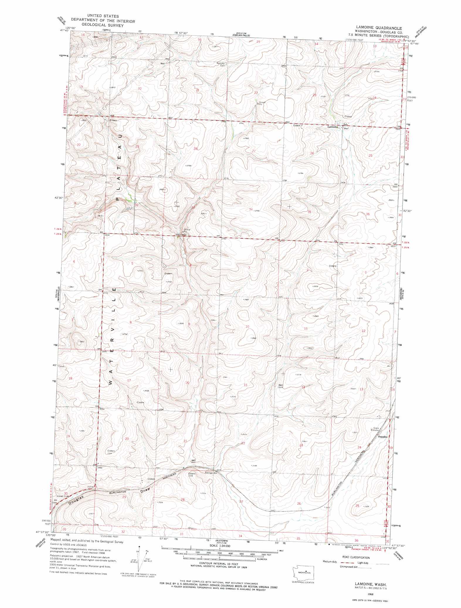
Lamoine Topo Map Washington
To zoom in, hover over the map of Lamoine
USGS Topo Quad 47119f8 - 1:24,000 scale
| Topo Map Name: | Lamoine |
| USGS Topo Quad ID: | 47119f8 |
| Print Size: | ca. 21 1/4" wide x 27" high |
| Southeast Coordinates: | 47.625° N latitude / 119.875° W longitude |
| Map Center Coordinates: | 47.6875° N latitude / 119.9375° W longitude |
| U.S. State: | WA |
| Filename: | o47119f8.jpg |
| Download Map JPG Image: | Lamoine topo map 1:24,000 scale |
| Map Type: | Topographic |
| Topo Series: | 7.5´ |
| Map Scale: | 1:24,000 |
| Source of Map Images: | United States Geological Survey (USGS) |
| Alternate Map Versions: |
Lamoine WA 1968, updated 1971 Download PDF Buy paper map Lamoine WA 1968, updated 1978 Download PDF Buy paper map Lamoine WA 2011 Download PDF Buy paper map Lamoine WA 2014 Download PDF Buy paper map |
1:24,000 Topo Quads surrounding Lamoine
Manson |
Cooper Ridge |
Azwell |
Wells Dam |
Chief Joseph Dam |
Winesap |
Chelan |
Chelan Falls |
Mud Spring |
Mansfield |
Entiat |
Waterville |
Lamoine |
Withrow |
Jameson Lake West |
Orondo |
Douglas |
Alstown |
Farmer |
Jameson Lake Sw |
Rock Island |
Malaga Ne |
Palisades |
Rattlesnake Springs |
Sagebrush Flat |
> Back to 47119e1 at 1:100,000 scale
> Back to 47118a1 at 1:250,000 scale
> Back to U.S. Topo Maps home
Lamoine topo map: Gazetteer
Lamoine: Populated Places
Lamoine elevation 814m 2670′Okanogan City (historical) elevation 766m 2513′
Supplee elevation 763m 2503′
Lamoine digital topo map on disk
Buy this Lamoine topo map showing relief, roads, GPS coordinates and other geographical features, as a high-resolution digital map file on DVD: