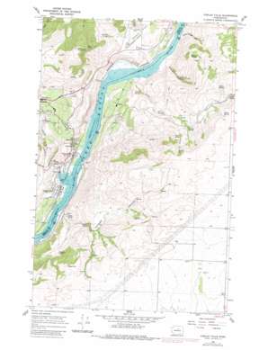
Chelan Falls Topo Map Washington
To zoom in, hover over the map of Chelan Falls
USGS Topo Quad 47119g8 - 1:24,000 scale
| Topo Map Name: | Chelan Falls |
| USGS Topo Quad ID: | 47119g8 |
| Print Size: | ca. 21 1/4" wide x 27" high |
| Southeast Coordinates: | 47.75° N latitude / 119.875° W longitude |
| Map Center Coordinates: | 47.8125° N latitude / 119.9375° W longitude |
| U.S. State: | WA |
| Filename: | o47119g8.jpg |
| Download Map JPG Image: | Chelan Falls topo map 1:24,000 scale |
| Map Type: | Topographic |
| Topo Series: | 7.5´ |
| Map Scale: | 1:24,000 |
| Source of Map Images: | United States Geological Survey (USGS) |
| Alternate Map Versions: |
Chelan Falls WA 1968, updated 1971 Download PDF Buy paper map Chelan Falls WA 1968, updated 1981 Download PDF Buy paper map Chelan Falls WA 2004, updated 2008 Download PDF Buy paper map Chelan Falls WA 2011 Download PDF Buy paper map Chelan Falls WA 2014 Download PDF Buy paper map |
| FStopo: | US Forest Service topo Chelan Falls is available: Download FStopo PDF Download FStopo TIF |
1:24,000 Topo Quads surrounding Chelan Falls
> Back to 47119e1 at 1:100,000 scale
> Back to 47118a1 at 1:250,000 scale
> Back to U.S. Topo Maps home
Chelan Falls topo map: Gazetteer
Chelan Falls: Airports
Chelan Municipal Airport elevation 384m 1259′Chelan Falls: Flats
Howard Flats elevation 270m 885′Chelan Falls: Parks
Chelan Falls Powerhouse Park elevation 224m 734′Gallagher Flat State Wildlife Recreation Area elevation 220m 721′
Chelan Falls: Populated Places
Beebe elevation 252m 826′Chelan Falls elevation 231m 757′
Chelan Falls: Springs
Abbott Spring elevation 266m 872′Beebe Springs elevation 260m 853′
Bigelow Spring elevation 730m 2395′
Buckner Spring elevation 466m 1528′
Corral Spring elevation 285m 935′
Fisher Spring elevation 690m 2263′
Griffin Spring elevation 845m 2772′
Gustin Spring elevation 911m 2988′
Hadley Spring elevation 622m 2040′
Hendricks Spring elevation 525m 1722′
Jackson Spring elevation 440m 1443′
McNeil Spring elevation 868m 2847′
North Beebe Spring elevation 243m 797′
Rausch Spring elevation 830m 2723′
Singleton Spring elevation 500m 1640′
South Beebe Spring elevation 236m 774′
Chelan Falls: Streams
Chelan River elevation 217m 711′Corral Creek elevation 223m 731′
Chelan Falls: Summits
Chelan Hill elevation 879m 2883′Deer Mountain elevation 975m 3198′
Chelan Falls: Valleys
Daybreak Canyon elevation 314m 1030′Farnham Canyon elevation 245m 803′
Hendricks Draw elevation 237m 777′
McNeil Canyon elevation 258m 846′
Sheep Trough Draw elevation 236m 774′
Chelan Falls digital topo map on disk
Buy this Chelan Falls topo map showing relief, roads, GPS coordinates and other geographical features, as a high-resolution digital map file on DVD:


