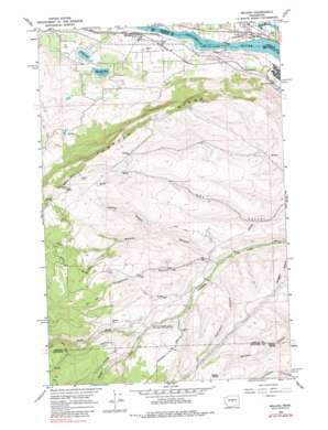
Malaga Topo Map Washington
To zoom in, hover over the map of Malaga
USGS Topo Quad 47120c2 - 1:24,000 scale
| Topo Map Name: | Malaga |
| USGS Topo Quad ID: | 47120c2 |
| Print Size: | ca. 21 1/4" wide x 27" high |
| Southeast Coordinates: | 47.25° N latitude / 120.125° W longitude |
| Map Center Coordinates: | 47.3125° N latitude / 120.1875° W longitude |
| U.S. State: | WA |
| Filename: | o47120c2.jpg |
| Download Map JPG Image: | Malaga topo map 1:24,000 scale |
| Map Type: | Topographic |
| Topo Series: | 7.5´ |
| Map Scale: | 1:24,000 |
| Source of Map Images: | United States Geological Survey (USGS) |
| Alternate Map Versions: |
Malaga WA 1966, updated 1968 Download PDF Buy paper map Malaga WA 1966, updated 1979 Download PDF Buy paper map Malaga WA 2011 Download PDF Buy paper map Malaga WA 2014 Download PDF Buy paper map |
1:24,000 Topo Quads surrounding Malaga
> Back to 47120a1 at 1:100,000 scale
> Back to 47120a1 at 1:250,000 scale
> Back to U.S. Topo Maps home
Malaga topo map: Gazetteer
Malaga: Dams
McLaughlin Dam elevation 682m 2237′Meadow Lake Dam elevation 266m 872′
Three Lakes Reservoir Dam elevation 270m 885′
Malaga: Lakes
Putters Lake elevation 187m 613′Malaga: Populated Places
Malaga elevation 208m 682′Malaga: Reservoirs
Lake Cortez elevation 270m 885′Meadow Lake elevation 266m 872′
Malaga: Ridges
Jumpoff Ridge elevation 1123m 3684′Malaga: Springs
Judkins Spring elevation 856m 2808′Whitson Spring elevation 463m 1519′
Malaga: Streams
North Fork Colockum Creek elevation 653m 2142′South Fork Colockum Creek elevation 653m 2142′
Malaga: Summits
Laurel Hill elevation 1149m 3769′Malaga: Valleys
Ivy Walker Canyon elevation 425m 1394′Kingsbury Canyon elevation 449m 1473′
Nickles Canyon elevation 637m 2089′
Robinson Canyon elevation 473m 1551′
Malaga digital topo map on disk
Buy this Malaga topo map showing relief, roads, GPS coordinates and other geographical features, as a high-resolution digital map file on DVD:


