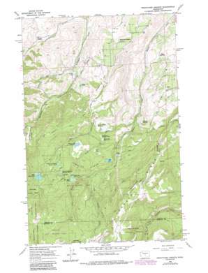
Wenatchee Heights Topo Map Washington
To zoom in, hover over the map of Wenatchee Heights
USGS Topo Quad 47120c3 - 1:24,000 scale
| Topo Map Name: | Wenatchee Heights |
| USGS Topo Quad ID: | 47120c3 |
| Print Size: | ca. 21 1/4" wide x 27" high |
| Southeast Coordinates: | 47.25° N latitude / 120.25° W longitude |
| Map Center Coordinates: | 47.3125° N latitude / 120.3125° W longitude |
| U.S. State: | WA |
| Filename: | o47120c3.jpg |
| Download Map JPG Image: | Wenatchee Heights topo map 1:24,000 scale |
| Map Type: | Topographic |
| Topo Series: | 7.5´ |
| Map Scale: | 1:24,000 |
| Source of Map Images: | United States Geological Survey (USGS) |
| Alternate Map Versions: |
Wenatchee Heights WA 1966, updated 1968 Download PDF Buy paper map Wenatchee Heights WA 1966, updated 1978 Download PDF Buy paper map Wenatchee Heights WA 1966, updated 1987 Download PDF Buy paper map Wenatchee Heights WA 1966, updated 1987 Download PDF Buy paper map Wenatchee Heights WA 2003, updated 2006 Download PDF Buy paper map Wenatchee Heights WA 2011 Download PDF Buy paper map Wenatchee Heights WA 2014 Download PDF Buy paper map |
| FStopo: | US Forest Service topo Wenatchee Heights is available: Download FStopo PDF Download FStopo TIF |
1:24,000 Topo Quads surrounding Wenatchee Heights
> Back to 47120a1 at 1:100,000 scale
> Back to 47120a1 at 1:250,000 scale
> Back to U.S. Topo Maps home
Wenatchee Heights topo map: Gazetteer
Wenatchee Heights: Airports
Hoverhawk Ranch Airport elevation 734m 2408′Wenatchee Heights: Basins
Stemilt Basin elevation 1066m 3497′Wenatchee Heights: Dams
Cammack Dam elevation 735m 2411′Clear Lake Dam elevation 915m 3001′
Greenwood Reservoir Number One Dam elevation 877m 2877′
Greenwood Reservoir Number Two Dam elevation 882m 2893′
Lily Lake Dam elevation 950m 3116′
Mathison Reservoir Dam elevation 705m 2312′
Milo Wood Pond Dam elevation 1150m 3772′
Rose Lake Dam elevation 951m 3120′
Spring Hill Dam elevation 1044m 3425′
Spring Hill Saddle Dam elevation 1051m 3448′
Steffen Brothers Reservoir Dam elevation 1155m 3789′
Stemilt Main Dam elevation 856m 2808′
Stemilt Saddle Dam elevation 858m 2814′
Upper Wheeler Dam elevation 1317m 4320′
Wenatchee Heights Reservoir Number One Dam elevation 1214m 3982′
Wenatchee Heights Reservoir Number Two Dam elevation 1190m 3904′
Wood Reservoir Dam elevation 558m 1830′
Zimmerman Pond Dam elevation 687m 2253′
Wenatchee Heights: Flats
Pole Flat elevation 1518m 4980′Wenatchee Heights: Parks
Squilchuck State Park elevation 959m 3146′Wenatchee Heights: Populated Places
Wenatchee Heights elevation 699m 2293′Wenatchee Heights: Reservoirs
Clear Lake elevation 915m 3001′Greenwood Reservoir Number One elevation 877m 2877′
Greenwood Reservoir Number Two elevation 882m 2893′
Lily Lake elevation 950m 3116′
Mathison Reservoir elevation 705m 2312′
Milo Wood Pond elevation 1151m 3776′
Rose Lake elevation 951m 3120′
Spring Hill Reservoir elevation 1044m 3425′
Steffen Brothers Reservoir elevation 1155m 3789′
Stemilt Project Reservoir elevation 856m 2808′
Upper Wheeler Reservoir elevation 1317m 4320′
Wenatchee Heights Reservoir Number One elevation 1214m 3982′
Wenatchee Heights Reservoir Number Two elevation 1190m 3904′
Wood Reservoir elevation 558m 1830′
Zimmerman Pond elevation 687m 2253′
Wenatchee Heights: Streams
Big Stemilt Creek elevation 959m 3146′Little Stemilt Creek elevation 967m 3172′
Middle Creek elevation 815m 2673′
Miners Run Creek elevation 877m 2877′
Orr Creek elevation 614m 2014′
Wenatchee Heights: Summits
Stemilt Hill elevation 757m 2483′Wheeler Hill elevation 917m 3008′
Wenatchee Heights: Valleys
Pitcher Canyon elevation 361m 1184′Wenatchee Heights digital topo map on disk
Buy this Wenatchee Heights topo map showing relief, roads, GPS coordinates and other geographical features, as a high-resolution digital map file on DVD:


