Malaga Ne Topo Map Washington
To zoom in, hover over the map of Malaga Ne
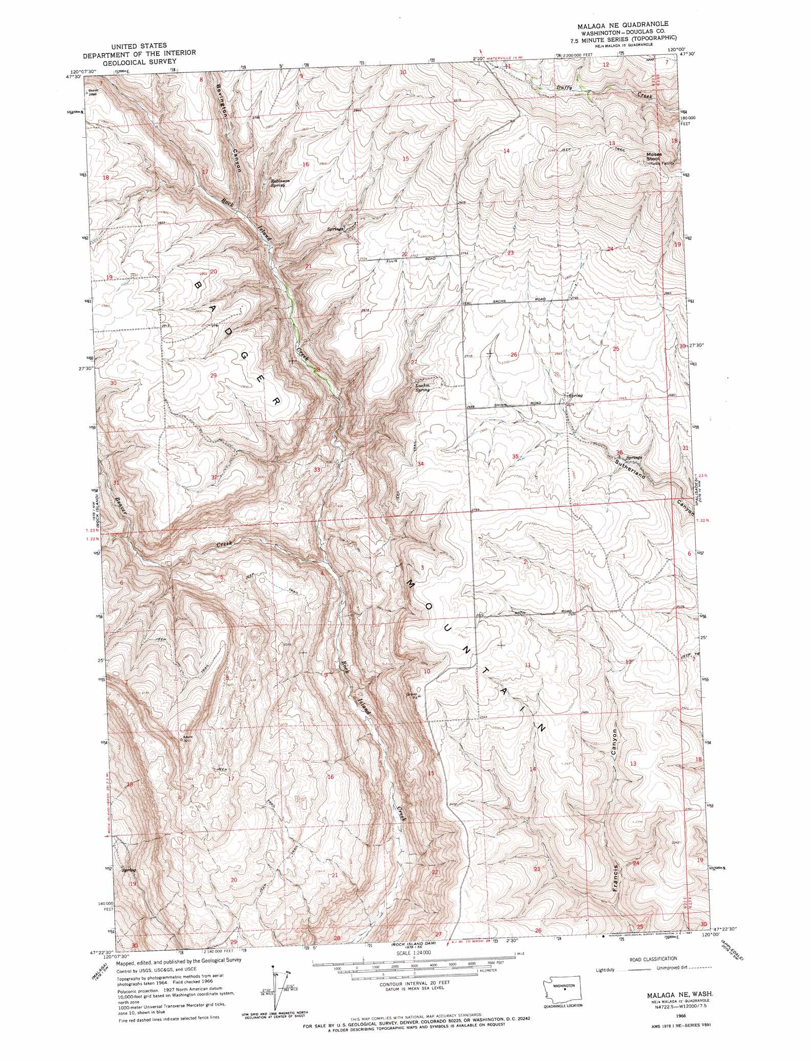
USGS Topo Quad 47120d1 - 1:24,000 scale
| Topo Map Name: | Malaga Ne |
| USGS Topo Quad ID: | 47120d1 |
| Print Size: | ca. 21 1/4" wide x 27" high |
| Southeast Coordinates: | 47.375° N latitude / 120° W longitude |
| Map Center Coordinates: | 47.4375° N latitude / 120.0625° W longitude |
| U.S. State: | WA |
| Filename: | o47120d1.jpg |
| Download Map JPG Image: | Malaga Ne topo map 1:24,000 scale |
| Map Type: | Topographic |
| Topo Series: | 7.5´ |
| Map Scale: | 1:24,000 |
| Source of Map Images: | United States Geological Survey (USGS) |
| Alternate Map Versions: |
Malaga NE WA 1966, updated 1967 Download PDF Buy paper map Malaga NE WA 2011 Download PDF Buy paper map Malaga NE WA 2014 Download PDF Buy paper map |
1:24,000 Topo Quads surrounding Malaga Ne
Ardenvoir |
Entiat |
Waterville |
Lamoine |
Withrow |
Rocky Reach Dam |
Orondo |
Douglas |
Alstown |
Farmer |
Wenatchee |
Rock Island |
Malaga Ne |
Palisades |
Rattlesnake Springs |
Wenatchee Heights |
Malaga |
Rock Island Dam |
Appledale |
Monument Hill |
Colockum Pass |
Stray Gulch |
West Bar |
Babcock Ridge |
Quincy |
> Back to 47120a1 at 1:100,000 scale
> Back to 47120a1 at 1:250,000 scale
> Back to U.S. Topo Maps home
Malaga Ne topo map: Gazetteer
Malaga Ne: Springs
Luehm Spring elevation 763m 2503′Robinson Spring elevation 773m 2536′
Malaga Ne: Streams
Beaver Creek elevation 481m 1578′Malaga Ne: Summits
Badger Mountain elevation 610m 2001′Moses Stool elevation 1099m 3605′
Malaga Ne: Valleys
Bevington Canyon elevation 696m 2283′Malaga Ne digital topo map on disk
Buy this Malaga Ne topo map showing relief, roads, GPS coordinates and other geographical features, as a high-resolution digital map file on DVD: