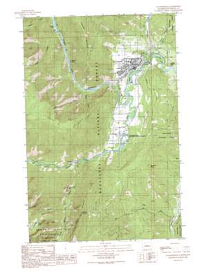
Leavenworth Topo Map Washington
To zoom in, hover over the map of Leavenworth
USGS Topo Quad 47120e6 - 1:24,000 scale
| Topo Map Name: | Leavenworth |
| USGS Topo Quad ID: | 47120e6 |
| Print Size: | ca. 21 1/4" wide x 27" high |
| Southeast Coordinates: | 47.5° N latitude / 120.625° W longitude |
| Map Center Coordinates: | 47.5625° N latitude / 120.6875° W longitude |
| U.S. State: | WA |
| Filename: | o47120e6.jpg |
| Download Map JPG Image: | Leavenworth topo map 1:24,000 scale |
| Map Type: | Topographic |
| Topo Series: | 7.5´ |
| Map Scale: | 1:24,000 |
| Source of Map Images: | United States Geological Survey (USGS) |
| Alternate Map Versions: |
Leavenworth WA 1989, updated 1989 Download PDF Buy paper map Leavenworth WA 1989, updated 1989 Download PDF Buy paper map Leavenworth WA 1989, updated 1989 Download PDF Buy paper map Leavenworth WA 2003, updated 2006 Download PDF Buy paper map Leavenworth WA 2011 Download PDF Buy paper map Leavenworth WA 2014 Download PDF Buy paper map |
| FStopo: | US Forest Service topo Leavenworth is available: Download FStopo PDF Download FStopo TIF |
1:24,000 Topo Quads surrounding Leavenworth
> Back to 47120e1 at 1:100,000 scale
> Back to 47120a1 at 1:250,000 scale
> Back to U.S. Topo Maps home
Leavenworth topo map: Gazetteer
Leavenworth: Areas
Tumwater Botanical Area elevation 1114m 3654′Leavenworth: Cliffs
Snow Creek Wall elevation 1074m 3523′Leavenworth: Dams
Tumwater Canyon Dam elevation 452m 1482′Leavenworth: Lakes
Toketie Lake elevation 1886m 6187′Leavenworth: Parks
Leavenworth Winter Sports Area elevation 439m 1440′Leavenworth: Pillars
Castle Rock elevation 546m 1791′Leavenworth: Populated Places
Leavenworth elevation 357m 1171′Leavenworth: Reservoirs
Lake Jolanda elevation 450m 1476′Leavenworth: Streams
Chumstick Creek elevation 329m 1079′Eagle Creek elevation 373m 1223′
Icicle Creek elevation 335m 1099′
Mill Creek elevation 416m 1364′
Power Creek elevation 398m 1305′
Slide Creek elevation 469m 1538′
Snow Creek elevation 401m 1315′
Steep Creek elevation 393m 1289′
Toketie Creek elevation 896m 2939′
Leavenworth: Summits
Boundary Butte elevation 937m 3074′Tumwater Mountain elevation 1363m 4471′
Tumwater Mountain elevation 1363m 4471′
Wedge Mountain elevation 1762m 5780′
Leavenworth: Trails
Icicle Trail elevation 1163m 3815′Snow Lakes Trail elevation 1191m 3907′
Leavenworth: Valleys
Pendleton Canyon elevation 453m 1486′Stevens Canyon elevation 403m 1322′
Tumwater Canyon elevation 359m 1177′
Leavenworth digital topo map on disk
Buy this Leavenworth topo map showing relief, roads, GPS coordinates and other geographical features, as a high-resolution digital map file on DVD:


