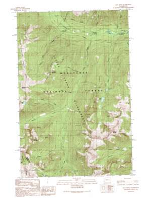
Jack Ridge Topo Map Washington
To zoom in, hover over the map of Jack Ridge
USGS Topo Quad 47120e8 - 1:24,000 scale
| Topo Map Name: | Jack Ridge |
| USGS Topo Quad ID: | 47120e8 |
| Print Size: | ca. 21 1/4" wide x 27" high |
| Southeast Coordinates: | 47.5° N latitude / 120.875° W longitude |
| Map Center Coordinates: | 47.5625° N latitude / 120.9375° W longitude |
| U.S. State: | WA |
| Filename: | o47120e8.jpg |
| Download Map JPG Image: | Jack Ridge topo map 1:24,000 scale |
| Map Type: | Topographic |
| Topo Series: | 7.5´ |
| Map Scale: | 1:24,000 |
| Source of Map Images: | United States Geological Survey (USGS) |
| Alternate Map Versions: |
Jack Ridge WA 1989, updated 1989 Download PDF Buy paper map Jack Ridge WA 2003, updated 2006 Download PDF Buy paper map Jack Ridge WA 2011 Download PDF Buy paper map Jack Ridge WA 2014 Download PDF Buy paper map |
| FStopo: | US Forest Service topo Jack Ridge is available: Download FStopo PDF Download FStopo TIF |
1:24,000 Topo Quads surrounding Jack Ridge
> Back to 47120e1 at 1:100,000 scale
> Back to 47120a1 at 1:250,000 scale
> Back to U.S. Topo Maps home
Jack Ridge topo map: Gazetteer
Jack Ridge: Lakes
Cradle Lake elevation 1884m 6181′Trout Lake elevation 1460m 4790′
Jack Ridge: Mines
Van Epps Mine elevation 1626m 5334′Jack Ridge: Ridges
Blackjack Ridge elevation 1951m 6400′Jack Ridge elevation 2090m 6856′
Sixtysix Hundred Ridge elevation 2039m 6689′
Jack Ridge: Streams
Ben Creek elevation 1108m 3635′Black Pine Creek elevation 842m 2762′
Boggy Creek elevation 834m 2736′
Chatter Creek elevation 807m 2647′
Dunn Creek elevation 1072m 3517′
Grindstone Creek elevation 842m 2762′
Jack Creek elevation 814m 2670′
Meadow Creek elevation 1128m 3700′
Pablo Creek elevation 1160m 3805′
Solomon Creek elevation 1219m 3999′
Trout Creek elevation 809m 2654′
Jack Ridge: Summits
Bootjack Mountain elevation 2056m 6745′Eightmile Mountain elevation 2397m 7864′
Harding Mountain elevation 2174m 7132′
Highchair Mountain elevation 2113m 6932′
Jack Ridge digital topo map on disk
Buy this Jack Ridge topo map showing relief, roads, GPS coordinates and other geographical features, as a high-resolution digital map file on DVD:


