Chumstick Mountain Topo Map Washington
To zoom in, hover over the map of Chumstick Mountain
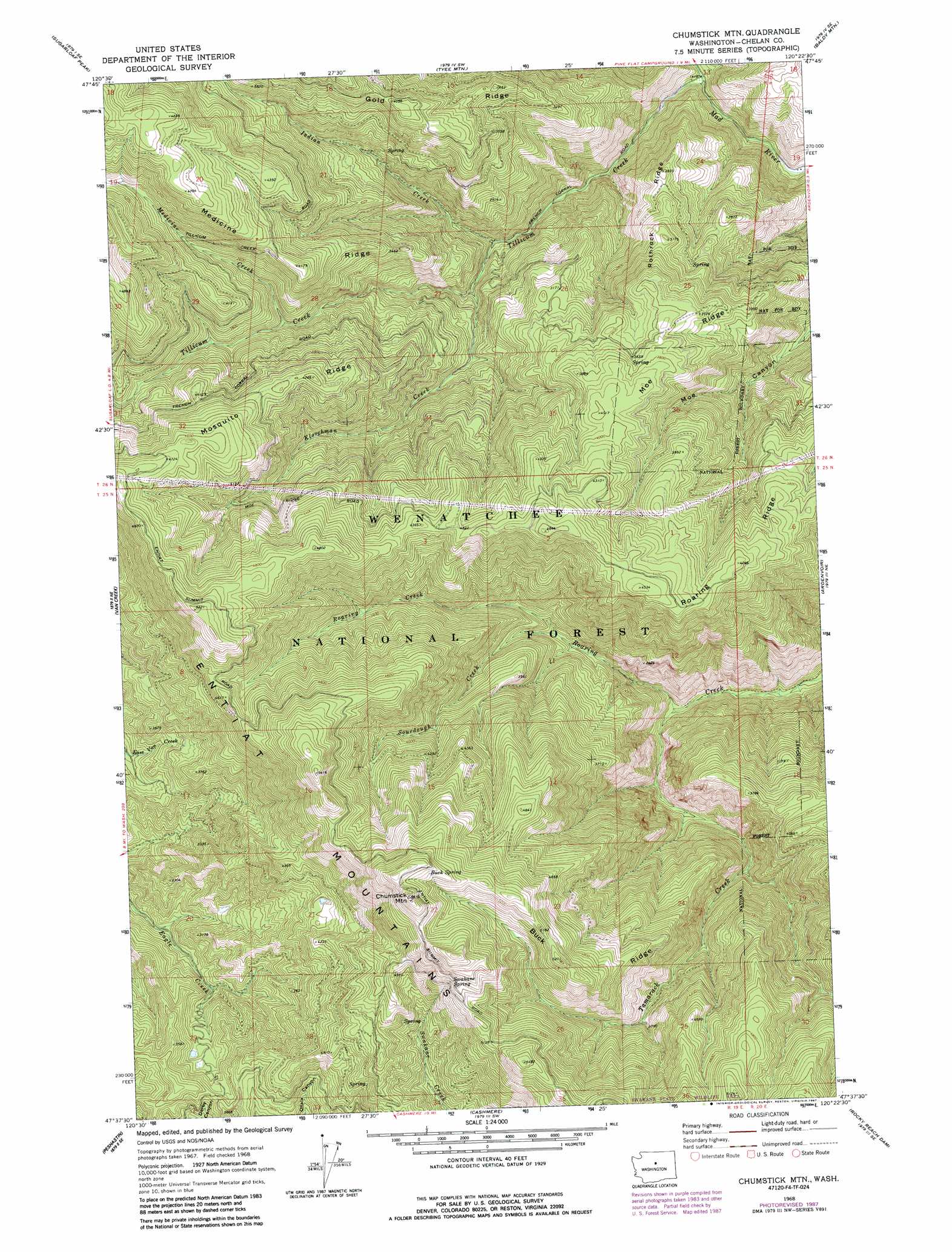
USGS Topo Quad 47120f4 - 1:24,000 scale
| Topo Map Name: | Chumstick Mountain |
| USGS Topo Quad ID: | 47120f4 |
| Print Size: | ca. 21 1/4" wide x 27" high |
| Southeast Coordinates: | 47.625° N latitude / 120.375° W longitude |
| Map Center Coordinates: | 47.6875° N latitude / 120.4375° W longitude |
| U.S. State: | WA |
| Filename: | o47120f4.jpg |
| Download Map JPG Image: | Chumstick Mountain topo map 1:24,000 scale |
| Map Type: | Topographic |
| Topo Series: | 7.5´ |
| Map Scale: | 1:24,000 |
| Source of Map Images: | United States Geological Survey (USGS) |
| Alternate Map Versions: |
Chumstick Mtn WA 1968, updated 1972 Download PDF Buy paper map Chumstick Mtn WA 1968, updated 1981 Download PDF Buy paper map Chumstick Mtn WA 1968, updated 1987 Download PDF Buy paper map Chumstick Mountain WA 2003, updated 2006 Download PDF Buy paper map Chumstick Mountain WA 2011 Download PDF Buy paper map Chumstick Mountain WA 2014 Download PDF Buy paper map |
| FStopo: | US Forest Service topo Chumstick Mountain is available: Download FStopo PDF Download FStopo TIF |
1:24,000 Topo Quads surrounding Chumstick Mountain
Chikamin Creek |
Silver Falls |
Brief |
Stormy Mountain |
Manson |
Plain |
Sugarloaf Peak |
Tyee Mountain |
Baldy Mountain |
Winesap |
Winton |
Van Creek |
Chumstick Mountain |
Ardenvoir |
Entiat |
Leavenworth |
Peshastin |
Cashmere |
Rocky Reach Dam |
Orondo |
Blewett |
Tiptop |
Monitor |
Wenatchee |
Rock Island |
> Back to 47120e1 at 1:100,000 scale
> Back to 47120a1 at 1:250,000 scale
> Back to U.S. Topo Maps home
Chumstick Mountain topo map: Gazetteer
Chumstick Mountain: Reservoirs
Hidden Reservoir elevation 925m 3034′Chumstick Mountain: Ridges
Buck Ridge elevation 1575m 5167′Medicine Ridge elevation 1431m 4694′
Moe Ridge elevation 977m 3205′
Mosquito Ridge elevation 1295m 4248′
Roaring Ridge elevation 1283m 4209′
Rothrock Ridge elevation 881m 2890′
Chumstick Mountain: Springs
Buck Spring elevation 1677m 5501′Swakane Spring elevation 1561m 5121′
Chumstick Mountain: Streams
Indian Creek elevation 614m 2014′Kloochman Creek elevation 693m 2273′
Medicine Creek elevation 948m 3110′
Sourdough Creek elevation 810m 2657′
Tamarack Creek elevation 598m 1961′
Tillicum Creek elevation 429m 1407′
Chumstick Mountain: Summits
Chumstick Mountain elevation 1771m 5810′Chumstick Mountain digital topo map on disk
Buy this Chumstick Mountain topo map showing relief, roads, GPS coordinates and other geographical features, as a high-resolution digital map file on DVD: