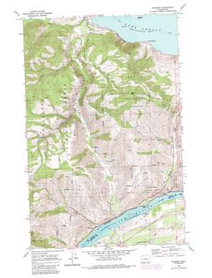
Winesap Topo Map Washington
To zoom in, hover over the map of Winesap
USGS Topo Quad 47120g2 - 1:24,000 scale
| Topo Map Name: | Winesap |
| USGS Topo Quad ID: | 47120g2 |
| Print Size: | ca. 21 1/4" wide x 27" high |
| Southeast Coordinates: | 47.75° N latitude / 120.125° W longitude |
| Map Center Coordinates: | 47.8125° N latitude / 120.1875° W longitude |
| U.S. State: | WA |
| Filename: | o47120g2.jpg |
| Download Map JPG Image: | Winesap topo map 1:24,000 scale |
| Map Type: | Topographic |
| Topo Series: | 7.5´ |
| Map Scale: | 1:24,000 |
| Source of Map Images: | United States Geological Survey (USGS) |
| Alternate Map Versions: |
Winesap WA 1968, updated 1972 Download PDF Buy paper map Winesap WA 1968, updated 1984 Download PDF Buy paper map Winesap WA 1968, updated 1987 Download PDF Buy paper map Winesap WA 2004, updated 2008 Download PDF Buy paper map Winesap WA 2011 Download PDF Buy paper map Winesap WA 2014 Download PDF Buy paper map |
| FStopo: | US Forest Service topo Winesap is available: Download FStopo PDF Download FStopo TIF |
1:24,000 Topo Quads surrounding Winesap
> Back to 47120e1 at 1:100,000 scale
> Back to 47120a1 at 1:250,000 scale
> Back to U.S. Topo Maps home
Winesap topo map: Gazetteer
Winesap: Airports
Ross Private Strip elevation 261m 856′Winesap: Capes
Wapato Point elevation 336m 1102′Winesap: Parks
Entiat State Wildlife Area elevation 424m 1391′Lake Chelan State Park elevation 340m 1115′
Winesap: Populated Places
Maplecreek elevation 390m 1279′Sunnybank elevation 348m 1141′
Winesap elevation 232m 761′
Winesap: Streams
Barrett Creek elevation 451m 1479′Bear Creek elevation 441m 1446′
Johnson Creek elevation 423m 1387′
Maple Creek elevation 374m 1227′
Winesap: Summits
Bear Mountain elevation 1087m 3566′Goosetail Rock elevation 219m 718′
Winesap: Tunnels
Knapps Hill Tunnel elevation 419m 1374′Winesap: Valleys
Davis Canyon elevation 471m 1545′Ficher Canyon elevation 243m 797′
Knapp Coulee elevation 222m 728′
Navarre Coulee elevation 218m 715′
Oklahoma Gulch elevation 217m 711′
Winesap digital topo map on disk
Buy this Winesap topo map showing relief, roads, GPS coordinates and other geographical features, as a high-resolution digital map file on DVD:


