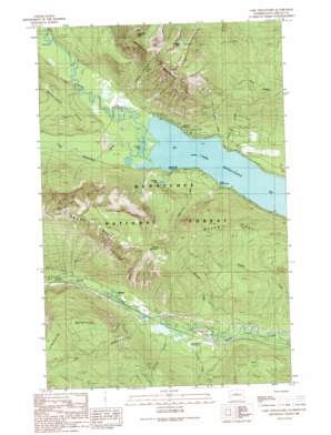
Lake Wenatchee Topo Map Washington
To zoom in, hover over the map of Lake Wenatchee
USGS Topo Quad 47120g7 - 1:24,000 scale
| Topo Map Name: | Lake Wenatchee |
| USGS Topo Quad ID: | 47120g7 |
| Print Size: | ca. 21 1/4" wide x 27" high |
| Southeast Coordinates: | 47.75° N latitude / 120.75° W longitude |
| Map Center Coordinates: | 47.8125° N latitude / 120.8125° W longitude |
| U.S. State: | WA |
| Filename: | o47120g7.jpg |
| Download Map JPG Image: | Lake Wenatchee topo map 1:24,000 scale |
| Map Type: | Topographic |
| Topo Series: | 7.5´ |
| Map Scale: | 1:24,000 |
| Source of Map Images: | United States Geological Survey (USGS) |
| Alternate Map Versions: |
Lake Wenatchee WA 1989, updated 1989 Download PDF Buy paper map Lake Wenatchee WA 1989, updated 1989 Download PDF Buy paper map Lake Wenatchee WA 2004, updated 2008 Download PDF Buy paper map Lake Wenatchee WA 2011 Download PDF Buy paper map Lake Wenatchee WA 2014 Download PDF Buy paper map |
| FStopo: | US Forest Service topo Lake Wenatchee is available: Download FStopo PDF Download FStopo TIF |
1:24,000 Topo Quads surrounding Lake Wenatchee
> Back to 47120e1 at 1:100,000 scale
> Back to 47120a1 at 1:250,000 scale
> Back to U.S. Topo Maps home
Lake Wenatchee topo map: Gazetteer
Lake Wenatchee: Airports
Nason Creek State Airport (historical) elevation 667m 2188′Lake Wenatchee: Forests
Leavenworth Ranger District (historical) elevation 710m 2329′Lake Wenatchee: Lakes
Dirtyface Lake elevation 1484m 4868′Hidden Lake elevation 692m 2270′
Lake Wenatchee elevation 571m 1873′
Squaw Lake elevation 571m 1873′
Lake Wenatchee: Populated Places
Merritt elevation 668m 2191′Nason Creek elevation 666m 2185′
Telma elevation 576m 1889′
Lake Wenatchee: Streams
Barnard Creek elevation 591m 1938′Butcher Creek elevation 651m 2135′
Coulter Creek elevation 656m 2152′
Fall Creek elevation 573m 1879′
Gill Creek elevation 661m 2168′
Kahler Creek elevation 615m 2017′
Little Wenatchee River elevation 571m 1873′
Plainview Creek elevation 572m 1876′
Roaring Creek elevation 651m 2135′
Silverly Creek elevation 586m 1922′
White River elevation 571m 1873′
Lake Wenatchee: Summits
Dirty Face Mountain elevation 1798m 5898′Dirtyface Peak elevation 1903m 6243′
Round Mountain elevation 1734m 5688′
Lake Wenatchee digital topo map on disk
Buy this Lake Wenatchee topo map showing relief, roads, GPS coordinates and other geographical features, as a high-resolution digital map file on DVD:


