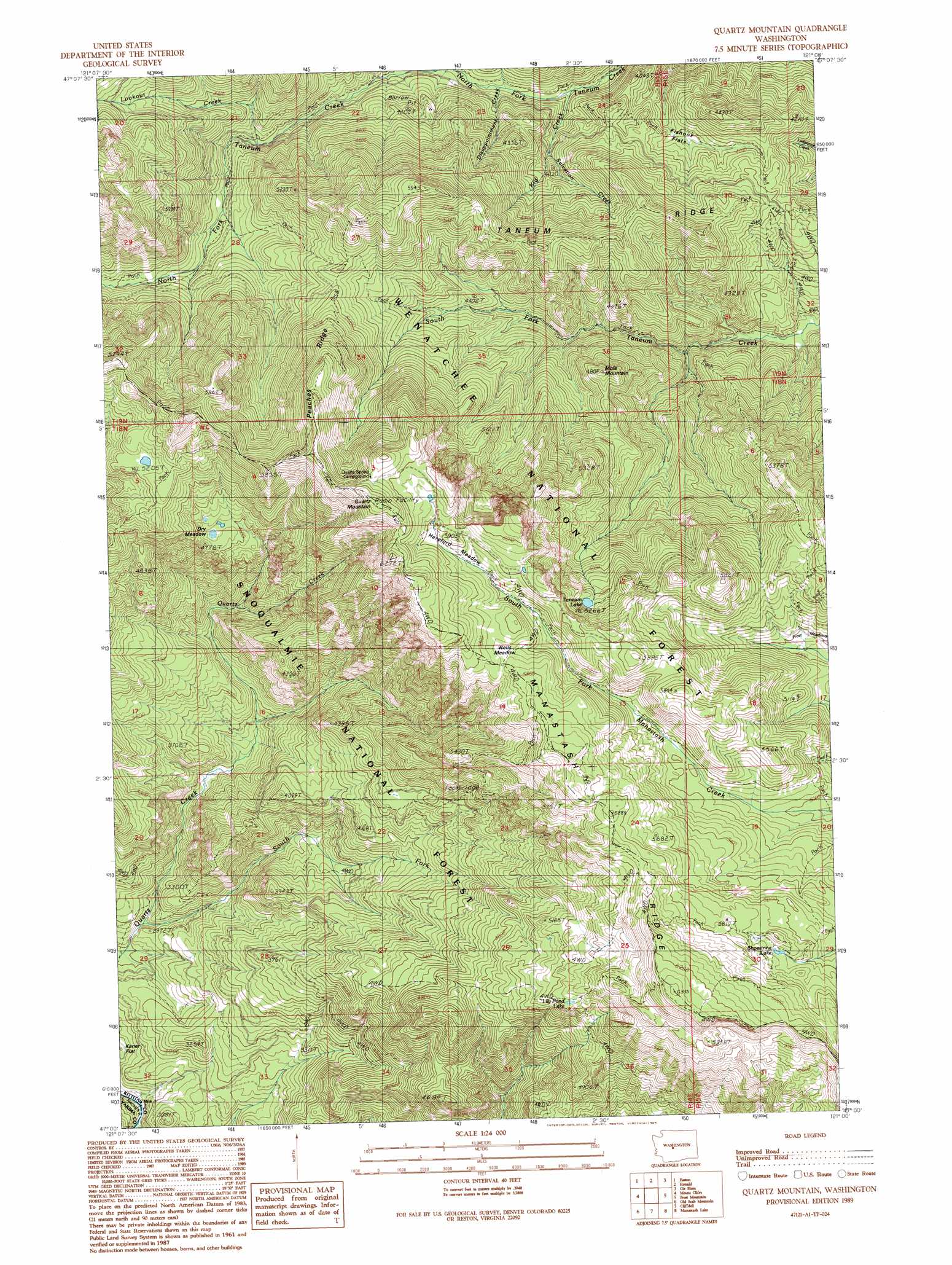
Quartz Mountain Topo Map Washington
To zoom in, hover over the map of Quartz Mountain
USGS Topo Quad 47121a1 - 1:24,000 scale
| Topo Map Name: | Quartz Mountain |
| USGS Topo Quad ID: | 47121a1 |
| Print Size: | ca. 21 1/4" wide x 27" high |
| Southeast Coordinates: | 47° N latitude / 121° W longitude |
| Map Center Coordinates: | 47.0625° N latitude / 121.0625° W longitude |
| U.S. State: | WA |
| Filename: | o47121a1.jpg |
| Download Map JPG Image: | Quartz Mountain topo map 1:24,000 scale |
| Map Type: | Topographic |
| Topo Series: | 7.5´ |
| Map Scale: | 1:24,000 |
| Source of Map Images: | United States Geological Survey (USGS) |
| Alternate Map Versions: |
Quartz Mountain WA 1989, updated 1989 Download PDF Buy paper map Quartz Mountain WA 2011 Download PDF Buy paper map Quartz Mountain WA 2014 Download PDF Buy paper map |
| FStopo: | US Forest Service topo Quartz Mountain is available: Download FStopo PDF Download FStopo TIF |
1:24,000 Topo Quads surrounding Quartz Mountain
Stampede Pass |
Kachess Lake |
Cle Elum Lake |
Teanaway Butte |
Red Top Mountain |
Blowout Mountain |
Easton |
Ronald |
Cle Elum |
Teanaway |
Raven Roost |
Mount Clifty |
Quartz Mountain |
Frost Mountain |
Taneum Canyon |
Goose Prairie |
Old Scab Mountain |
Cliffdell |
Manastash Lake |
Hudson Creek |
Bumping Lake |
Timberwolf Mountain |
Meeks Table |
Nile |
Milk Canyon |
> Back to 47121a1 at 1:100,000 scale
> Back to 47120a1 at 1:250,000 scale
> Back to U.S. Topo Maps home
Quartz Mountain topo map: Gazetteer
Quartz Mountain: Flats
Dry Meadow elevation 1414m 4639′Fishhook Flats elevation 1198m 3930′
Frost Meadows elevation 1472m 4829′
Hereford Meadow elevation 1765m 5790′
Quartz Mountain: Lakes
Lily Pond Lake elevation 1611m 5285′Shoestring Lake elevation 1727m 5666′
Taneum Lake elevation 1607m 5272′
Quartz Mountain: Ridges
Peaches Ridge elevation 1810m 5938′Taneum Ridge elevation 1488m 4881′
Quartz Mountain: Streams
Disappointment Creek elevation 1108m 3635′Kid Creek elevation 1088m 3569′
Lookout Creek elevation 1217m 3992′
Salvation Creek elevation 1097m 3599′
South Fork Quartz Creek elevation 872m 2860′
Quartz Mountain: Summits
Mole Mountain elevation 1454m 4770′Quartz Mountain elevation 1919m 6295′
Quartz Mountain: Trails
Fishhook Flats Trail elevation 1285m 4215′Frost Mountain Lookout Trail elevation 1563m 5127′
Kaner Flat Trail elevation 1464m 4803′
North Fork Taneum Trail elevation 1198m 3930′
Quartz Creek Trail elevation 1199m 3933′
Quartz Mountain digital topo map on disk
Buy this Quartz Mountain topo map showing relief, roads, GPS coordinates and other geographical features, as a high-resolution digital map file on DVD: